
Bikepacking from Geilo to Aurlandsvangen
Customize your own route based on our template or discover how our community prefers to cycle from Geilo to Aurlandsvangen.
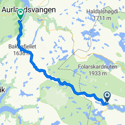
Route template
Geilo to Aurlandsvangen

- 23 h 27 min
- Duration
- 241.7 km
- Distance
- 5,601 m
- Ascent
- 6,375 m
- Descent
- 10.3 km/h
- Avg. speed
- 1,523 m
- Max. altitude
This epic cycling route takes you from Geilo, a popular mountain resort town known for its winter sports and stunning Hardangervidda plateau views, all the way to the serene fjord village of Aurlandsvangen. Get ready for a serious adventure: the route covers roughly 242 km and packs over 5,600 meters of climbing—so bring your climbing legs and lots of snacks!
You’ll experience a bit of everything along the way: quiet mountain roads, some busier stretches, and a mix of surfaces from smooth asphalt to crunchy gravel. Around two-thirds of the surfaces are mixed or missing data, so expect the unexpected—classic Norwegian backroads! As you climb above 1,500 meters at the highest point, the scenery is breathtaking, and the long descents into fjordland are exhilarating.
Your finish line, Aurlandsvangen, is perched at the edge of the famous Aurlandsfjord, a UNESCO World Heritage area. It’s a picture-perfect spot to celebrate your epic ride with a well-deserved meal and a fjord view. Enjoy—this is a true bucket-list cycling challenge!
Community
Top users in this region


From our community
The best bike routes from Geilo to Aurlandsvangen

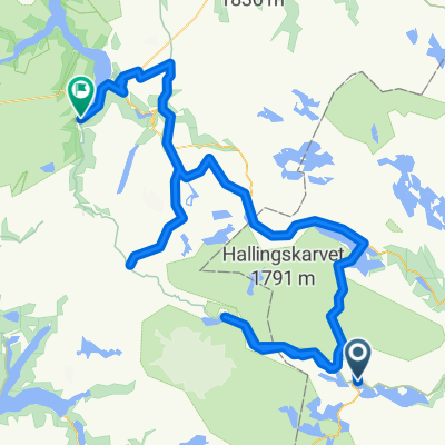
Rallarvegen: Haugastøl - Flåm
Cycling route in Geilo, Buskerud, Norway
- 77.4 km
- Distance
- 1,800 m
- Ascent
- 2,787 m
- Descent

From Haugastøl to Flåm
Cycling route in Geilo, Buskerud, Norway
- 85.6 km
- Distance
- 1,970 m
- Ascent
- 2,955 m
- Descent

Geilo - Aurlandsvangen
Cycling route in Geilo, Buskerud, Norway
- 92.8 km
- Distance
- 1,872 m
- Ascent
- 1,795 m
- Descent

Rallarvegen: Haugastøl - Flåm
Cycling route in Geilo, Buskerud, Norway
- 74.1 km
- Distance
- 2,119 m
- Ascent
- 3,106 m
- Descent

Haugastøl, Finse, Hallingseid, Flåm
Cycling route in Geilo, Buskerud, Norway
- 206.4 km
- Distance
- 5,900 m
- Ascent
- 6,866 m
- Descent

Rallarvegen: Haugastøl - Flåm
Cycling route in Geilo, Buskerud, Norway
- 77.4 km
- Distance
- 1,800 m
- Ascent
- 2,787 m
- Descent

Rallarvegen from Haugastol to Flåm
Cycling route in Geilo, Buskerud, Norway
- 78.2 km
- Distance
- 1,051 m
- Ascent
- 1,794 m
- Descent

Haugastøl - Thunshelle
Cycling route in Geilo, Buskerud, Norway
- 71.2 km
- Distance
- 1,150 m
- Ascent
- 1,799 m
- Descent

Discover more routes
 Rallarvegen: Haugastøl - Flåm
- Distance
- 74.1 km
- Ascent
- 2,119 m
- Descent
- 3,106 m
- Location
- Geilo, Buskerud, Norway
 Rallarvegen
- Distance
- 76.5 km
- Ascent
- 0 m
- Descent
- 0 m
- Location
- Geilo, Buskerud, Norway
 Haugastøl - Flåm
- Distance
- 84.8 km
- Ascent
- 1,831 m
- Descent
- 2,836 m
- Location
- Geilo, Buskerud, Norway
 Haugastøl, Finse, Hallingseid, Flåm
- Distance
- 206.4 km
- Ascent
- 5,900 m
- Descent
- 6,866 m
- Location
- Geilo, Buskerud, Norway
 Rallarvegen: Haugastøl - Flåm
- Distance
- 77.4 km
- Ascent
- 1,800 m
- Descent
- 2,787 m
- Location
- Geilo, Buskerud, Norway
 Rallarvegen from Haugastol to Flåm
- Distance
- 78.2 km
- Ascent
- 1,051 m
- Descent
- 1,794 m
- Location
- Geilo, Buskerud, Norway
 Haugastøl - Thunshelle
- Distance
- 71.2 km
- Ascent
- 1,150 m
- Descent
- 1,799 m
- Location
- Geilo, Buskerud, Norway
 Rallarvegen
- Distance
- 63 km
- Ascent
- 556 m
- Descent
- 640 m
- Location
- Geilo, Buskerud, Norway