
Route template
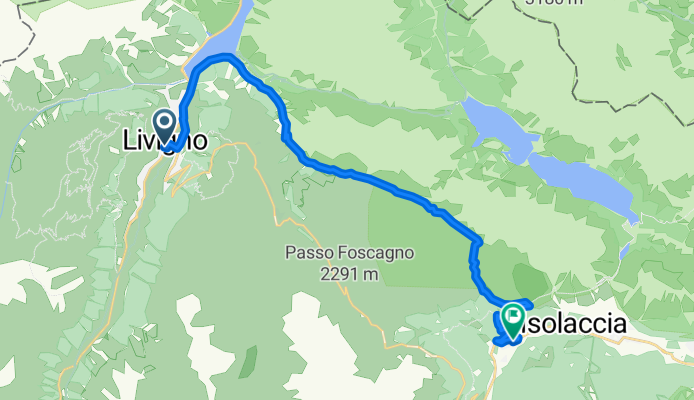
Livigno to Isolaccia

- 2 h 46 min
- Duration
- 25.4 km
- Distance
- 882 m
- Ascent
- 1,348 m
- Descent
- 9.2 km/h
- Avg. speed
- 2,327 m
- Max. altitude
This route takes you from the vibrant alpine resort of Livigno to the peaceful village of Isolaccia, covering just over 25 km through the heart of the Italian Alps. Livigno is famous for its duty-free shopping and top-tier mountain biking scene, so it’s the perfect spot to kick off your ride.
From the start, expect plenty of variety: about 43% is on mountain paths and 29% on rugged tracks, with stretches of gravel and some good ol’ asphalt to keep things interesting. There’s a solid climb early on—almost 900 meters of ascent—and you’ll reach alpine heights of over 2,300 meters, so be ready for those big mountain views (and maybe a few sheep).
As you descend nearly 1,350 meters toward Isolaccia, the landscape opens up to lush valleys and forested slopes. Isolaccia itself sits quietly in Valdidentro and is a gateway to more hidden Gems in Valtellina. Whether you're in it for the scenery, the challenge, or just a really good Panino at the end, this ride will definitely deliver. Pack layers and bring your camera—you’ll want to remember this one!
Community
Top users in this region


From our community
The best bike routes from Livigno to Isolaccia
Livigno to Semogo
Cycling route in Livigno, Lombardy, Italy
- 22.3 km
- Distance
- 923 m
- Ascent
- 1,279 m
- Descent

5-ROUTE_2022-Livigno-Rifugio_Fraele
Cycling route in Livigno, Lombardy, Italy
- 17.1 km
- Distance
- 759 m
- Ascent
- 630 m
- Descent

AlpenCross 2017 4.Etappe - Alternative
Cycling route in Livigno, Lombardy, Italy
- 15.3 km
- Distance
- 544 m
- Ascent
- 481 m
- Descent
4 Star MTB Tour - prima tappa CLONED FROM ROUTE 970650
Cycling route in Livigno, Lombardy, Italy
- 32.8 km
- Distance
- 1,050 m
- Ascent
- 1,040 m
- Descent

Climb Alps - Foscagno Pass from Ponte del Rezz
Cycling route in Livigno, Lombardy, Italy
- 4 km
- Distance
- 273 m
- Ascent
- 0 m
- Descent

Passo Foscagno da Livigno
Cycling route in Livigno, Lombardy, Italy
- 13.1 km
- Distance
- 663 m
- Ascent
- 198 m
- Descent

Livigno-Carosello-Mottolino - Livigno-Carosello-Mottolino
Cycling route in Livigno, Lombardy, Italy
- 40.9 km
- Distance
- 1,786 m
- Ascent
- 2,243 m
- Descent
bormio unpaved roads da livigno -102X 3300
Cycling route in Livigno, Lombardy, Italy
- 92.6 km
- Distance
- 2,560 m
- Ascent
- 2,444 m
- Descent

Livigno - Mortirolo - Gavia - Livigno
Cycling route in Livigno, Lombardy, Italy
- 161.8 km
- Distance
- 4,538 m
- Ascent
- 4,475 m
- Descent

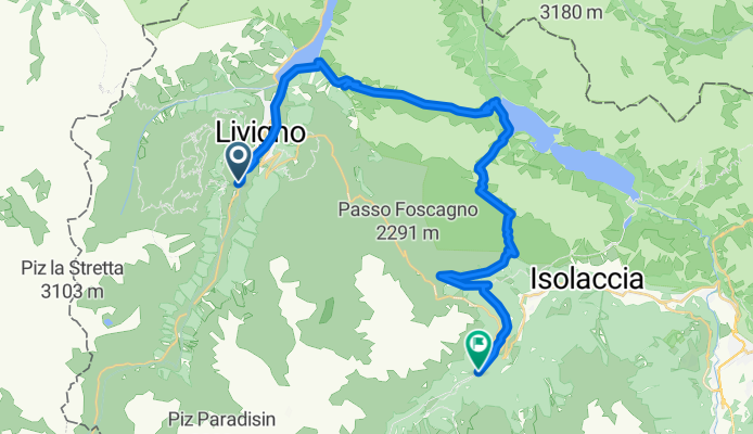
livigno isolatia
Cycling route in Livigno, Lombardy, Italy
- 24.7 km
- Distance
- 489 m
- Ascent
- 1,508 m
- Descent


Discover more routes
 Climb Alps - Foscagno Pass from Ponte del Rezz
- Distance
- 4 km
- Ascent
- 273 m
- Descent
- 0 m
- Location
- Livigno, Lombardy, Italy
 Passo Foscagno da Livigno
- Distance
- 13.1 km
- Ascent
- 663 m
- Descent
- 198 m
- Location
- Livigno, Lombardy, Italy
 Livigno-Carosello-Mottolino - Livigno-Carosello-Mottolino
- Distance
- 40.9 km
- Ascent
- 1,786 m
- Descent
- 2,243 m
- Location
- Livigno, Lombardy, Italy
 bormio unpaved roads da livigno -102X 3300
- Distance
- 92.6 km
- Ascent
- 2,560 m
- Descent
- 2,444 m
- Location
- Livigno, Lombardy, Italy
 Livigno - Mortirolo - Gavia - Livigno
- Distance
- 161.8 km
- Ascent
- 4,538 m
- Descent
- 4,475 m
- Location
- Livigno, Lombardy, Italy
 livigno isolatia
- Distance
- 24.7 km
- Ascent
- 489 m
- Descent
- 1,508 m
- Location
- Livigno, Lombardy, Italy
 Livigno
- Distance
- 16.1 km
- Ascent
- 283 m
- Descent
- 788 m
- Location
- Livigno, Lombardy, Italy
 Livigno
- Distance
- 34.1 km
- Ascent
- 1,086 m
- Descent
- 939 m
- Location
- Livigno, Lombardy, Italy
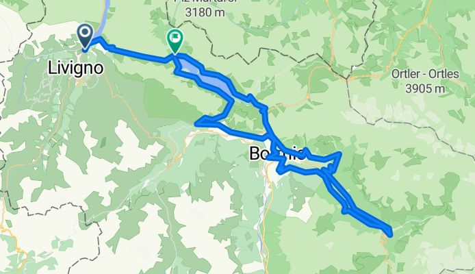
Routes from Livigno
Cycling day trip from
Livigno to Bormio
Routes to Isolaccia
By bicycle from
Bormio to Isolaccia