
Cycling day trip from Minneapolis to Mendota Heights
Customize your own route based on our template or discover how our community prefers to cycle from Minneapolis to Mendota Heights.
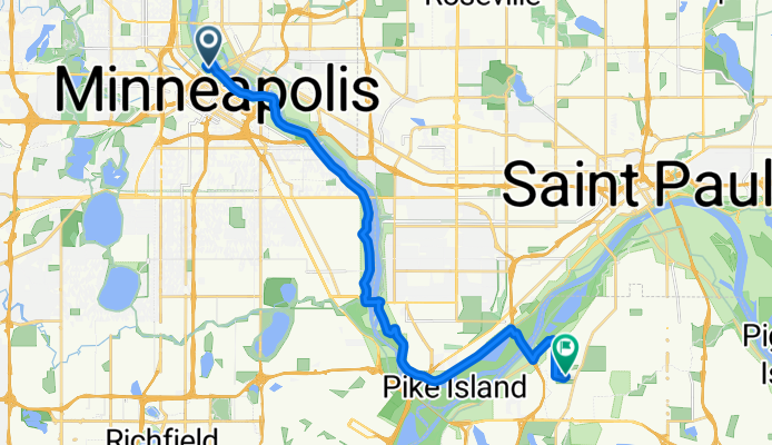
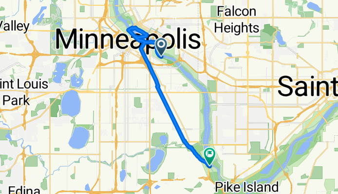
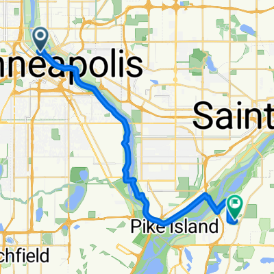
Route template
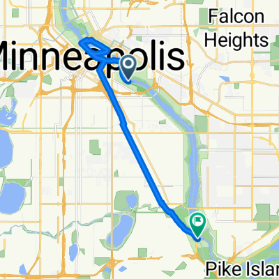
Minneapolis to Mendota Heights
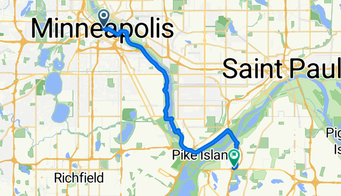
- 1 h 12 min
- Duration
- 21.4 km
- Distance
- 194 m
- Ascent
- 179 m
- Descent
- 17.9 km/h
- Avg. speed
- 275 m
- Max. altitude
Community
Top users in this region


From our community
The best bike routes from Minneapolis to Mendota Heights

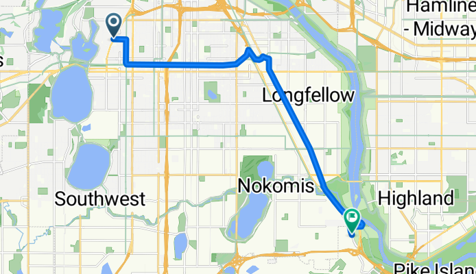
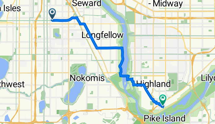
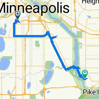
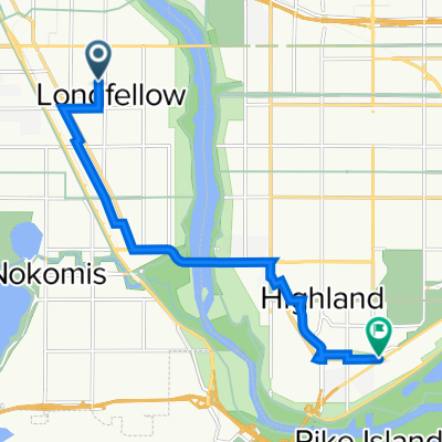
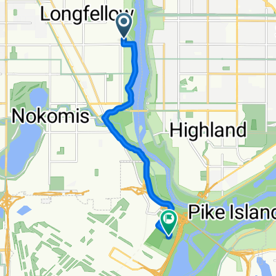
B2B00534 55407>55121 via Hiawatha Trl, Big Rivers Trl, Pilot Knob Rd
Cycling route in Minneapolis, Minnesota, United States
- 14.7 km
- Distance
- 83 m
- Ascent
- 79 m
- Descent

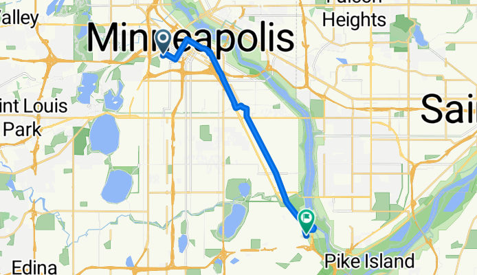
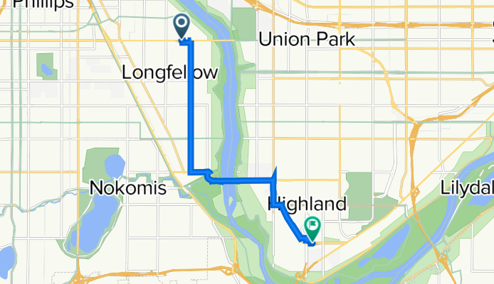
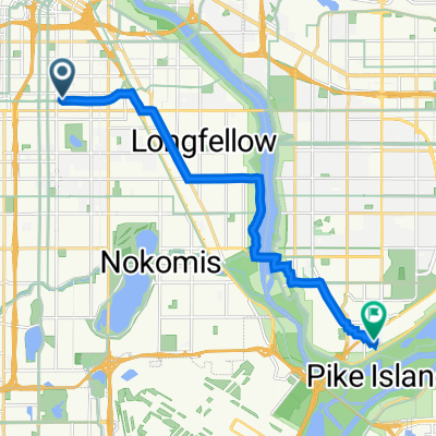
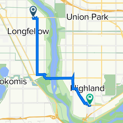
B2B00475 55406>55121 via 46th Ave S, Mendota Bridge, Pilot Knob, Lone Oak Rd
Cycling route in Minneapolis, Minnesota, United States
- 18.2 km
- Distance
- 114 m
- Ascent
- 97 m
- Descent
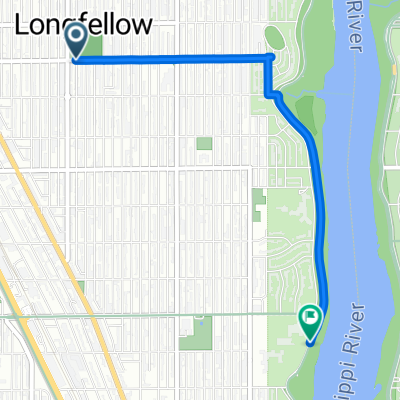
B2B00845 55405>55417 via Greenway, Minnehaha
Cycling route in Minneapolis, Minnesota, United States
- 12.7 km
- Distance
- 0 m
- Ascent
- 17 m
- Descent
B2B00442 55403 > 55417 via DT Mpls, LRT Trail, Minnehaha
Cycling route in Minneapolis, Minnesota, United States
- 12.7 km
- Distance
- 77 m
- Ascent
- 74 m
- Descent
Clifton Avenue 416, Minneapolis to Itasca Avenue 2086, Saint Paul
Cycling route in Minneapolis, Minnesota, United States
- 15.7 km
- Distance
- 35 m
- Ascent
- 29 m
- Descent
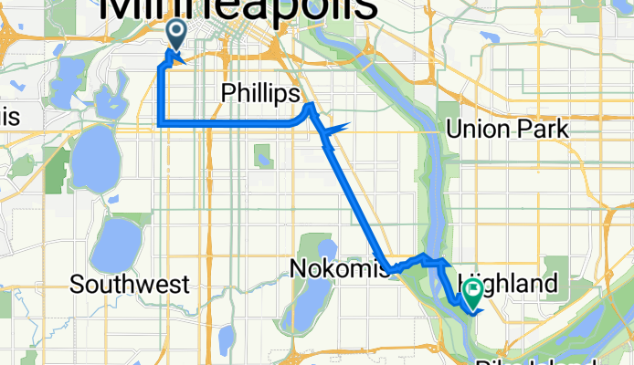
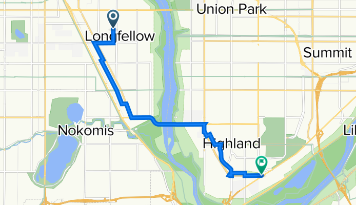
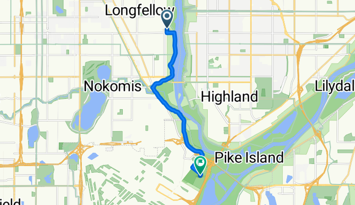
N First St, Minneapolis to Evergreen Knolls, Mendota Heights
Cycling route in Minneapolis, Minnesota, United States
- 22.5 km
- Distance
- 144 m
- Ascent
- 118 m
- Descent
10th Avenue South 2830, Minneapolis to West Maynard Drive 1357W, Saint Paul
Cycling route in Minneapolis, Minnesota, United States
- 12.2 km
- Distance
- 47 m
- Ascent
- 33 m
- Descent
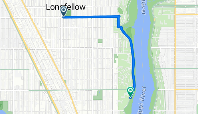
longfellow to bluff
Cycling route in Minneapolis, Minnesota, United States
- 3.2 km
- Distance
- 7 m
- Ascent
- 13 m
- Descent
Fort Snelling
Cycling route in Minneapolis, Minnesota, United States
- 7.4 km
- Distance
- 50 m
- Ascent
- 52 m
- Descent
Mpls - W River & 4th to Stone Arch Bridge and back to Minnehaha
Cycling route in Minneapolis, Minnesota, United States
- 15.9 km
- Distance
- 105 m
- Ascent
- 96 m
- Descent
Discover more routes
 Clifton Avenue 416, Minneapolis to Itasca Avenue 2086, Saint Paul
- Distance
- 15.7 km
- Ascent
- 35 m
- Descent
- 29 m
- Location
- Minneapolis, Minnesota, United States
 N First St, Minneapolis to Evergreen Knolls, Mendota Heights
- Distance
- 22.5 km
- Ascent
- 144 m
- Descent
- 118 m
- Location
- Minneapolis, Minnesota, United States
 testt
testt- Distance
- 9.1 km
- Ascent
- 59 m
- Descent
- 65 m
- Location
- Minneapolis, Minnesota, United States
 10th Avenue South 2830, Minneapolis to West Maynard Drive 1357W, Saint Paul
- Distance
- 12.2 km
- Ascent
- 47 m
- Descent
- 33 m
- Location
- Minneapolis, Minnesota, United States
 longfellow to bluff
- Distance
- 3.2 km
- Ascent
- 7 m
- Descent
- 13 m
- Location
- Minneapolis, Minnesota, United States
 Fort Snelling
- Distance
- 7.4 km
- Ascent
- 50 m
- Descent
- 52 m
- Location
- Minneapolis, Minnesota, United States
 test2
test2- Distance
- 8.7 km
- Ascent
- 59 m
- Descent
- 64 m
- Location
- Minneapolis, Minnesota, United States
 Mpls - W River & 4th to Stone Arch Bridge and back to Minnehaha
- Distance
- 15.9 km
- Ascent
- 105 m
- Descent
- 96 m
- Location
- Minneapolis, Minnesota, United States
Routes from Minneapolis
Cycling day trip from
Minneapolis to Saint Paul
Cycling day trip from
Minneapolis to Richfield
Quick ride by bicycle from
Minneapolis to Saint Louis Park
Quick ride by bicycle from
Minneapolis to Saint Anthony