
By bicycle from Richfield to Saint Louis Park
Customize your own route based on our template or discover how our community prefers to cycle from Richfield to Saint Louis Park.
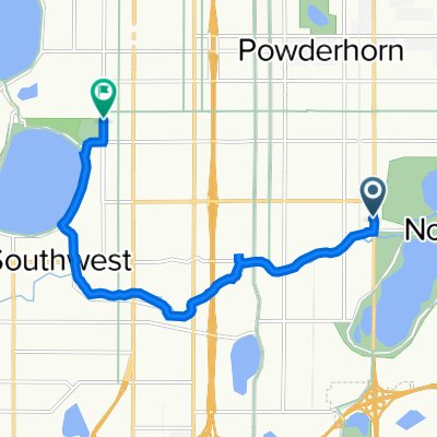
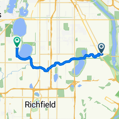
Route template
Richfield to Saint Louis Park
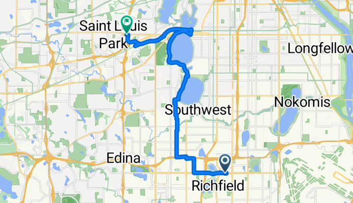
- 57 min
- Duration
- 17.2 km
- Distance
- 97 m
- Ascent
- 78 m
- Descent
- 18.1 km/h
- Avg. speed
- 276 m
- Max. altitude
Roll out from Richfield, a bike‑friendly first‑ring suburb known for Wood Lake Nature Center and Best Buy’s headquarters, and aim northwest toward Saint Louis Park. It’s about 17 km and mostly on separated cycleways with some quiet neighborhood streets, so it feels relaxed and low‑stress.
The route is largely smooth asphalt with a bit of concrete, and the terrain is gentle—think mostly flat with a few mild rises. Expect a steady, easy spin rather than any big climbs. At a casual pace, plan on roughly an hour to an hour and a half.
As you near Saint Louis Park, you can link into regional trails (like the Cedar Lake Regional Trail) that make riding here a breeze. SLP has plenty of post‑ride options—parks such as Wolfe Park and cafés around the West End area are close by.
Tips: watch for pedestrians near parks and trail crossings, and bring lights for the underpasses. It’s a simple, pleasant urban ride connecting two classic Twin Cities suburbs.
Community
Top users in this region


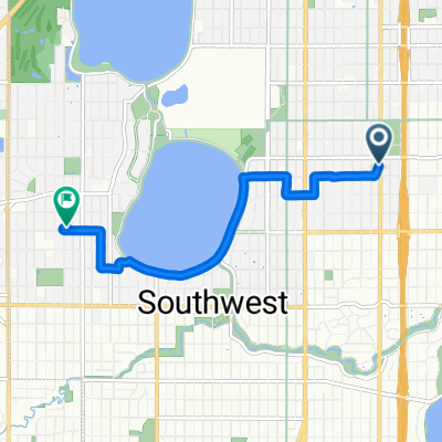
From our community
The best bike routes from Richfield to Saint Louis Park
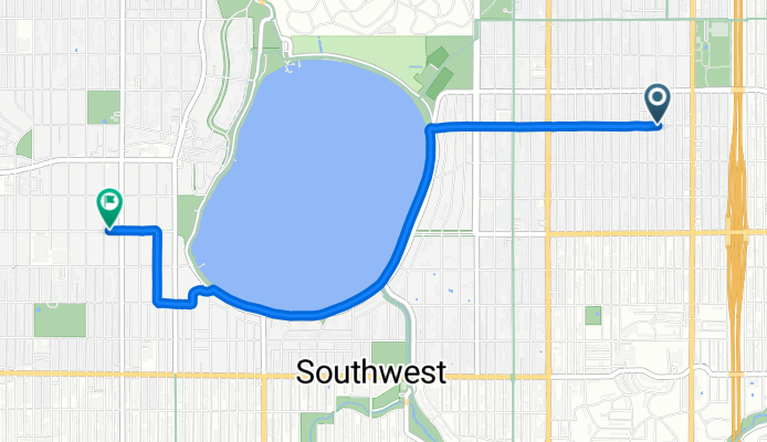
W 43rd St, Minneapolis to Zenith Ave S, Minneapolis
Cycling route in Richfield, Minnesota, United States
- 4.7 km
- Distance
- 33 m
- Ascent
- 26 m
- Descent

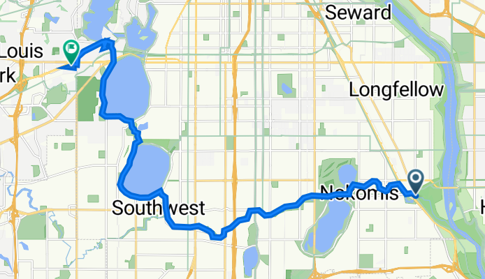
MoA - Office (St. Louis Park)
Cycling route in Richfield, Minnesota, United States
- 21.5 km
- Distance
- 74 m
- Ascent
- 44 m
- Descent

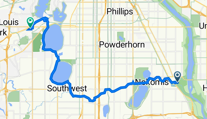
56th & Lyndale to Belt Line Blvd
Cycling route in Richfield, Minnesota, United States
- 9.3 km
- Distance
- 60 m
- Ascent
- 56 m
- Descent

B2B00978 55410>55410 via Upton Av
Cycling route in Richfield, Minnesota, United States
- 1.5 km
- Distance
- 10 m
- Ascent
- 3 m
- Descent

4712 Cedar Ave S, Minneapolis to 4033 King's Hwy, Minneapolis
Cycling route in Richfield, Minnesota, United States
- 7.8 km
- Distance
- 49 m
- Ascent
- 35 m
- Descent
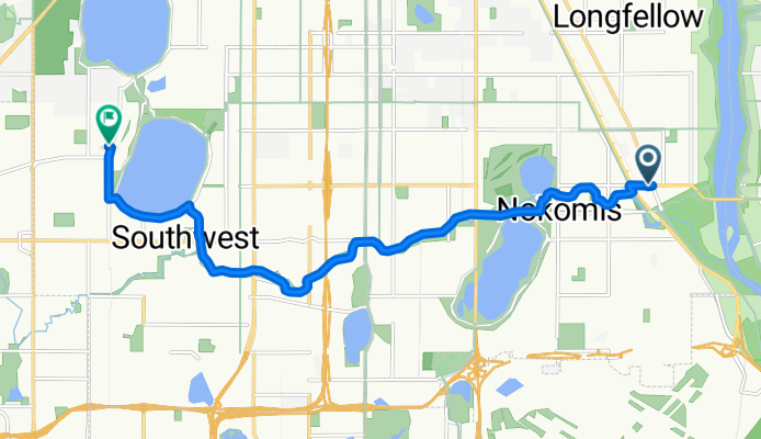
Route to 4015 CR-25, St. Louis Park
Cycling route in Richfield, Minnesota, United States
- 17.6 km
- Distance
- 72 m
- Ascent
- 44 m
- Descent

Oops forgot to record
Cycling route in Richfield, Minnesota, United States
- 15.9 km
- Distance
- 53 m
- Ascent
- 51 m
- Descent
Route to 4015 CR-25, St. Louis Park
Cycling route in Richfield, Minnesota, United States
- 17.7 km
- Distance
- 69 m
- Ascent
- 52 m
- Descent
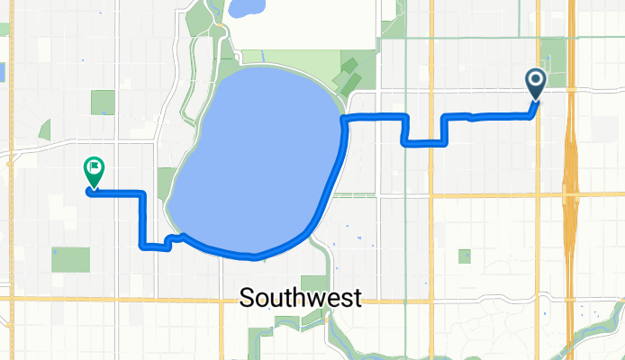
E Lake Harriet Pkwy, Minneapolis to Toledo Ave S, St. Louis Park
Cycling route in Richfield, Minnesota, United States
- 5.1 km
- Distance
- 47 m
- Ascent
- 30 m
- Descent

B2B00001 55419 > 55416 via Lake Harriet, 38th, France
Cycling route in Richfield, Minnesota, United States
- 8.4 km
- Distance
- 75 m
- Ascent
- 76 m
- Descent
3939 E 46th St, Minneapolis to 2810 W 43rd St, Minneapolis
Cycling route in Richfield, Minnesota, United States
- 11.2 km
- Distance
- 57 m
- Ascent
- 43 m
- Descent
Nicollet Ave, Minneapolis to Zenith Ave S, Minneapolis
Cycling route in Richfield, Minnesota, United States
- 5.2 km
- Distance
- 30 m
- Ascent
- 23 m
- Descent
Discover more routes
 4712 Cedar Ave S, Minneapolis to 4033 King's Hwy, Minneapolis
- Distance
- 7.8 km
- Ascent
- 49 m
- Descent
- 35 m
- Location
- Richfield, Minnesota, United States
 Route to 4015 CR-25, St. Louis Park
- Distance
- 17.6 km
- Ascent
- 72 m
- Descent
- 44 m
- Location
- Richfield, Minnesota, United States
 Oops forgot to record
- Distance
- 15.9 km
- Ascent
- 53 m
- Descent
- 51 m
- Location
- Richfield, Minnesota, United States
 Route to 4015 CR-25, St. Louis Park
- Distance
- 17.7 km
- Ascent
- 69 m
- Descent
- 52 m
- Location
- Richfield, Minnesota, United States
- E Lake Harriet Pkwy, Minneapolis to Toledo Ave S, St. Louis Park
- Distance
- 5.1 km
- Ascent
- 47 m
- Descent
- 30 m
- Location
- Richfield, Minnesota, United States
 B2B00001 55419 > 55416 via Lake Harriet, 38th, France
- Distance
- 8.4 km
- Ascent
- 75 m
- Descent
- 76 m
- Location
- Richfield, Minnesota, United States
 3939 E 46th St, Minneapolis to 2810 W 43rd St, Minneapolis
- Distance
- 11.2 km
- Ascent
- 57 m
- Descent
- 43 m
- Location
- Richfield, Minnesota, United States
 Nicollet Ave, Minneapolis to Zenith Ave S, Minneapolis
- Distance
- 5.2 km
- Ascent
- 30 m
- Descent
- 23 m
- Location
- Richfield, Minnesota, United States
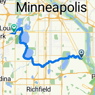
Routes from Richfield
Cycling day trip from
Richfield to Minneapolis
Routes to Saint Louis Park
Cycling day trip from
Burnsville to Saint Louis Park
By bicycle from
Edina to Saint Louis Park
By bicycle from
Minneapolis to Saint Louis Park