
By bicycle from San Francisco to Daly City
Customize your own route based on our template or discover how our community prefers to cycle from San Francisco to Daly City.
Route template
San Francisco to Daly City
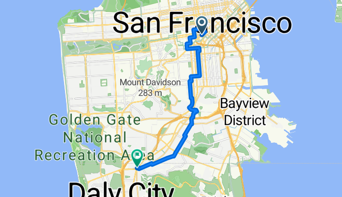
- 48 min
- Duration
- 13.8 km
- Distance
- 240 m
- Ascent
- 139 m
- Descent
- 17.2 km/h
- Avg. speed
- 127 m
- Max. altitude
This ride takes you from the vibrant streets of San Francisco down to Daly City, cruising just under 14 km—with a good bit of climbing along the way! You'll start amidst San Francisco’s iconic hills and unique neighborhoods (maybe grab a coffee to fuel up). The route is mostly on quiet roads and has a decent chunk of dedicated cycleway, so you can ride without too much traffic stress. Expect a smooth roll on asphalt almost the whole way, though about half the surfaces aren’t specified—so be ready for a little variety.
As you head south, you’ll catch great glimpses of the city skyline and, on a clear day, maybe even the Pacific. Daly City is often called the “Gateway to the Peninsula,” marking your transition into a more suburban vibe. If you like a mix of urban energy and chill roads, this route is a solid pick!
Community
Top users in this region


From our community
The best bike routes from San Francisco to Daly City


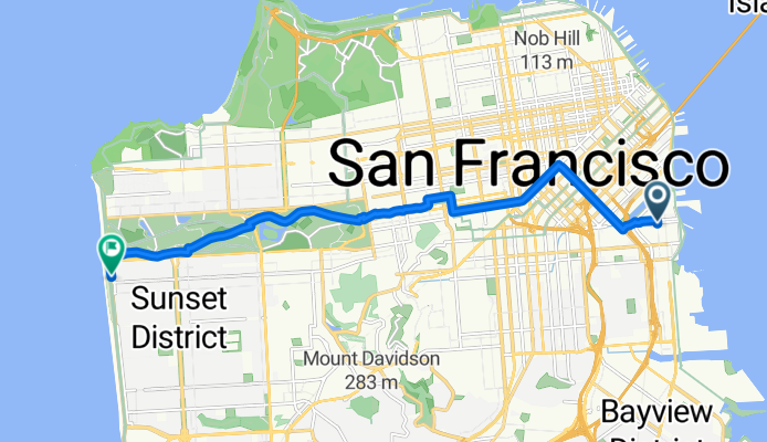
Market Street, San Francisco to 48th Avenue 2499, San Francisco
Cycling route in San Francisco, California, United States
- 12.2 km
- Distance
- 55 m
- Ascent
- 80 m
- Descent
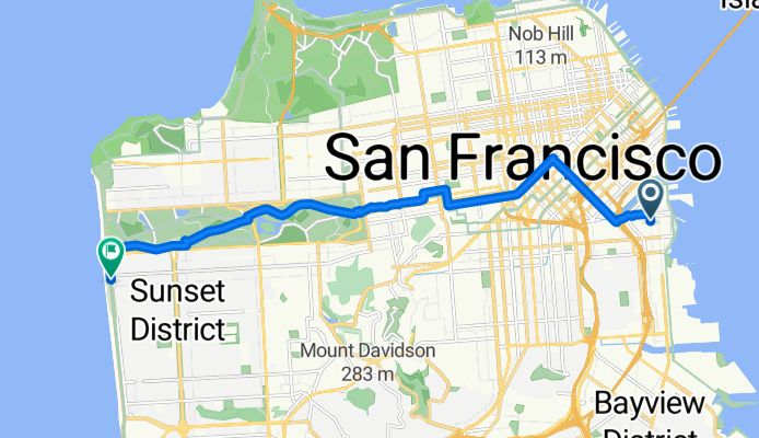
home to Ocean beach
Cycling route in San Francisco, California, United States
- 13.3 km
- Distance
- 137 m
- Ascent
- 129 m
- Descent

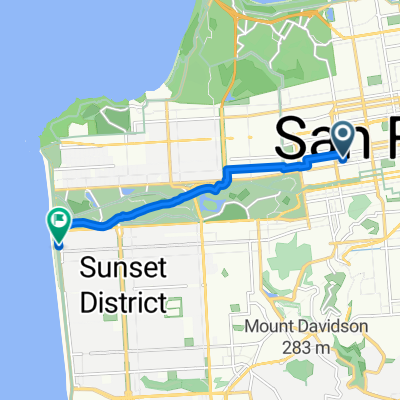
754 Kirkham St, San Francisco to 731 Huron Ave, San Francisco
Cycling route in San Francisco, California, United States
- 9.1 km
- Distance
- 146 m
- Ascent
- 152 m
- Descent
Gene Friend Way to La Playa Street
Cycling route in San Francisco, California, United States
- 14.1 km
- Distance
- 146 m
- Ascent
- 98 m
- Descent

Mission to the Wiggle to Golden Gate Park to Ocean Beach
Cycling route in San Francisco, California, United States
- 11.7 km
- Distance
- 125 m
- Ascent
- 118 m
- Descent

1770 Post St, San Francisco to 214 Edinburgh St, San Francisco
Cycling route in San Francisco, California, United States
- 9.2 km
- Distance
- 128 m
- Ascent
- 86 m
- Descent

Leisurely Ride From Panhandle To Sloat
Cycling route in San Francisco, California, United States
- 10.2 km
- Distance
- 37 m
- Ascent
- 113 m
- Descent

Embarcadero to Chestnut to SFSU to Daly City Bart
Cycling route in San Francisco, California, United States
- 21.6 km
- Distance
- 268 m
- Ascent
- 220 m
- Descent

NDeL: Lake Merced Run
Cycling route in San Francisco, California, United States
- 7.8 km
- Distance
- 62 m
- Ascent
- 109 m
- Descent

Route to Ocean Beach
Cycling route in San Francisco, California, United States
- 7.4 km
- Distance
- 70 m
- Ascent
- 132 m
- Descent

home the long way
Cycling route in San Francisco, California, United States
- 19.2 km
- Distance
- 237 m
- Ascent
- 162 m
- Descent

Rainbow to Home
Cycling route in San Francisco, California, United States
- 8.8 km
- Distance
- 169 m
- Ascent
- 89 m
- Descent
Discover more routes
 Mission to the Wiggle to Golden Gate Park to Ocean Beach
- Distance
- 11.7 km
- Ascent
- 125 m
- Descent
- 118 m
- Location
- San Francisco, California, United States
 1770 Post St, San Francisco to 214 Edinburgh St, San Francisco
- Distance
- 9.2 km
- Ascent
- 128 m
- Descent
- 86 m
- Location
- San Francisco, California, United States
 Leisurely Ride From Panhandle To Sloat
- Distance
- 10.2 km
- Ascent
- 37 m
- Descent
- 113 m
- Location
- San Francisco, California, United States
 Embarcadero to Chestnut to SFSU to Daly City Bart
- Distance
- 21.6 km
- Ascent
- 268 m
- Descent
- 220 m
- Location
- San Francisco, California, United States
 NDeL: Lake Merced Run
- Distance
- 7.8 km
- Ascent
- 62 m
- Descent
- 109 m
- Location
- San Francisco, California, United States
 Route to Ocean Beach
- Distance
- 7.4 km
- Ascent
- 70 m
- Descent
- 132 m
- Location
- San Francisco, California, United States
 home the long way
- Distance
- 19.2 km
- Ascent
- 237 m
- Descent
- 162 m
- Location
- San Francisco, California, United States
 Rainbow to Home
- Distance
- 8.8 km
- Ascent
- 169 m
- Descent
- 89 m
- Location
- San Francisco, California, United States
Routes from San Francisco
Cycling day trip from
San Francisco to Belvedere Tiburon
By bicycle from
San Francisco to Sausalito