
Cycling day trip from Bells Corners to le Plateau
Customize your own route based on our template or discover how our community prefers to cycle from Bells Corners to le Plateau.
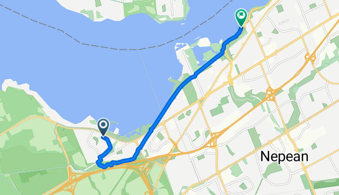
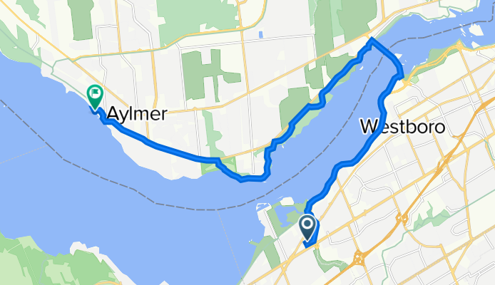
Route template
Bells Corners to le Plateau

- 1 h 43 min
- Duration
- 29.5 km
- Distance
- 185 m
- Ascent
- 192 m
- Descent
- 17.1 km/h
- Avg. speed
- 97 m
- Max. altitude
Kick off your ride in Bells Corners, a lively suburb on Ottawa’s west end packed with local shops and restaurants — and from there, you’re in for a relaxed cruise heading north to le Plateau in Gatineau. This 29.5 km route is mostly on smooth asphalt and paved cycleways, so you can expect a comfy ride the whole way.
You’ll roll out through green neighbourhoods, zip along some dedicated paths (over 70% of this route is on bike trails!), and catch a few gentle hills with about 185 meters of total ascent — just enough to keep things interesting, but nothing too grueling. As you reach le Plateau, you’ll enjoy the vibe of one of Gatineau’s newer and fastest-growing neighbourhoods, known for its parks, shopping, and beautiful views.
This is an ideal city ride if you want to keep things mostly traffic-free and smoothly paved, while getting a taste of both Ottawa and Gatineau scenery. Don’t forget your camera, and maybe plan a coffee stop at either end!
Community
Top users in this region


From our community
The best bike routes from Bells Corners to le Plateau

100 km C
Cycling route in Bells Corners, Ontario, Canada
- 60.5 km
- Distance
- 485 m
- Ascent
- 391 m
- Descent

West Pkwy Beaches
Cycling route in Bells Corners, Ontario, Canada
- 10.1 km
- Distance
- 29 m
- Ascent
- 40 m
- Descent

Carlingwood Library
Cycling route in Bells Corners, Ontario, Canada
- 5.1 km
- Distance
- 16 m
- Ascent
- 13 m
- Descent
Deschênes Rapids w/ Jaafar
Cycling route in Bells Corners, Ontario, Canada
- 7.7 km
- Distance
- 43 m
- Ascent
- 25 m
- Descent

71 Equestrian Dr, Ottawa to Champlain Bridge, Ottawa
Cycling route in Bells Corners, Ontario, Canada
- 20 km
- Distance
- 53 m
- Ascent
- 104 m
- Descent


McClellan Road to Champlain
Cycling route in Bells Corners, Ontario, Canada
- 43.6 km
- Distance
- 639 m
- Ascent
- 417 m
- Descent

1701 County Road 15, Ottawa to Gatineau Pky, Pontiac
Cycling route in Bells Corners, Ontario, Canada
- 34.3 km
- Distance
- 520 m
- Ascent
- 297 m
- Descent

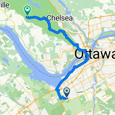
20 Deerfield Dr, Ottawa to 346–398 Du Lac-Meech Lake Rd, Chelsea
Cycling route in Bells Corners, Ontario, Canada
- 44.1 km
- Distance
- 2,580 m
- Ascent
- 2,524 m
- Descent
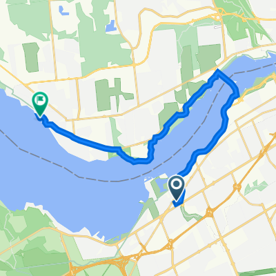
2525 Carling Ave, Ottawa to 1 Rue Principale, Gatineau
Cycling route in Bells Corners, Ontario, Canada
- 17.6 km
- Distance
- 86 m
- Ascent
- 107 m
- Descent
Discover more routes
 71 Equestrian Dr, Ottawa to Champlain Bridge, Ottawa
- Distance
- 20 km
- Ascent
- 53 m
- Descent
- 104 m
- Location
- Bells Corners, Ontario, Canada
 home to Meach
- Distance
- 31.7 km
- Ascent
- 230 m
- Descent
- 143 m
- Location
- Bells Corners, Ontario, Canada
 parliament
- Distance
- 12.4 km
- Ascent
- 34 m
- Descent
- 35 m
- Location
- Bells Corners, Ontario, Canada
 McClellan Road to Champlain
- Distance
- 43.6 km
- Ascent
- 639 m
- Descent
- 417 m
- Location
- Bells Corners, Ontario, Canada
 1701 County Road 15, Ottawa to Gatineau Pky, Pontiac
- Distance
- 34.3 km
- Ascent
- 520 m
- Descent
- 297 m
- Location
- Bells Corners, Ontario, Canada
 Walk 2
- Distance
- 3.6 km
- Ascent
- 28 m
- Descent
- 15 m
- Location
- Bells Corners, Ontario, Canada
 20 Deerfield Dr, Ottawa to 346–398 Du Lac-Meech Lake Rd, Chelsea
- Distance
- 44.1 km
- Ascent
- 2,580 m
- Descent
- 2,524 m
- Location
- Bells Corners, Ontario, Canada
 2525 Carling Ave, Ottawa to 1 Rue Principale, Gatineau
- Distance
- 17.6 km
- Ascent
- 86 m
- Descent
- 107 m
- Location
- Bells Corners, Ontario, Canada
Routes from Bells Corners
Cycling day trip from
Bells Corners to Ottawa
Routes to le Plateau
By bicycle from
Ottawa to le Plateau
By bicycle from
Gatineau to le Plateau