
Quick ride by bicycle from Mississauga to Etobicoke
Customize your own route based on our template or discover how our community prefers to cycle from Mississauga to Etobicoke.
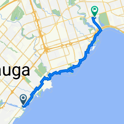
Route template
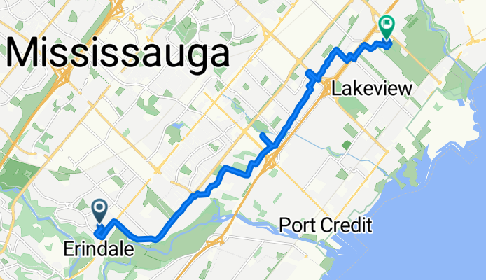
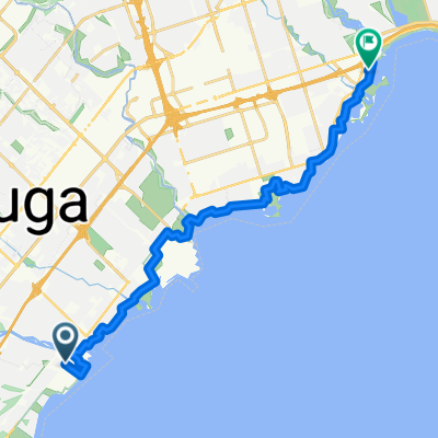
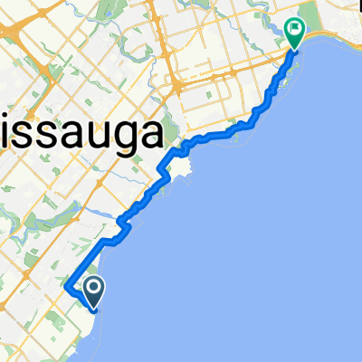
Mississauga to Etobicoke

- 1 h 1 min
- Duration
- 17.7 km
- Distance
- 90 m
- Ascent
- 102 m
- Descent
- 17.5 km/h
- Avg. speed
- 165 m
- Max. altitude
Looking for a fun ride from Mississauga to Etobicoke? This 17.7 km route is a great way to explore the best of the GTA on two wheels! You’ll start off in Mississauga, a diverse city known for its beautiful parks and waterfront, cruising mostly on smooth asphalt paths—perfect for a relaxed, scenic journey.
The ride features a nice mix of dedicated cycleways (about 78% of your trip), so you’ll be able to enjoy the scenery without too much traffic stress. Along the way, expect gentle rolling hills (around 90 meters of ascent and just over 100 meters of descent), so it’s approachable for most cyclists.
Your route ends in Etobicoke, part of Toronto but with a vibe all its own—think leafy neighborhoods, waterfront trails, and easy access to the Humber Bay shoreline. Take a break at one of the local bakeries or explore the parks when you arrive. If you’re after a leisurely, mostly paved cycling adventure that connects two vibrant areas, this ride is a winner!
Community
Top users in this region


From our community
The best bike routes from Mississauga to Etobicoke


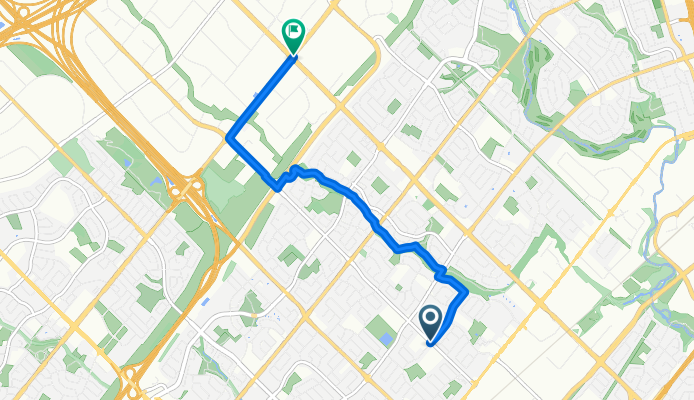
Square1 to Woodbine Casino
Cycling route in Mississauga, Ontario, Canada
- 18.4 km
- Distance
- 122 m
- Ascent
- 103 m
- Descent


Waterfront Trail: Mississauga to Etobicoke
Cycling route in Mississauga, Ontario, Canada
- 6.6 km
- Distance
- 28 m
- Ascent
- 24 m
- Descent
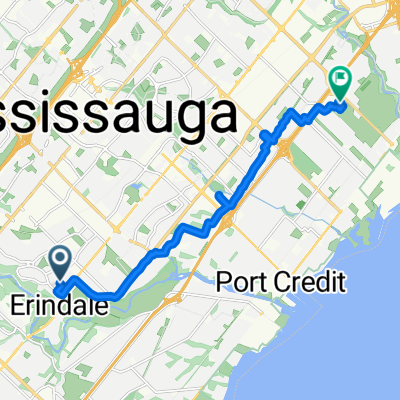
Ballydown Cres, Mississauga to Dixie Rd, Mississauga
Cycling route in Mississauga, Ontario, Canada
- 13 km
- Distance
- 45 m
- Ascent
- 71 m
- Descent

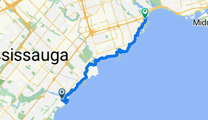
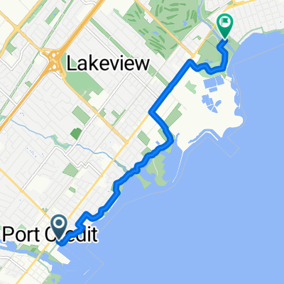
91 Lakeshore Rd E, Mississauga to 65 Deforest Rd, Toronto
Cycling route in Mississauga, Ontario, Canada
- 19.9 km
- Distance
- 74 m
- Ascent
- 48 m
- Descent
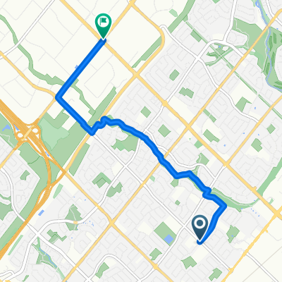
Route in Mississauga
Cycling route in Mississauga, Ontario, Canada
- 6.4 km
- Distance
- 39 m
- Ascent
- 24 m
- Descent

91 Lakeshore Rd E, Mississauga to 2120 Dundas St E, Mississauga
Cycling route in Mississauga, Ontario, Canada
- 11.8 km
- Distance
- 57 m
- Ascent
- 16 m
- Descent
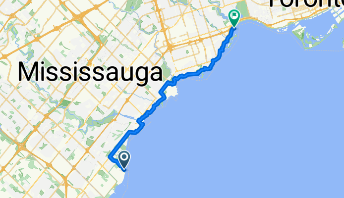
Mississauga Rd S, Mississauga to Marine Parade Dr, Toronto
Cycling route in Mississauga, Ontario, Canada
- 19.6 km
- Distance
- 34 m
- Ascent
- 35 m
- Descent
Watersedge Rd, Mississauga to Humber River Recreational Trail, Toronto
Cycling route in Mississauga, Ontario, Canada
- 24.6 km
- Distance
- 116 m
- Ascent
- 119 m
- Descent
Discover more routes
 Sq1toWdbnRtk
- Distance
- 19.7 km
- Ascent
- 126 m
- Descent
- 105 m
- Location
- Mississauga, Ontario, Canada
 Waterfront Trail: Mississauga to Etobicoke
- Distance
- 6.6 km
- Ascent
- 28 m
- Descent
- 24 m
- Location
- Mississauga, Ontario, Canada
 Ballydown Cres, Mississauga to Dixie Rd, Mississauga
- Distance
- 13 km
- Ascent
- 45 m
- Descent
- 71 m
- Location
- Mississauga, Ontario, Canada
 91 Lakeshore Rd E, Mississauga to 65 Deforest Rd, Toronto
- Distance
- 19.9 km
- Ascent
- 74 m
- Descent
- 48 m
- Location
- Mississauga, Ontario, Canada
 Route in Mississauga
- Distance
- 6.4 km
- Ascent
- 39 m
- Descent
- 24 m
- Location
- Mississauga, Ontario, Canada
 91 Lakeshore Rd E, Mississauga to 2120 Dundas St E, Mississauga
- Distance
- 11.8 km
- Ascent
- 57 m
- Descent
- 16 m
- Location
- Mississauga, Ontario, Canada
 Mississauga Rd S, Mississauga to Marine Parade Dr, Toronto
- Distance
- 19.6 km
- Ascent
- 34 m
- Descent
- 35 m
- Location
- Mississauga, Ontario, Canada
 Watersedge Rd, Mississauga to Humber River Recreational Trail, Toronto
- Distance
- 24.6 km
- Ascent
- 116 m
- Descent
- 119 m
- Location
- Mississauga, Ontario, Canada
Routes from Mississauga
Cycling day trip from
Mississauga to Oakville
Cycling day trip from
Mississauga to Milton
Routes to Etobicoke
Cycling day trip from
Toronto to Etobicoke
Cycling day trip from
Concord to Etobicoke