
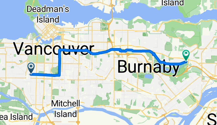
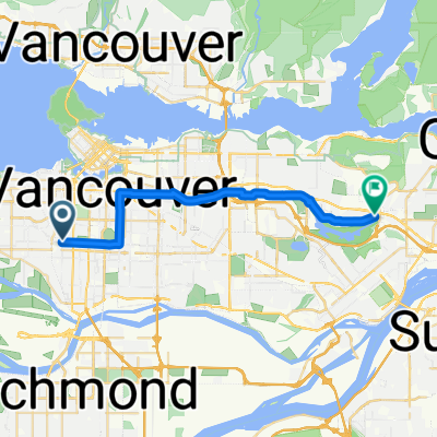
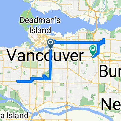
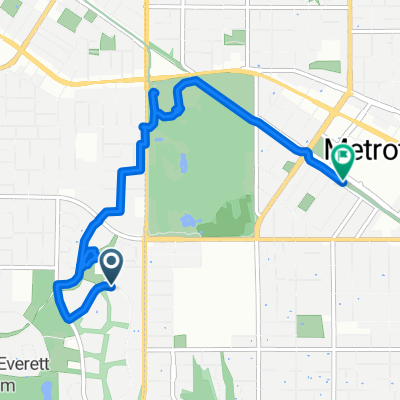
Route template
Vancouver to Burnaby

- 58 min
- Duration
- 17.2 km
- Distance
- 185 m
- Ascent
- 174 m
- Descent
- 17.7 km/h
- Avg. speed
- 118 m
- Max. altitude
This bike ride takes you from Vancouver’s lively cityscape to the heart of Burnaby, all in just over 17 km. Leaving Vancouver, you’ll pedal through mostly tranquil roads (and a dedicated cycleway for part of your journey)—so it’s a relaxed route with minimal traffic hassle. The pavement’s in great shape for nearly the entire way, so expect a smooth ride, whether you’re on a road bike or a cruiser.
The route climbs a bit—just shy of 200 meters total ascent—but nothing that’ll leave you gasping unless you sprint the hills! Cycling north-east, you’ll see the city fade into greener, quieter neighborhoods. Burnaby, your destination, is known for its beautiful parks, like Central Park and Burnaby Lake, and is just a few pedal-strokes away from Vancouver but with a whole different feel. In less than two hours, you can swap bustling urban life for peaceful suburban charm. Great for a daily commute, a weekend outing, or just discovering a new favorite coffee spot!
Community
Top users in this region


From our community
The best bike routes from Vancouver to Burnaby

Lakewood Studio
Cycling route in Vancouver, British Columbia, Canada
- 10.8 km
- Distance
- 78 m
- Ascent
- 165 m
- Descent

Central Valley Greenway to Burnaby Lake
Cycling route in Vancouver, British Columbia, Canada
- 16.9 km
- Distance
- 41 m
- Ascent
- 109 m
- Descent

W 36th Ave, Vancouver to BC Pky, Burnaby
Cycling route in Vancouver, British Columbia, Canada
- 12.7 km
- Distance
- 141 m
- Ascent
- 98 m
- Descent

Bike to Deep Cove
Cycling route in Vancouver, British Columbia, Canada
- 26.3 km
- Distance
- 232 m
- Ascent
- 234 m
- Descent
Cypress Street to Government Street
Cycling route in Vancouver, British Columbia, Canada
- 21.8 km
- Distance
- 104 m
- Ascent
- 153 m
- Descent

3779 Beatrice St, Vancouver to 5069–5271 Penzance Dr, Burnaby
Cycling route in Vancouver, British Columbia, Canada
- 10.1 km
- Distance
- 126 m
- Ascent
- 132 m
- Descent


Bike to Burnaby
Cycling route in Vancouver, British Columbia, Canada
- 6 km
- Distance
- 114 m
- Ascent
- 27 m
- Descent

Deer lake park!
Cycling route in Vancouver, British Columbia, Canada
- 11.7 km
- Distance
- 132 m
- Ascent
- 122 m
- Descent
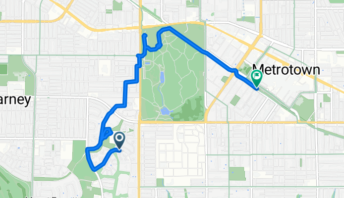
Celista Drive to Metrotown Station
Cycling route in Vancouver, British Columbia, Canada
- 5.7 km
- Distance
- 96 m
- Ascent
- 48 m
- Descent

525 E Fifth Ave, Vancouver to 5210 Norfolk St, Burnaby
Cycling route in Vancouver, British Columbia, Canada
- 9.4 km
- Distance
- 96 m
- Ascent
- 63 m
- Descent
Discover more routes
 Cypress Street to Government Street
- Distance
- 21.8 km
- Ascent
- 104 m
- Descent
- 153 m
- Location
- Vancouver, British Columbia, Canada
 3779 Beatrice St, Vancouver to 5069–5271 Penzance Dr, Burnaby
- Distance
- 10.1 km
- Ascent
- 126 m
- Descent
- 132 m
- Location
- Vancouver, British Columbia, Canada
 To Work
- Distance
- 9.5 km
- Ascent
- 90 m
- Descent
- 69 m
- Location
- Vancouver, British Columbia, Canada
 Slow ride
- Distance
- 35 km
- Ascent
- 304 m
- Descent
- 256 m
- Location
- Vancouver, British Columbia, Canada
 Bike to Burnaby
- Distance
- 6 km
- Ascent
- 114 m
- Descent
- 27 m
- Location
- Vancouver, British Columbia, Canada
 Deer lake park!
- Distance
- 11.7 km
- Ascent
- 132 m
- Descent
- 122 m
- Location
- Vancouver, British Columbia, Canada
 Celista Drive to Metrotown Station
- Distance
- 5.7 km
- Ascent
- 96 m
- Descent
- 48 m
- Location
- Vancouver, British Columbia, Canada
 525 E Fifth Ave, Vancouver to 5210 Norfolk St, Burnaby
- Distance
- 9.4 km
- Ascent
- 96 m
- Descent
- 63 m
- Location
- Vancouver, British Columbia, Canada
Routes from Vancouver
Cycling day trip from
Vancouver to New Westminster
By bicycle from
Vancouver to North Vancouver
By bicycle from
Vancouver to West End
Routes to Burnaby
By bicycle from
West End to Burnaby
By bicycle from
New Westminster to Burnaby