
By bicycle from West End of London to Hackney
Customize your own route based on our template or discover how our community prefers to cycle from West End of London to Hackney.
Route template
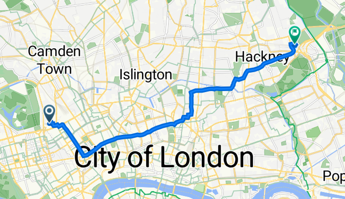
West End of London to Hackney

- 47 min
- Duration
- 13.9 km
- Distance
- 76 m
- Ascent
- 101 m
- Descent
- 17.7 km/h
- Avg. speed
- 43 m
- Max. altitude
This ride takes you from the vibrant West End—a hub of theatres, shops, and nightlife—over to Hackney, one of East London’s coolest creative districts. The route covers a bit under 14 km on mostly paved surfaces, with plenty of dedicated cycleways and quiet roads, so it’s beginner-friendly and pretty comfortable.
You’ll glide past some classic London landmarks as you head east, possibly catching glimpses of Soho’s busy corners, historic Bloomsbury, and the green spaces around Islington. Expect modest elevation, with a gentle climb and even easier descent, making it a pretty relaxed journey.
Arriving in Hackney, you’ll find street art, independent cafes, and lively parks. London Fields and Broadway Market are must-visits if you want to stretch your legs or grab a coffee. With Hackney’s diverse vibe—blending local markets, vintage shops, and vibrant nightlife—you’ll enjoy both the ride and the destination.
Community
Top users in this region


From our community
The best bike routes from West End of London to Hackney

11–15 Portman Square, London to Beckford House, Mayville Estate, London
Cycling route in West End of London, England, United Kingdom
- 8.6 km
- Distance
- 61 m
- Ascent
- 68 m
- Descent

42 Langham Street, London to 11 Mildmay Road, London
Cycling route in West End of London, England, United Kingdom
- 9.1 km
- Distance
- 25 m
- Ascent
- 32 m
- Descent

20-22 Elsley court, Great Titchfield St, London to 43–47 Oldhill St, London
Cycling route in West End of London, England, United Kingdom
- 10.1 km
- Distance
- 39 m
- Ascent
- 35 m
- Descent

Cleveland Street 102 to Spring Lea Cruising Club
Cycling route in West End of London, England, United Kingdom
- 11.2 km
- Distance
- 53 m
- Ascent
- 79 m
- Descent
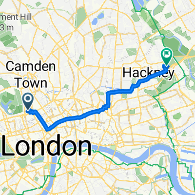
![warren st. to leyton orient [and back]](https://media.bikemap.net/routes/600795/staticmaps/in_8e81bf6f-f77b-4383-8d86-fa5fc5a5dd26_694x400_bikemap-2021-3D-static.png)
warren st. to leyton orient [and back]
Cycling route in West End of London, England, United Kingdom
- 12.8 km
- Distance
- 34 m
- Ascent
- 59 m
- Descent

50 Knightsbridge, London to Fisheries Building, 40-44 Lamb Lane, London
Cycling route in West End of London, England, United Kingdom
- 11 km
- Distance
- 80 m
- Ascent
- 73 m
- Descent

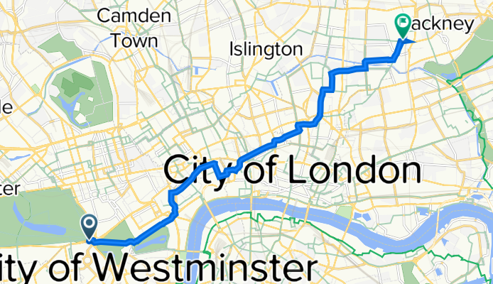
51.517° N -0.142° W to 51.548° N -0.011° W
Cycling route in West End of London, England, United Kingdom
- 13.9 km
- Distance
- 66 m
- Ascent
- 91 m
- Descent

39 Devonshire Close, London to 10 Endeavour Square, London
Cycling route in West End of London, England, United Kingdom
- 14.1 km
- Distance
- 301 m
- Ascent
- 322 m
- Descent

81 Baker St, London a 211 Crownfield Road, London
Cycling route in West End of London, England, United Kingdom
- 13.5 km
- Distance
- 211 m
- Ascent
- 230 m
- Descent
Longford Street 8 to Edmeston Close 98
Cycling route in West End of London, England, United Kingdom
- 10.2 km
- Distance
- 0 m
- Ascent
- 63 m
- Descent

Upper Brook Street 20 to Marcon Place 16
Cycling route in West End of London, England, United Kingdom
- 9.8 km
- Distance
- 10 m
- Ascent
- 18 m
- Descent
Hyde Park Corner Station, Knightsbridge, London to 56 The Vicarage, Lamb Lane, London
Cycling route in West End of London, England, United Kingdom
- 9.9 km
- Distance
- 139 m
- Ascent
- 143 m
- Descent
Discover more routes
![warren st. to leyton orient [and back]](https://media.bikemap.net/routes/600795/staticmaps/in_8e81bf6f-f77b-4383-8d86-fa5fc5a5dd26_400x400_bikemap-2021-3D-static.png) warren st. to leyton orient [and back]
warren st. to leyton orient [and back]- Distance
- 12.8 km
- Ascent
- 34 m
- Descent
- 59 m
- Location
- West End of London, England, United Kingdom
 50 Knightsbridge, London to Fisheries Building, 40-44 Lamb Lane, London
- Distance
- 11 km
- Ascent
- 80 m
- Descent
- 73 m
- Location
- West End of London, England, United Kingdom
 51.517° N -0.142° W to 51.548° N -0.011° W
- Distance
- 13.9 km
- Ascent
- 66 m
- Descent
- 91 m
- Location
- West End of London, England, United Kingdom
 39 Devonshire Close, London to 10 Endeavour Square, London
- Distance
- 14.1 km
- Ascent
- 301 m
- Descent
- 322 m
- Location
- West End of London, England, United Kingdom
 81 Baker St, London a 211 Crownfield Road, London
- Distance
- 13.5 km
- Ascent
- 211 m
- Descent
- 230 m
- Location
- West End of London, England, United Kingdom
 Longford Street 8 to Edmeston Close 98
- Distance
- 10.2 km
- Ascent
- 0 m
- Descent
- 63 m
- Location
- West End of London, England, United Kingdom
 Upper Brook Street 20 to Marcon Place 16
- Distance
- 9.8 km
- Ascent
- 10 m
- Descent
- 18 m
- Location
- West End of London, England, United Kingdom
 Hyde Park Corner Station, Knightsbridge, London to 56 The Vicarage, Lamb Lane, London
- Distance
- 9.9 km
- Ascent
- 139 m
- Descent
- 143 m
- Location
- West End of London, England, United Kingdom
Routes from West End of London
By bicycle from
West End of London to Clerkenwell
By bicycle from
West End of London to Holloway
Routes to Hackney
By bicycle from
City of London to Hackney
By bicycle from
Camberwell to Hackney