
Cycling day trip from Sátoraljaújhely to Gönc
Customize your own route based on our template or discover how our community prefers to cycle from Sátoraljaújhely to Gönc.
Route template
Sátoraljaújhely to Gönc

- 3 h 47 min
- Duration
- 51.3 km
- Distance
- 827 m
- Ascent
- 689 m
- Descent
- 13.6 km/h
- Avg. speed
- 564 m
- Max. altitude
Get ready for a scenic adventure starting in Sátoraljaújhely, a charming border town famed for its hilltop castle and the Zemplén Adventure Park. Your ride to Gönc covers just over 51 km and takes you deep into northern Hungary’s picturesque landscapes.
The route will challenge your legs, with about 827 meters of climbing—expect some solid hills as you ride through the Zemplén Mountains. Surfaces are a real mix: while almost a third is smooth asphalt, you’ll tackle plenty of tracks (including gravel and ground), making this ideal for gravel bikes or sturdy hybrids.
You’ll wind through forests, quiet roads, and authentic villages, soaking in the peaceful vibes of the Hungarian countryside. Watch out for the “missing surface” segments—those could throw in a little off-the-beaten-track excitement!
When you roll into Gönc, reward yourself with some famous Gönc apricot pálinka (brandy)—the town is celebrated for its orchards and fruit brandy. This memorable route is perfect for adventurous cyclists keen on exploring Hungary’s lesser-known wonders.
Community
Top users in this region


From our community
The best bike routes from Sátoraljaújhely to Gönc

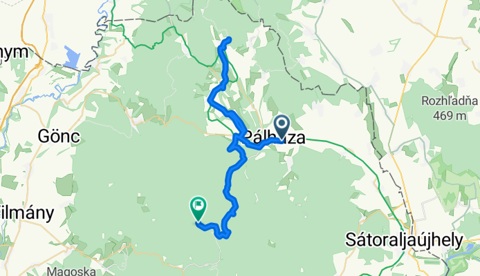
STEREO 10.1 Pálháza-Kőkapu
Cycling route in Sátoraljaújhely, Borsod-Abauj Zemplen county, Hungary
- 22.5 km
- Distance
- 558 m
- Ascent
- 481 m
- Descent

From Pálháza to Mogyoróska
Cycling route in Sátoraljaújhely, Borsod-Abauj Zemplen county, Hungary
- 24.9 km
- Distance
- 894 m
- Ascent
- 446 m
- Descent
Pálháza_Füzér_Kerekkő
Cycling route in Sátoraljaújhely, Borsod-Abauj Zemplen county, Hungary
- 41.8 km
- Distance
- 709 m
- Ascent
- 379 m
- Descent

Pálháza_Füzér
Cycling route in Sátoraljaújhely, Borsod-Abauj Zemplen county, Hungary
- 15.2 km
- Distance
- 345 m
- Ascent
- 58 m
- Descent

OKT Nagy-Milici Kék 2
Cycling route in Sátoraljaújhely, Borsod-Abauj Zemplen county, Hungary
- 17.5 km
- Distance
- 252 m
- Ascent
- 227 m
- Descent

Touring 2.1 Pálháza-Regéc Vára
Cycling route in Sátoraljaújhely, Borsod-Abauj Zemplen county, Hungary
- 28.4 km
- Distance
- 735 m
- Ascent
- 287 m
- Descent

18.6 TOURING Pálháza-Pusztaf-Füzér-Aszfalt
Cycling route in Sátoraljaújhely, Borsod-Abauj Zemplen county, Hungary
- 16.7 km
- Distance
- 361 m
- Ascent
- 81 m
- Descent

18.1 TOURING PÁlháza-Pusztaf-Füzér-Hollóh-Aszfalt
Cycling route in Sátoraljaújhely, Borsod-Abauj Zemplen county, Hungary
- 22.6 km
- Distance
- 459 m
- Ascent
- 301 m
- Descent

Touring 5.2 GYEREK Pálháza-Cserepes Tető-Béla-kő
Cycling route in Sátoraljaújhely, Borsod-Abauj Zemplen county, Hungary
- 5 km
- Distance
- 49 m
- Ascent
- 35 m
- Descent

18.3 TOURING PÁlháza-Pusztaf-IZRA-tó-Füzér-Hollóh-Aszfalt
Cycling route in Sátoraljaújhely, Borsod-Abauj Zemplen county, Hungary
- 27.8 km
- Distance
- 571 m
- Ascent
- 416 m
- Descent

pünkösdi túra 2015 1. nap
Cycling route in Sátoraljaújhely, Borsod-Abauj Zemplen county, Hungary
- 23.7 km
- Distance
- 183 m
- Ascent
- 74 m
- Descent

Touring 3.5 Pálháza(vizimalom)-Kőkapu(RÖNK)
Cycling route in Sátoraljaújhely, Borsod-Abauj Zemplen county, Hungary
- 9.8 km
- Distance
- 134 m
- Ascent
- 33 m
- Descent
Discover more routes
 OKT Nagy-Milici Kék 2
- Distance
- 17.5 km
- Ascent
- 252 m
- Descent
- 227 m
- Location
- Sátoraljaújhely, Borsod-Abauj Zemplen county, Hungary
 Touring 2.1 Pálháza-Regéc Vára
- Distance
- 28.4 km
- Ascent
- 735 m
- Descent
- 287 m
- Location
- Sátoraljaújhely, Borsod-Abauj Zemplen county, Hungary
 18.6 TOURING Pálháza-Pusztaf-Füzér-Aszfalt
- Distance
- 16.7 km
- Ascent
- 361 m
- Descent
- 81 m
- Location
- Sátoraljaújhely, Borsod-Abauj Zemplen county, Hungary
 18.1 TOURING PÁlháza-Pusztaf-Füzér-Hollóh-Aszfalt
- Distance
- 22.6 km
- Ascent
- 459 m
- Descent
- 301 m
- Location
- Sátoraljaújhely, Borsod-Abauj Zemplen county, Hungary
 Touring 5.2 GYEREK Pálháza-Cserepes Tető-Béla-kő
- Distance
- 5 km
- Ascent
- 49 m
- Descent
- 35 m
- Location
- Sátoraljaújhely, Borsod-Abauj Zemplen county, Hungary
 18.3 TOURING PÁlháza-Pusztaf-IZRA-tó-Füzér-Hollóh-Aszfalt
- Distance
- 27.8 km
- Ascent
- 571 m
- Descent
- 416 m
- Location
- Sátoraljaújhely, Borsod-Abauj Zemplen county, Hungary
 pünkösdi túra 2015 1. nap
- Distance
- 23.7 km
- Ascent
- 183 m
- Descent
- 74 m
- Location
- Sátoraljaújhely, Borsod-Abauj Zemplen county, Hungary
 Touring 3.5 Pálháza(vizimalom)-Kőkapu(RÖNK)
- Distance
- 9.8 km
- Ascent
- 134 m
- Descent
- 33 m
- Location
- Sátoraljaújhely, Borsod-Abauj Zemplen county, Hungary
Routes to Gönc
Cycling day trip from
Košice to Gönc