
Cycling day trip from Gönc to Sátoraljaújhely
Customize your own route based on our template or discover how our community prefers to cycle from Gönc to Sátoraljaújhely.
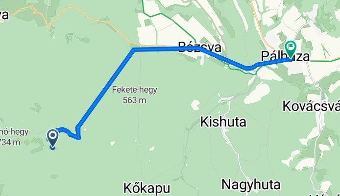
Route template
Gönc to Sátoraljaújhely

- 3 h 36 min
- Duration
- 47.3 km
- Distance
- 736 m
- Ascent
- 873 m
- Descent
- 13.1 km/h
- Avg. speed
- 473 m
- Max. altitude
This scenic cycling route takes you from the small town of Gönc—known for its legendary apricot brandy and rich history—over to the captivating border town of Sátoraljaújhely. You’ll cover just over 47 km, pedaling through a mix of rolling hills and picturesque northern Hungarian landscapes. Expect a solid workout, as there’s over 700 meters of climbing and some real descents too—nothing too extreme, but enough to keep it interesting.
You’re mostly riding on paved or asphalt surfaces, but there’s a good stretch of unpaved and gravel, so a hybrid or gravel bike will make for a smoother ride. The route threads through quiet roads and tracks, with minimal busy road sections. Along the way, you’ll get glimpses of rural villages and possibly vineyards, as this region is famed for its agriculture.
When you roll into Sátoraljaújhely, you’ll be at the gateway to Zemplén Hills and near the Slovak border—a town famed for history, adventure parks, and unique landmarks like the Magyar Kálvária. All in all, it’s a rewarding, off-the-beaten-path adventure for cyclists!
Community
Top users in this region


From our community
The best bike routes from Gönc to Sátoraljaújhely

12.31 Zemplén kör 2022
Cycling route in Gönc, Borsod-Abauj Zemplen county, Hungary
- 20.7 km
- Distance
- 198 m
- Ascent
- 481 m
- Descent


Pálháza 30km körút
Cycling route in Gönc, Borsod-Abauj Zemplen county, Hungary
- 14.2 km
- Distance
- 80 m
- Ascent
- 388 m
- Descent

STEREO 10.2 Kőkapu-Pálháza
Cycling route in Gönc, Borsod-Abauj Zemplen county, Hungary
- 8.5 km
- Distance
- 25 m
- Ascent
- 101 m
- Descent

18.7 TOURING Pálháza-Pusztaf-Füzér-Aszfalt
Cycling route in Gönc, Borsod-Abauj Zemplen county, Hungary
- 16.4 km
- Distance
- 67 m
- Ascent
- 351 m
- Descent

18.4 TOURING VISSZA PÁlháza-Pusztaf-IZRA-tó-Füzér-Hollóh-Aszfalt
Cycling route in Gönc, Borsod-Abauj Zemplen county, Hungary
- 27.5 km
- Distance
- 408 m
- Ascent
- 566 m
- Descent

3. napi túraútvonal_zemplén
Cycling route in Gönc, Borsod-Abauj Zemplen county, Hungary
- 50.4 km
- Distance
- 685 m
- Ascent
- 748 m
- Descent

pálháza
Cycling route in Gönc, Borsod-Abauj Zemplen county, Hungary
- 13.5 km
- Distance
- 101 m
- Ascent
- 206 m
- Descent

Touring 2.2 Regéc Vára - Pálháza
Cycling route in Gönc, Borsod-Abauj Zemplen county, Hungary
- 28.4 km
- Distance
- 268 m
- Ascent
- 712 m
- Descent

Touring 2.65 Kőkapu (RÖNK) - Szuha völgy - Pálháza
Cycling route in Gönc, Borsod-Abauj Zemplen county, Hungary
- 13.6 km
- Distance
- 86 m
- Ascent
- 189 m
- Descent

Családos Zemplén kör - 2014 - III. szakasz
Cycling route in Gönc, Borsod-Abauj Zemplen county, Hungary
- 27 km
- Distance
- 230 m
- Ascent
- 301 m
- Descent

Touring 5.3 GYEREK Béla-kő-Szuha-völgy-Pálháza
Cycling route in Gönc, Borsod-Abauj Zemplen county, Hungary
- 6.9 km
- Distance
- 72 m
- Ascent
- 87 m
- Descent

Touring 2.6 Kőkapu (RÖNK) - Pálháza
Cycling route in Gönc, Borsod-Abauj Zemplen county, Hungary
- 9.3 km
- Distance
- 29 m
- Ascent
- 129 m
- Descent
Discover more routes
 18.4 TOURING VISSZA PÁlháza-Pusztaf-IZRA-tó-Füzér-Hollóh-Aszfalt
- Distance
- 27.5 km
- Ascent
- 408 m
- Descent
- 566 m
- Location
- Gönc, Borsod-Abauj Zemplen county, Hungary
 3. napi túraútvonal_zemplén
- Distance
- 50.4 km
- Ascent
- 685 m
- Descent
- 748 m
- Location
- Gönc, Borsod-Abauj Zemplen county, Hungary
 pálháza
- Distance
- 13.5 km
- Ascent
- 101 m
- Descent
- 206 m
- Location
- Gönc, Borsod-Abauj Zemplen county, Hungary
 Touring 2.2 Regéc Vára - Pálháza
- Distance
- 28.4 km
- Ascent
- 268 m
- Descent
- 712 m
- Location
- Gönc, Borsod-Abauj Zemplen county, Hungary
 Touring 2.65 Kőkapu (RÖNK) - Szuha völgy - Pálháza
- Distance
- 13.6 km
- Ascent
- 86 m
- Descent
- 189 m
- Location
- Gönc, Borsod-Abauj Zemplen county, Hungary
 Családos Zemplén kör - 2014 - III. szakasz
- Distance
- 27 km
- Ascent
- 230 m
- Descent
- 301 m
- Location
- Gönc, Borsod-Abauj Zemplen county, Hungary
 Touring 5.3 GYEREK Béla-kő-Szuha-völgy-Pálháza
- Distance
- 6.9 km
- Ascent
- 72 m
- Descent
- 87 m
- Location
- Gönc, Borsod-Abauj Zemplen county, Hungary
 Touring 2.6 Kőkapu (RÖNK) - Pálháza
- Distance
- 9.3 km
- Ascent
- 29 m
- Descent
- 129 m
- Location
- Gönc, Borsod-Abauj Zemplen county, Hungary