
Cycling day trip from Vysoké Tatry to Ždiar
Customize your own route based on our template or discover how our community prefers to cycle from Vysoké Tatry to Ždiar.
Route template
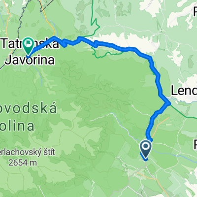
Vysoké Tatry to Ždiar
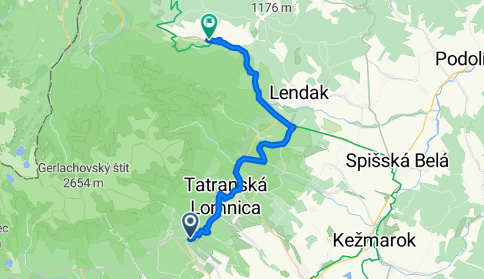
- 2 h 1 min
- Duration
- 27.5 km
- Distance
- 566 m
- Ascent
- 581 m
- Descent
- 13.6 km/h
- Avg. speed
- 930 m
- Max. altitude
Ready for a ride through the heart of the High Tatras? This route starts in the mountain town of Vysoké Tatry—famous for its stunning alpine scenery and the gateway to Slovakia’s tallest peaks. You’ll pedal north for just under 28 km, heading toward the charming mountain village of Ždiar. Along the way, you’ll tackle over 560 meters of climbing (and enjoy even more on the way down!), weaving through fir forests, meadows, and open mountain panoramas.
About half the route is smooth asphalt, while the rest includes some gravel and unpaved tracks—so a gravel or mountain bike is your friend. Expect a mix of dedicated cycleways and quiet backroads, with only brief encounters with busier traffic. Ždiar, your destination, is famous for its brightly painted wooden houses and traditional Goral culture—so don’t forget to explore the village after your ride!
It’s a beautiful, moderately challenging route for anyone keen to soak up some Tatras nature and Slovak mountain charm.
Community
Top users in this region


From our community
The best bike routes from Vysoké Tatry to Ždiar

Biela voda-2869-8866-8863-2870-Zdiar-MTB
Cycling route in Vysoké Tatry, Prešov Region, Slovakia
- 28.8 km
- Distance
- 534 m
- Ascent
- 518 m
- Descent

2022 - IL - day6 - Tatranská Lomnica - Zelené pleso and back
Cycling route in Vysoké Tatry, Prešov Region, Slovakia
- 10.8 km
- Distance
- 715 m
- Ascent
- 21 m
- Descent
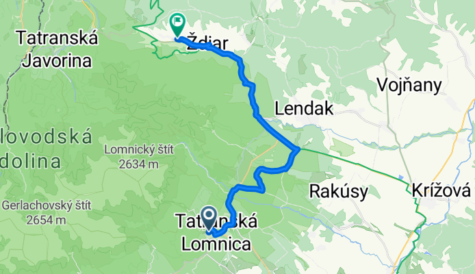
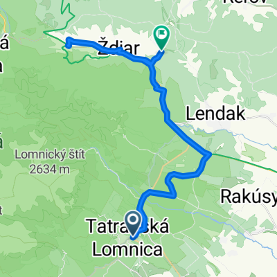
Tatranská Lomnica, Vysoké Tatry až Ždiar, Ždiar
Cycling route in Vysoké Tatry, Prešov Region, Slovakia
- 23.8 km
- Distance
- 556 m
- Ascent
- 495 m
- Descent

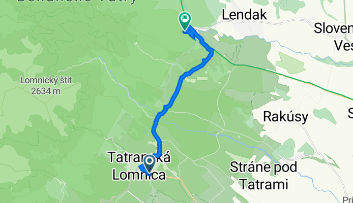
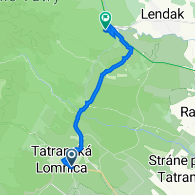
Projekt: 231108 5 km Dolina Kežmarskej Bielej vody
Cycling route in Vysoké Tatry, Prešov Region, Slovakia
- 4.8 km
- Distance
- 462 m
- Ascent
- 0 m
- Descent

Tatry 2010 - Tatranské Matliare - Tatranská Javorina
Cycling route in Vysoké Tatry, Prešov Region, Slovakia
- 25.7 km
- Distance
- 574 m
- Ascent
- 452 m
- Descent

Tatranská Lomnica - Osturňa
Cycling route in Vysoké Tatry, Prešov Region, Slovakia
- 31.9 km
- Distance
- 491 m
- Ascent
- 595 m
- Descent
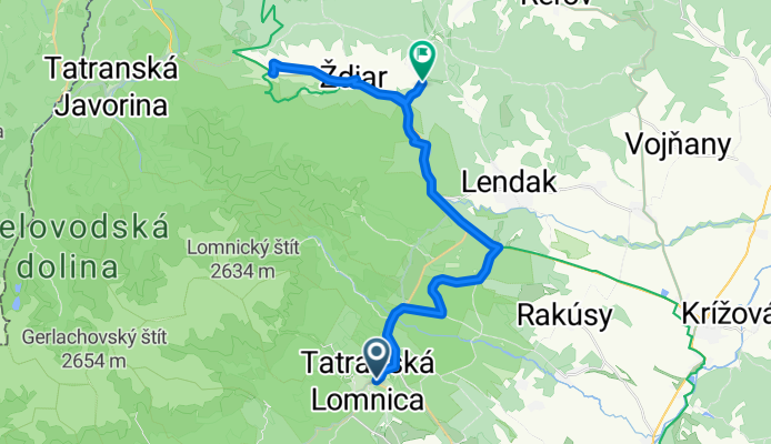
Tátralomnic, Magastátra - Ždiar, Zár
Cycling route in Vysoké Tatry, Prešov Region, Slovakia
- 31.8 km
- Distance
- 772 m
- Ascent
- 733 m
- Descent

Tatranská Lomnica- Tatranská Javorina
Cycling route in Vysoké Tatry, Prešov Region, Slovakia
- 28 km
- Distance
- 519 m
- Ascent
- 366 m
- Descent

zelene pleso
Cycling route in Vysoké Tatry, Prešov Region, Slovakia
- 10.5 km
- Distance
- 721 m
- Ascent
- 27 m
- Descent

cesta na zelene pleso
Cycling route in Vysoké Tatry, Prešov Region, Slovakia
- 7.6 km
- Distance
- 622 m
- Ascent
- 0 m
- Descent

Tatry Tour mała runda
Cycling route in Vysoké Tatry, Prešov Region, Slovakia
- 36.3 km
- Distance
- 528 m
- Ascent
- 555 m
- Descent
Recovered Route
Cycling route in Vysoké Tatry, Prešov Region, Slovakia
- 12 km
- Distance
- 266 m
- Ascent
- 228 m
- Descent
Discover more routes
 Tatry 2010 - Tatranské Matliare - Tatranská Javorina
- Distance
- 25.7 km
- Ascent
- 574 m
- Descent
- 452 m
- Location
- Vysoké Tatry, Prešov Region, Slovakia
 Tatranská Lomnica - Osturňa
- Distance
- 31.9 km
- Ascent
- 491 m
- Descent
- 595 m
- Location
- Vysoké Tatry, Prešov Region, Slovakia
 Tátralomnic, Magastátra - Ždiar, Zár
- Distance
- 31.8 km
- Ascent
- 772 m
- Descent
- 733 m
- Location
- Vysoké Tatry, Prešov Region, Slovakia
 Tatranská Lomnica- Tatranská Javorina
- Distance
- 28 km
- Ascent
- 519 m
- Descent
- 366 m
- Location
- Vysoké Tatry, Prešov Region, Slovakia
 zelene pleso
- Distance
- 10.5 km
- Ascent
- 721 m
- Descent
- 27 m
- Location
- Vysoké Tatry, Prešov Region, Slovakia
 cesta na zelene pleso
- Distance
- 7.6 km
- Ascent
- 622 m
- Descent
- 0 m
- Location
- Vysoké Tatry, Prešov Region, Slovakia
 Tatry Tour mała runda
- Distance
- 36.3 km
- Ascent
- 528 m
- Descent
- 555 m
- Location
- Vysoké Tatry, Prešov Region, Slovakia
 Recovered Route
- Distance
- 12 km
- Ascent
- 266 m
- Descent
- 228 m
- Location
- Vysoké Tatry, Prešov Region, Slovakia
Routes from Vysoké Tatry
Cycling day trip from
Vysoké Tatry to Strba