
Quick ride by bicycle from La Pintana to Puente Alto
Customize your own route based on our template or discover how our community prefers to cycle from La Pintana to Puente Alto.
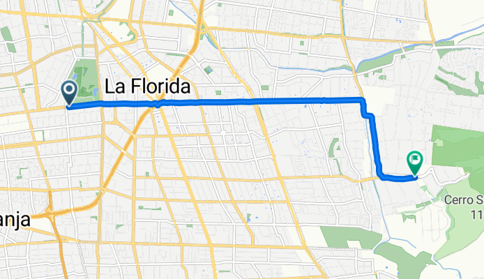
Route template
La Pintana to Puente Alto

- 30 min
- Duration
- 8.9 km
- Distance
- 68 m
- Ascent
- 0 m
- Descent
- 17.9 km/h
- Avg. speed
- 700 m
- Max. altitude
This relaxed cycling route takes you from La Pintana to Puente Alto—two bustling communes in the southern part of Santiago, Chile. Starting out in La Pintana, known for its local markets and lively neighborhoods, you’ll head east on mostly paved surfaces and dedicated cycleways, which cover almost 60% of the journey. The ride is a shade under 9 km, steadily gaining about 68 meters of elevation but nothing too daunting.
You'll roll along quiet residential streets most of the way, with just a short stint on busier roads. Puente Alto, your destination, is one of Santiago’s largest and fastest-growing districts, famous for its parks and plazas. With the Andes often visible in the distance and plenty of local flavor along the way, this route is perfect for a laid-back urban ride. Expect a smooth pedal, thanks to the quality surfaces, and enjoy cruising into Puente Alto ready for some exploration or a café stop!
Community
Top users in this region


From our community
The best bike routes from La Pintana to Puente Alto

AL CAMPAMENTO DE VERANO
Cycling route in La Pintana, Santiago Metropolitan, Chile
- 33 km
- Distance
- 397 m
- Ascent
- 58 m
- Descent

Ciclovía Vicuña Mackenna - Concha y Toro
Cycling route in La Pintana, Santiago Metropolitan, Chile
- 8.9 km
- Distance
- 83 m
- Ascent
- 0 m
- Descent

De San Patricio 11416, Santiago a Los Corrales 97, Pirque
Cycling route in La Pintana, Santiago Metropolitan, Chile
- 24.5 km
- Distance
- 160 m
- Ascent
- 63 m
- Descent
Pasaje La Cañamera, La Granja a Avenida Las Perdices, La Florida
Cycling route in La Pintana, Santiago Metropolitan, Chile
- 8.3 km
- Distance
- 438 m
- Ascent
- 302 m
- Descent

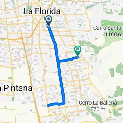
Calle E, La Pintana a Teniente Bello, Puente Alto
Cycling route in La Pintana, Santiago Metropolitan, Chile
- 8.6 km
- Distance
- 82 m
- Ascent
- 4 m
- Descent

De Avenida San José de la Estrella 340, La Florida a Glaciares 3638, Puente Alto
Cycling route in La Pintana, Santiago Metropolitan, Chile
- 7.6 km
- Distance
- 138 m
- Ascent
- 22 m
- Descent

Paseo fácil
Cycling route in La Pintana, Santiago Metropolitan, Chile
- 7.7 km
- Distance
- 139 m
- Ascent
- 22 m
- Descent

Ruta relajada
Cycling route in La Pintana, Santiago Metropolitan, Chile
- 7.8 km
- Distance
- 135 m
- Ascent
- 23 m
- Descent

Ruta desde Avenida San José de la Estrella 108, Santiago
Cycling route in La Pintana, Santiago Metropolitan, Chile
- 7.5 km
- Distance
- 141 m
- Ascent
- 22 m
- Descent

Ruta desde Avenida San José de la Estrella 108, Santiago
Cycling route in La Pintana, Santiago Metropolitan, Chile
- 7.9 km
- Distance
- 134 m
- Ascent
- 21 m
- Descent

Avenida Vicuña Mackenna Oriente, La Florida to Corcolén, La Florida
Cycling route in La Pintana, Santiago Metropolitan, Chile
- 24.6 km
- Distance
- 164 m
- Ascent
- 125 m
- Descent

De Avenida San José de la Estrella 340, La Florida a El Macizo Norte 7302, Santiago
Cycling route in La Pintana, Santiago Metropolitan, Chile
- 7.9 km
- Distance
- 136 m
- Ascent
- 0 m
- Descent
Discover more routes
 Calle E, La Pintana a Teniente Bello, Puente Alto
- Distance
- 8.6 km
- Ascent
- 82 m
- Descent
- 4 m
- Location
- La Pintana, Santiago Metropolitan, Chile
 De Avenida San José de la Estrella 340, La Florida a Glaciares 3638, Puente Alto
- Distance
- 7.6 km
- Ascent
- 138 m
- Descent
- 22 m
- Location
- La Pintana, Santiago Metropolitan, Chile
 Paseo fácil
- Distance
- 7.7 km
- Ascent
- 139 m
- Descent
- 22 m
- Location
- La Pintana, Santiago Metropolitan, Chile
 Ruta relajada
- Distance
- 7.8 km
- Ascent
- 135 m
- Descent
- 23 m
- Location
- La Pintana, Santiago Metropolitan, Chile
 Ruta desde Avenida San José de la Estrella 108, Santiago
- Distance
- 7.5 km
- Ascent
- 141 m
- Descent
- 22 m
- Location
- La Pintana, Santiago Metropolitan, Chile
 Ruta desde Avenida San José de la Estrella 108, Santiago
- Distance
- 7.9 km
- Ascent
- 134 m
- Descent
- 21 m
- Location
- La Pintana, Santiago Metropolitan, Chile
 Avenida Vicuña Mackenna Oriente, La Florida to Corcolén, La Florida
- Distance
- 24.6 km
- Ascent
- 164 m
- Descent
- 125 m
- Location
- La Pintana, Santiago Metropolitan, Chile
 De Avenida San José de la Estrella 340, La Florida a El Macizo Norte 7302, Santiago
- Distance
- 7.9 km
- Ascent
- 136 m
- Descent
- 0 m
- Location
- La Pintana, Santiago Metropolitan, Chile
Routes from La Pintana
Cycling day trip from
La Pintana to Villa Presidente Frei
Cycling day trip from
La Pintana to Lo Prado
Quick ride by bicycle from
La Pintana to San Bernardo
Routes to Puente Alto
Cycling day trip from
Santiago to Puente Alto
Cycling day trip from
Villa Presidente Frei to Puente Alto
Quick ride by bicycle from
San Bernardo to Puente Alto