
By bicycle from Neustadt/Süd to Hürth
Customize your own route based on our template or discover how our community prefers to cycle from Neustadt/Süd to Hürth.
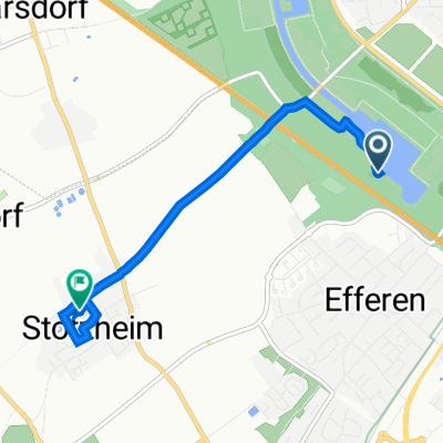
Route template
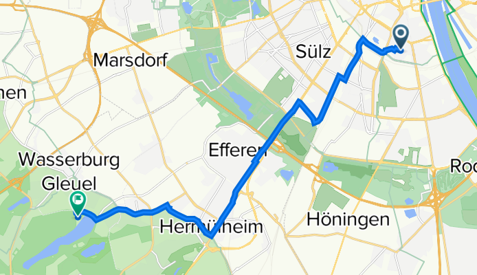
Neustadt/Süd to Hürth

- 48 min
- Duration
- 13.7 km
- Distance
- 73 m
- Ascent
- 36 m
- Descent
- 17.1 km/h
- Avg. speed
- 92 m
- Max. altitude
This cycling route starts in Neustadt/Süd, one of Cologne’s most vibrant neighborhoods, known for its trendy bars, great food spots, and proximity to the greenbelt parks. Your ride kicks off in the heart of the city and takes you southwest toward Hürth—a quieter, suburban town just outside Cologne.
The journey is just under 14 km, mostly on paved surfaces, so it’s a relaxed spin even for casual cyclists. You’ll enjoy a nice mix of urban cycling and green stretches, with most of the route being on dedicated paths or quiet roads. The ascent is gentle (just over 70 meters total), so it shouldn’t be too tough, and you’ll lose a bit more elevation than you gain—meaning the ride gets easier as you head toward Hürth.
Once you arrive, Hürth welcomes you with its cozy atmosphere and several lovely spots to grab a coffee or snack. Fun fact: Hürth is known for its proximity to the Stadtwald forest and is home to the German Broadcasting Museum if you’re up for a little exploring after your ride!
Community
Top users in this region


From our community
The best bike routes from Neustadt/Süd to Hürth

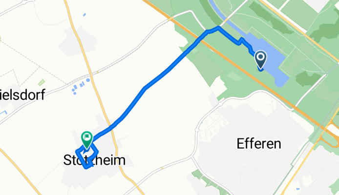
Klettenberg/Sülz - Otto Maigler-See
Cycling route in Neustadt/Süd, North Rhine-Westphalia, Germany
- 7.3 km
- Distance
- 65 m
- Ascent
- 28 m
- Descent

Rennrad Einsteigerrunde ab Köln Lindenthal
Cycling route in Neustadt/Süd, North Rhine-Westphalia, Germany
- 43.4 km
- Distance
- 143 m
- Ascent
- 101 m
- Descent

Hohenlied zur Bruder-Klaus-Kapelle
Cycling route in Neustadt/Süd, North Rhine-Westphalia, Germany
- 6.9 km
- Distance
- 37 m
- Ascent
- 21 m
- Descent

Linzer Straße 37A, Köln nach Villering 40, Hürth
Cycling route in Neustadt/Süd, North Rhine-Westphalia, Germany
- 7.3 km
- Distance
- 27 m
- Ascent
- 10 m
- Descent

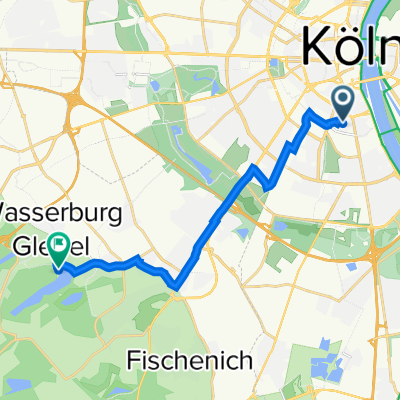
Lindenthal, Köln nach Im Wiesengrund 33, Hürth
Cycling route in Neustadt/Süd, North Rhine-Westphalia, Germany
- 14.2 km
- Distance
- 68 m
- Ascent
- 64 m
- Descent

OM_SEE
Cycling route in Neustadt/Süd, North Rhine-Westphalia, Germany
- 10.7 km
- Distance
- 34 m
- Ascent
- 13 m
- Descent
Rolandstraße 76–96, Köln nach Hürth
Cycling route in Neustadt/Süd, North Rhine-Westphalia, Germany
- 12.8 km
- Distance
- 53 m
- Ascent
- 13 m
- Descent
Lindenthal, Keulen naar Rodderstraße 41, Hürth
Cycling route in Neustadt/Süd, North Rhine-Westphalia, Germany
- 4.3 km
- Distance
- 17 m
- Ascent
- 13 m
- Descent

Kartäusergasse 9, Köln nach Steinstraße 16, Hürth
Cycling route in Neustadt/Süd, North Rhine-Westphalia, Germany
- 6.7 km
- Distance
- 22 m
- Ascent
- 13 m
- Descent

Moselstraße 40–52, Köln nach Hans-Böckler-Straße 170D, Hürth
Cycling route in Neustadt/Süd, North Rhine-Westphalia, Germany
- 9 km
- Distance
- 17 m
- Ascent
- 14 m
- Descent

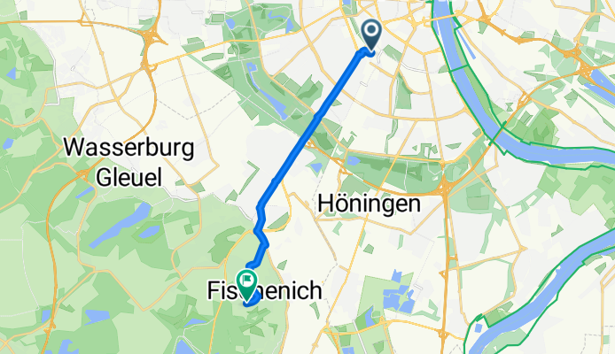
Bethovenpark-Otto Maigler See.
Cycling route in Neustadt/Süd, North Rhine-Westphalia, Germany
- 7.1 km
- Distance
- 30 m
- Ascent
- 7 m
- Descent
20151223_100030.gpx
Cycling route in Neustadt/Süd, North Rhine-Westphalia, Germany
- 9.6 km
- Distance
- 90 m
- Ascent
- 22 m
- Descent
Discover more routes
 Lindenthal, Köln nach Im Wiesengrund 33, Hürth
- Distance
- 14.2 km
- Ascent
- 68 m
- Descent
- 64 m
- Location
- Neustadt/Süd, North Rhine-Westphalia, Germany
 OM_SEE
- Distance
- 10.7 km
- Ascent
- 34 m
- Descent
- 13 m
- Location
- Neustadt/Süd, North Rhine-Westphalia, Germany
 Rolandstraße 76–96, Köln nach Hürth
- Distance
- 12.8 km
- Ascent
- 53 m
- Descent
- 13 m
- Location
- Neustadt/Süd, North Rhine-Westphalia, Germany
 Lindenthal, Keulen naar Rodderstraße 41, Hürth
- Distance
- 4.3 km
- Ascent
- 17 m
- Descent
- 13 m
- Location
- Neustadt/Süd, North Rhine-Westphalia, Germany
 Kartäusergasse 9, Köln nach Steinstraße 16, Hürth
- Distance
- 6.7 km
- Ascent
- 22 m
- Descent
- 13 m
- Location
- Neustadt/Süd, North Rhine-Westphalia, Germany
 Moselstraße 40–52, Köln nach Hans-Böckler-Straße 170D, Hürth
- Distance
- 9 km
- Ascent
- 17 m
- Descent
- 14 m
- Location
- Neustadt/Süd, North Rhine-Westphalia, Germany
 Bethovenpark-Otto Maigler See.
- Distance
- 7.1 km
- Ascent
- 30 m
- Descent
- 7 m
- Location
- Neustadt/Süd, North Rhine-Westphalia, Germany
 20151223_100030.gpx
- Distance
- 9.6 km
- Ascent
- 90 m
- Descent
- 22 m
- Location
- Neustadt/Süd, North Rhine-Westphalia, Germany
Routes from Neustadt/Süd
By bicycle from
Neustadt/Süd to Mengenich
By bicycle from
Neustadt/Süd to Frechen
Routes to Hürth
Cycling day trip from
Bornheim to Hürth
By bicycle from
Poll to Hürth
By bicycle from
Frechen to Hürth