

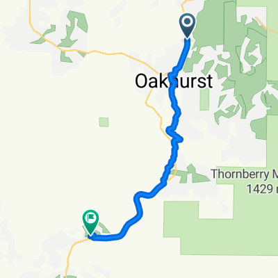
Oak_YosEnt
A cycling route starting in Oakhurst, California, United States of America.
Overview
About this route
- -:--
- Duration
- 25.7 km
- Distance
- 1,053 m
- Ascent
- 178 m
- Descent
- ---
- Avg. speed
- 1,582 m
- Avg. speed
Route quality
Waytypes & surfaces along the route
Waytypes
Busy road
22.8 km
(89 %)
Quiet road
1.1 km
(4 %)
Surfaces
Paved
17.7 km
(69 %)
Asphalt
17.7 km
(69 %)
Undefined
8 km
(31 %)
Continue with Bikemap
Use, edit, or download this cycling route
You would like to ride Oak_YosEnt or customize it for your own trip? Here is what you can do with this Bikemap route:
Free features
- Save this route as favorite or in collections
- Copy & plan your own version of this route
- Sync your route with Garmin or Wahoo
Premium features
Free trial for 3 days, or one-time payment. More about Bikemap Premium.
- Navigate this route on iOS & Android
- Export a GPX / KML file of this route
- Create your custom printout (try it for free)
- Download this route for offline navigation
Discover more Premium features.
Get Bikemap PremiumFrom our community
Other popular routes starting in Oakhurst
 China Creek Condos Loop, Oakhurst to 40182–40206 Road 222, Bass Lake
- Distance
- 13.5 km
- Ascent
- 484 m
- Descent
- 124 m
- Location
- Oakhurst, California, United States of America
 KALIFORNIE 14.7.13 - FORKS CAMPGROUND - TRIMMER CAMPGROUND
- Distance
- 86.7 km
- Ascent
- 913 m
- Descent
- 1,637 m
- Location
- Oakhurst, California, United States of America
 Bass Lake - Central Camp - Beasore Part 1
- Distance
- 15.2 km
- Ascent
- 345 m
- Descent
- 183 m
- Location
- Oakhurst, California, United States of America
 California 41 41129, Oakhurst to Pony Express Lane 46982, Coarsegold
- Distance
- 13.6 km
- Ascent
- 296 m
- Descent
- 318 m
- Location
- Oakhurst, California, United States of America
 Bass Lake Loop
- Distance
- 56.9 km
- Ascent
- 1,191 m
- Descent
- 1,161 m
- Location
- Oakhurst, California, United States of America
 Sugar Pine - Bass Lake area
- Distance
- 45.2 km
- Ascent
- 928 m
- Descent
- 928 m
- Location
- Oakhurst, California, United States of America
 Bass Lake Loop
- Distance
- 49.1 km
- Ascent
- 693 m
- Descent
- 693 m
- Location
- Oakhurst, California, United States of America
 Central Camp - Beasore Part 2
- Distance
- 61.9 km
- Ascent
- 1,662 m
- Descent
- 1,871 m
- Location
- Oakhurst, California, United States of America
Open it in the app