

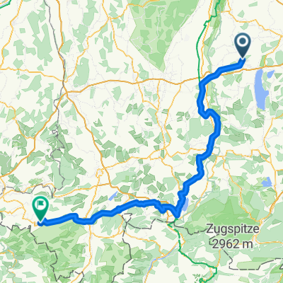
Geltendorf-Thaining
A cycling route starting in Eresing, Bavaria, Germany.
Overview
About this route
Am Bahnhof 19, 82269 Geltendorf
Zum Alten Wirt, Thaining Freitag, Samstag, Sonntag 11.00-14.00
- 4 h 14 min
- Duration
- 66.2 km
- Distance
- 508 m
- Ascent
- 506 m
- Descent
- 15.6 km/h
- Avg. speed
- 699 m
- Avg. speed

Route quality
Waytypes & surfaces along the route
Waytypes
Quiet road
30.1 km
(45 %)
Road
12.9 km
(20 %)
Surfaces
Paved
61.7 km
(93 %)
Unpaved
2.1 km
(3 %)
Asphalt
61.4 km
(93 %)
Gravel
1.1 km
(2 %)
Route highlights
Points of interest along the route
Accommodation after 30.9 km
Zum Alten Wirt
Continue with Bikemap
Use, edit, or download this cycling route
You would like to ride Geltendorf-Thaining or customize it for your own trip? Here is what you can do with this Bikemap route:
Free features
- Save this route as favorite or in collections
- Copy & plan your own version of this route
- Sync your route with Garmin or Wahoo
Premium features
Free trial for 3 days, or one-time payment. More about Bikemap Premium.
- Navigate this route on iOS & Android
- Export a GPX / KML file of this route
- Create your custom printout (try it for free)
- Download this route for offline navigation
Discover more Premium features.
Get Bikemap PremiumFrom our community
Other popular routes starting in Eresing
 St Ottilien Ammersee
- Distance
- 61.6 km
- Ascent
- 311 m
- Descent
- 310 m
- Location
- Eresing, Bavaria, Germany
 Eresing - Hohenpeissenberg
- Distance
- 48.9 km
- Ascent
- 650 m
- Descent
- 276 m
- Location
- Eresing, Bavaria, Germany
 13.09.10 Geltendorf-Oberstaufen
- Distance
- 148.4 km
- Ascent
- 770 m
- Descent
- 583 m
- Location
- Eresing, Bavaria, Germany
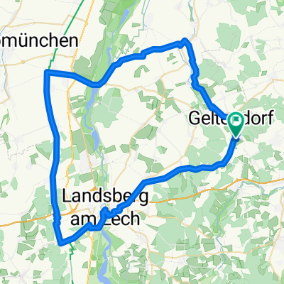
 Geltendorf-Landsberg
- Distance
- 65.6 km
- Ascent
- 525 m
- Descent
- 524 m
- Location
- Eresing, Bavaria, Germany
 Geltendorf - Hechendorf
- Distance
- 19.3 km
- Ascent
- 151 m
- Descent
- 207 m
- Location
- Eresing, Bavaria, Germany
 13.09.10 Geltendorf-Oberstaufen
- Distance
- 4.4 km
- Ascent
- 54 m
- Descent
- 18 m
- Location
- Eresing, Bavaria, Germany
 Ammerseerunde Hauptstraße 31, Eresing nach Landsberger Straße 64, Inning am Ammersee
- Distance
- 50.9 km
- Ascent
- 240 m
- Descent
- 289 m
- Location
- Eresing, Bavaria, Germany
 Geltendorf-Hurlach
- Distance
- 66.1 km
- Ascent
- 419 m
- Descent
- 421 m
- Location
- Eresing, Bavaria, Germany
Open it in the app