

Charleston & Mt Torrens Gravel Circuit
A cycling route starting in Lobethal, South Australia, Australia.
Overview
About this route
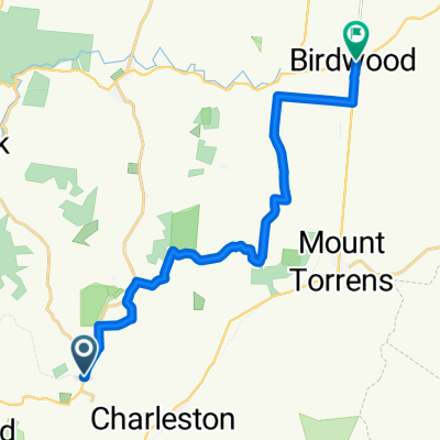
Mostly quiet and picturess gravel roads out on the Harrogate side, returning along the Amy Gillet Bike Track. You won't need a fancy bike, but being half fit will help!
- -:--
- Duration
- 34.8 km
- Distance
- 523 m
- Ascent
- 526 m
- Descent
- ---
- Avg. speed
- 535 m
- Avg. speed

Route quality
Waytypes & surfaces along the route
Waytypes
Quiet road
22.3 km
(64 %)
Cycleway
7.1 km
(20 %)
Surfaces
Paved
12.8 km
(37 %)
Unpaved
18.1 km
(52 %)
Ground
16.9 km
(48 %)
Asphalt
9.6 km
(27 %)
Continue with Bikemap
Use, edit, or download this cycling route
You would like to ride Charleston & Mt Torrens Gravel Circuit or customize it for your own trip? Here is what you can do with this Bikemap route:
Free features
- Save this route as favorite or in collections
- Copy & plan your own version of this route
- Sync your route with Garmin or Wahoo
Premium features
Free trial for 3 days, or one-time payment. More about Bikemap Premium.
- Navigate this route on iOS & Android
- Export a GPX / KML file of this route
- Create your custom printout (try it for free)
- Download this route for offline navigation
Discover more Premium features.
Get Bikemap PremiumFrom our community
Other popular routes starting in Lobethal
 Adelaide
- Distance
- 45.1 km
- Ascent
- 342 m
- Descent
- 480 m
- Location
- Lobethal, South Australia, Australia
 Steep Track Reroute- Cudlee Creek
- Distance
- 0.9 km
- Ascent
- 106 m
- Descent
- 30 m
- Location
- Lobethal, South Australia, Australia
 Charleston, Gladigau, Cyanide, Amy
- Distance
- 36.6 km
- Ascent
- 418 m
- Descent
- 416 m
- Location
- Lobethal, South Australia, Australia
 Lobethal Charleston , Mt Torrens All Sealed
- Distance
- 22.8 km
- Ascent
- 354 m
- Descent
- 354 m
- Location
- Lobethal, South Australia, Australia
 Mawson Trail Lobethal to Birdwood
- Distance
- 18.4 km
- Ascent
- 204 m
- Descent
- 230 m
- Location
- Lobethal, South Australia, Australia
 EgoTrip 2009 V2
- Distance
- 32.9 km
- Ascent
- 790 m
- Descent
- 790 m
- Location
- Lobethal, South Australia, Australia
 Kona Dirty Weekend 2010
- Distance
- 10.3 km
- Ascent
- 216 m
- Descent
- 217 m
- Location
- Lobethal, South Australia, Australia
 Newman Road 1, Charleston to Newman Road 17, Charleston
- Distance
- 38.4 km
- Ascent
- 458 m
- Descent
- 457 m
- Location
- Lobethal, South Australia, Australia
Open it in the app