

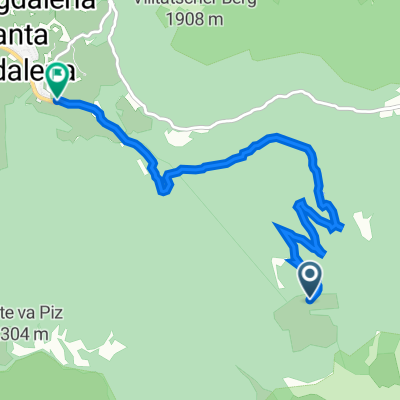
St. Magdalena - Zanser Alm - Glatschalm - Geisleralm - Brogleshütte - St. Magdalena - Zanser Alm - St. Magdalena
A cycling route starting in San Pietro, Trentino-Alto Adige, Italy.
Overview
About this route
lockerer Einstieg auf Asphalt hoch zur Zanser Alm ... sehr giftiger Anstieg zur Glatschalm ... dann Adolf Munkel Weg mit Bikeverbot ... super leckeres Mittagessen auf der Geisleralm ... dann wieder Adolf Munkel Weg zur Brogleshütte ... nur tragen und schieben ... dann über den Broglespass auf den Höhenweg ... unglaublicher Ausblick .... dann Kehrtwende und zurück zur Brogleshütte ... Singletrail (nur teilweise fahrbar und schwierig) runter nach St. Magdalena .... die abschliessende Runde nochmal zur Zanseralm und wieder nach St. Magdalena nur für die, die noch nicht genug haben :-)))
- -:--
- Duration
- 33.6 km
- Distance
- 1,391 m
- Ascent
- 1,394 m
- Descent
- ---
- Avg. speed
- ---
- Avg. speed

Continue with Bikemap
Use, edit, or download this cycling route
You would like to ride St. Magdalena - Zanser Alm - Glatschalm - Geisleralm - Brogleshütte - St. Magdalena - Zanser Alm - St. Magdalena or customize it for your own trip? Here is what you can do with this Bikemap route:
Free features
- Save this route as favorite or in collections
- Copy & plan your own version of this route
- Sync your route with Garmin or Wahoo
Premium features
Free trial for 3 days, or one-time payment. More about Bikemap Premium.
- Navigate this route on iOS & Android
- Export a GPX / KML file of this route
- Create your custom printout (try it for free)
- Download this route for offline navigation
Discover more Premium features.
Get Bikemap PremiumFrom our community
Other popular routes starting in San Pietro
 Villnöß - Zanser Grund - Geisleralm - Peitlerkofel - Umrundung - 40km - 1330 hm
- Distance
- 40.7 km
- Ascent
- 1,372 m
- Descent
- 1,371 m
- Location
- San Pietro, Trentino-Alto Adige, Italy
 St Magdalena Runde
- Distance
- 51.5 km
- Ascent
- 1,489 m
- Descent
- 1,444 m
- Location
- San Pietro, Trentino-Alto Adige, Italy
 PLOSE BIKE DAY
- Distance
- 59.1 km
- Ascent
- 1,441 m
- Descent
- 1,815 m
- Location
- San Pietro, Trentino-Alto Adige, Italy
 Villnöß nach Zanser Straße, Villnöß
- Distance
- 6.1 km
- Ascent
- 102 m
- Descent
- 762 m
- Location
- San Pietro, Trentino-Alto Adige, Italy
 Rund um den Peitlerkofel von St. Magdalena aus
- Distance
- 35.4 km
- Ascent
- 1,342 m
- Descent
- 1,342 m
- Location
- San Pietro, Trentino-Alto Adige, Italy
 Villnöß - Brogles - St. Ulrich
- Distance
- 17.4 km
- Ascent
- 922 m
- Descent
- 969 m
- Location
- San Pietro, Trentino-Alto Adige, Italy
 Transalp 2011 Tag 4
- Distance
- 42.5 km
- Ascent
- 2,130 m
- Descent
- 1,553 m
- Location
- San Pietro, Trentino-Alto Adige, Italy
 AlpX 2014 Tag4
- Distance
- 69.4 km
- Ascent
- 1,807 m
- Descent
- 2,054 m
- Location
- San Pietro, Trentino-Alto Adige, Italy
Open it in the app