

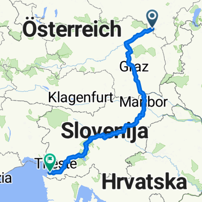
Semmering - Grado
A cycling route starting in Semmering, Lower Austria, Austria.
Overview
About this route
Gefahren in 5 Tagen mit Übernachtungen in
Köllach (bei Niklasdorf)
Teufenbach (bei Scheifling)
Bodensdorf am Ossiachersee
Resiutta
Ungefähre km-Angaben:
Semmering => Köllach: 70km
Köllach => Teufenbach: 100km
Teufenbach => Bodensdorf a. O.-See: 100km
Bodensdorf => Resiutta: 100km
Resiutta => Grado: 120km
Teils sehr gute Beschriftung (Mürztalradweg, Murtalradweg, AlpeAdriaRadweg), teils überhaupt keine Hinweise
Bei manchen Steigungen muss das Fahrrad geschoben werden. Manche Steigungen sind sehr lange und es geht kontinuierlich aufwärts, es gibt aber auch tolle Abfahrten.
Vom Belag her ist alles vertreten (Asphalt, Schotter, loser Kies, Beton, Feldwege,...)
Nicht unbedingt für Rennrad oder Mountainbike geeignet.
Manche Streckenteile sind auch für Kinder geeignet!
<span style="font-size: 15pt;" lang="DE"><span style="font-family: Times New Roman;"><font color="#000000">Semmering – Grado</font></span></span>
<span lang="DE"><span style="font-family: Times New Roman; color: #000000; font-size: small;"> </span></span>
<span lang="DE"><span style="font-size: small;"><font face="Times New Roman"><font color="#000000">1. Tag: Semmering – Köllach; <span style="mso-spacerun: yes;"> </span>Abfahrt 10:00; Ankunft: 16:30 Streckenlänge: 76,5km Ø 18,66 km/h</font></font></span></span>
<span lang="DE"><span style="font-size: small;"><font face="Times New Roman"><font color="#000000">steile Abfahrt bis Steinhaus. In Mürzzuschlag auf R5 gewechselt. Sehr gute Beschilderung der Strecke, kleine Teilstrecken auf Straße bis Bruck/Mur. R2 Richtung Leoben, die Mur Flussaufwärts<span style="mso-spacerun: yes;"> </span>ist schon anspruchsvoller als Flussabwärts, einige lange Anstiege. Bis Köllach. </font></font></span></span>
<span lang="DE"><span style="font-size: small;"><font face="Times New Roman"><font color="#000000">Mürzztal ist eine schöne Familienstrecke </font></font></span></span>
<span lang="DE"><span style="font-family: Times New Roman; color: #000000; font-size: small;"> </span></span>
<span style="color: #000000;"><span lang="DE"><font face="Times New Roman" size="3">2. Tag: Köllach - Teufenbach; <span style="mso-spacerun: yes;"> </span>Abfahrt 08:40; Ankunft: 17:00 Streckenlänge: 101km </font></span><span style="font-family: "Arial","sans-serif"; font-size: 13pt; mso-fareast-font-family: 'Times New Roman'; mso-font-kerning: 0pt; mso-ansi-language: DE-AT; mso-fareast-language: DE-AT;">Ø </span><span lang="DE"><font face="Times New Roman"><font size="3">17,9 km/h</font></font></span></span>
<span lang="DE"><span style="font-family: Times New Roman;"><font size="3"><font color="#000000">Strecke bis Kraubath gut beschildert dann auf Landstraße bis St. Lorenzen 37,9km. Teilweise herausfordernde Anstiege, Bergauf und Bergab hält sich die Waage. Von Knittelfeld bis Judenburg sehr schlechte Beschriftung Flussaufwärts, wenig Radwege vorhanden</font></font></span></span>
<span lang="DE"><span style="font-family: Times New Roman; color: #000000; font-size: small;"> </span></span>
<span lang="DE"><span style="font-family: Times New Roman;"><font size="3"><font color="#000000">3. Tag: Teufenbach – Seeboden; <span style="mso-spacerun: yes;"> </span>Abfahrt 08:40; Ankunft: 16:45 Streckenlänge: 95,5km Ø 17,37 km/h</font></font></span></span>
<span lang="DE"><span style="font-family: Times New Roman;"><font size="3"><font color="#000000">Anstieg nach Marienhof ca. 3 Kilometer (Wer sein Radl liebt – der Schiebt); Teilstücke Radweg, <span style="mso-spacerun: yes;"> </span>größtenteils Straße bis Friesach. Bis St. Veit/Glan (R7) fast keine Beschilderung zu finden. Wenig Möglichkeit zur Rast (keine Bänke am Weg - nur direkt neben Straße). Von St. Veit bis Feldkirch schlecht bis gar nicht beschildert (Radweg wird erst gebaut) => Fazit: besser mit dem Zug von Scheifling Richtung Feldkirchen fahren. In Feldkirchen unbedingt Richtung Zentrum halten, danach bis Ossiacher-See gut beschriftet.</font></font></span></span>
<span lang="DE"><span style="font-family: Times New Roman; color: #000000; font-size: small;"> </span></span>
<span lang="DE"><span style="font-family: Times New Roman;"><font size="3"><font color="#000000">4. Tag: Seeboden - Resiutta; <span style="mso-spacerun: yes;"> </span>Abfahrt 08:40; Ankunft: 16:45 Streckenlänge: 103,53km Ø 17,3 km/h</font></font></span></span>
<span lang="DE"><span style="font-family: Times New Roman;"><font size="3"><font color="#000000">Beschilderung (R2) bis Villach OK, auf R3 nicht beschrieben. Achtung bei Ausfahrt Villach: Die rote Brücke überqueren und dann gleich links halten (keine Info). Bis zum R3C ist die Beschilderung nicht gut aber Weg leicht zu finden. 12:00 in Arnoldstein, ab Grenze auf EAA (FVG1) wechseln, danach stetiger Anstieg bis Tarvis. Wunderschöne Strecke, sehr gute Beschilderung, mehrere Rastplätze laden ein, tolle Tunnelpassagen und faszinierende Ausblicke</font></font></span></span>
<span lang="DE"><span style="font-family: Times New Roman; color: #000000; font-size: small;"> </span></span>
<span lang="DE"><span style="font-family: Times New Roman;"><font size="3"><font color="#000000">5. Tag: Resiutta - Grado; <span style="mso-spacerun: yes;"> </span>Abfahrt 06:45; Ankunft: 17:30 <span style="mso-spacerun: yes;"> </span>Streckenlänge: 120km Ø 18 km/h</font></font></span></span>
<span lang="DE"><span style="font-family: Times New Roman;"><font size="3"><font color="#000000">Radweg ist zu Ende => Bundesstraße, dort auf die stark befahrenen Bundesstraße. Es gibt ab Maggio auf rechter Seite einen Schotter-Radweg (die im Radführer Stopptafel gibt es nicht mehr) - dürfte die alte Bundesstraße gewesen sein, Landschaftlich sehr schön, stetiges auf- und ab. Keine Radweghinweise zu finden, Radführer war eine große Hilfe beim Suchen. Venzone ist wunderschön, längeren Stopp einplanen, Radwegbeschreibung zur Weiterfahrt sehr schlecht. Strecke Bordone war sehr schön auch leicht zu finden - bis auf die Flussüberquerung. Buja war die Katastrophe - haben sich verfahren, große Steigung drinnen, nur mithilfe Einheimischer wieder weitergefunden. Nicht Bundesstraße fahren, viele Ortschaft sind auf einem Hügel. In Udine ersten Wegweiser nach Grado gefunden und Bundesstraße gefolgt. Ab Strassaldo wieder Alpe/Adria Wegweiser durch Zufall gefunden, bei <span style="mso-bidi-font-style: italic;">Cervigniano </span>wieder eigner Radweg bis Grado. Bei Einfahrt Richtung Zentrum halten => auf der rechten Seite Hotelinfopoint.</font></font></span></span>
<span lang="DE"><span style="font-family: Times New Roman; color: #000000; font-size: small;"> </span></span>
<span lang="DE"><span style="font-family: Times New Roman;"><font size="3"><font color="#000000">Fazit entlang der Bahntrasse super beschrieben, tolle Rastmöglichkeiten, gut ausgebaut, danach gibt es keine Wegweiser mehr und Rastmöglickkeiten.</font></font></span></span>
<span lang="DE"><span style="font-family: Times New Roman; color: #000000; font-size: small;"> </span></span>
<span lang="DE"><span style="font-family: Times New Roman;"><font size="3"><font color="#000000">Die Fahrzeiten sind inkl. 3 kleiner Pausen. Mit „normalen Fahrrädern“ (keine Mountainbikes oder Rennräder.</font></font></span></span>
<span lang="DE"><span style="font-family: Times New Roman; color: #000000; font-size: small;"> </span></span>
<span lang="DE"><span style="font-family: Times New Roman;"><font size="3"><font color="#000000">Als Unterstützung hatten wir folgende Radwanderkarten von Bikelinke:</font></font></span></span>
<span style="color: #000000;"><span style="font-family: Symbol; mso-fareast-font-family: Symbol; mso-bidi-font-family: Symbol;" lang="DE"><span style="mso-list: Ignore;"><font size="3">·</font><span style="font: 7pt "Times New Roman";"> </span></span></span><span lang="DE"><font face="Times New Roman"><font size="3">Mur-Radweg</font></font></span></span>
<span style="color: #000000;"><span style="font-family: Symbol; mso-fareast-font-family: Symbol; mso-bidi-font-family: Symbol;" lang="DE"><span style="mso-list: Ignore;"><font size="3">·</font><span style="font: 7pt "Times New Roman";"> </span></span></span><span lang="DE"><font face="Times New Roman"><font size="3">Alpe-Adria-Radweg</font></font></span></span>
<span lang="DE"><span style="font-family: Times New Roman;"><font size="3"><font color="#000000">Empfehlenswert: </font></font></span></span>
<span style="color: #000000;"><span style="font-family: Symbol; mso-fareast-font-family: Symbol; mso-bidi-font-family: Symbol;" lang="DE"><span style="mso-list: Ignore;"><font size="3">·</font><span style="font: 7pt "Times New Roman";"> </span></span></span><span lang="DE"><font size="3"><font face="Times New Roman">Radatlas Kärnten</font></font></span></span>
Bei mehr Info: peter_liebert@hotmail.com
- -:--
- Duration
- 458.7 km
- Distance
- 858 m
- Ascent
- 1,842 m
- Descent
- ---
- Avg. speed
- ---
- Avg. speed
Route quality
Waytypes & surfaces along the route
Waytypes
Undefined
458.7 km
(100 %)
Surfaces
Undefined
458.7 km
(100 %)
Continue with Bikemap
Use, edit, or download this cycling route
You would like to ride Semmering - Grado or customize it for your own trip? Here is what you can do with this Bikemap route:
Free features
- Save this route as favorite or in collections
- Copy & plan your own version of this route
- Sync your route with Garmin or Wahoo
Premium features
Free trial for 3 days, or one-time payment. More about Bikemap Premium.
- Navigate this route on iOS & Android
- Export a GPX / KML file of this route
- Create your custom printout (try it for free)
- Download this route for offline navigation
Discover more Premium features.
Get Bikemap PremiumFrom our community
Other popular routes starting in Semmering
 2. Tag 2014
- Distance
- 130.7 km
- Ascent
- 1,798 m
- Descent
- 2,106 m
- Location
- Semmering, Lower Austria, Austria
 Hochschwab-túra
- Distance
- 238.6 km
- Ascent
- 4,805 m
- Descent
- 4,827 m
- Location
- Semmering, Lower Austria, Austria
 ALPEN 033: Semmering - Rust/Neusiedler See
- Distance
- 91.3 km
- Ascent
- 148 m
- Descent
- 998 m
- Location
- Semmering, Lower Austria, Austria
 fkhhj
fkhhj- Distance
- 69.3 km
- Ascent
- 2,234 m
- Descent
- 2,115 m
- Location
- Semmering, Lower Austria, Austria
 Semmering-Izola
- Distance
- 476.6 km
- Ascent
- 1,082 m
- Descent
- 1,965 m
- Location
- Semmering, Lower Austria, Austria
 3.Etappe
- Distance
- 50.5 km
- Ascent
- 1,708 m
- Descent
- 1,987 m
- Location
- Semmering, Lower Austria, Austria
 Radfreunde St.Johann 2014 Tag 2
- Distance
- 119.5 km
- Ascent
- 1,751 m
- Descent
- 2,330 m
- Location
- Semmering, Lower Austria, Austria
 Pinkenkogel
- Distance
- 39.3 km
- Ascent
- 1,446 m
- Descent
- 1,440 m
- Location
- Semmering, Lower Austria, Austria