

Uphill zur Seespitze
A cycling route starting in Partschins, Trentino-Alto Adige, Italy.
Overview
About this route
Wegbeschreibung:
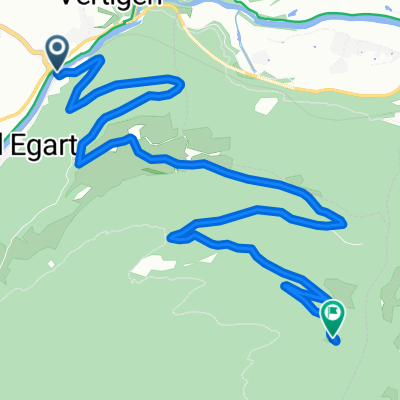
Die Tour beginnt vom Hotel. Fahren Sie die Straße Richtung Algund bis zum Radweg, folgen Sie diesem nun Richtung Vinschgau. Bei Töll geht es links hoch Richtung Aschbach/Quadrathöfe folgen Sie der Straße steil hoch bis zum Niederhof. Anschließend beginnt rechts der Seespitz Uphill Trail beginnt. Folgen Sie diesem durch den Wald vorbei an kleineren Hütten bis zur Seespitze. Hier ist der perfekte Ort für Ihre Mittagspause, bevor der aufregende Teil der Tour beginnt.
Für Adrenalinjunkies ist der “Steinbruchtrail” genau das richtige. Der technisch nicht so anspruchsvolle Trail sollte jedoch nur von geübten Mountainbikern gefahren werden. Für die gemütlichen Fahrer eignet sich der “Family Trail” perfekt, um über eine breite Forststraße zurück ins Tal zu kommen. Von dort kommen Sie wieder über den gleichen Weg zurück ins Hotel.
- -:--
- Duration
- 16.4 km
- Distance
- 1,310 m
- Ascent
- 161 m
- Descent
- ---
- Avg. speed
- 1,747 m
- Avg. speed

Route quality
Waytypes & surfaces along the route
Waytypes
Track
8.1 km
(50 %)
Quiet road
5.8 km
(35 %)
Surfaces
Paved
8.8 km
(54 %)
Unpaved
5.9 km
(36 %)
Asphalt
7.6 km
(46 %)
Gravel
4.8 km
(29 %)
Continue with Bikemap
Use, edit, or download this cycling route
You would like to ride Uphill zur Seespitze or customize it for your own trip? Here is what you can do with this Bikemap route:
Free features
- Save this route as favorite or in collections
- Copy & plan your own version of this route
- Sync your route with Garmin or Wahoo
Premium features
Free trial for 3 days, or one-time payment. More about Bikemap Premium.
- Navigate this route on iOS & Android
- Export a GPX / KML file of this route
- Create your custom printout (try it for free)
- Download this route for offline navigation
Discover more Premium features.
Get Bikemap PremiumFrom our community
Other popular routes starting in Partschins
 6. Etappe Meran - Campodeno (Rankipino!)
- Distance
- 73.3 km
- Ascent
- 1,543 m
- Descent
- 1,628 m
- Location
- Partschins, Trentino-Alto Adige, Italy
 Töll Kalterer See
- Distance
- 52.5 km
- Ascent
- 412 m
- Descent
- 675 m
- Location
- Partschins, Trentino-Alto Adige, Italy
 Partschins Mendolapass
- Distance
- 114.6 km
- Ascent
- 2,364 m
- Descent
- 2,364 m
- Location
- Partschins, Trentino-Alto Adige, Italy
 Töll Passeiertal Töll
- Distance
- 55.7 km
- Ascent
- 578 m
- Descent
- 578 m
- Location
- Partschins, Trentino-Alto Adige, Italy
 Aschbach
- Distance
- 8 km
- Ascent
- 963 m
- Descent
- 157 m
- Location
- Partschins, Trentino-Alto Adige, Italy
 Parschins - Stifsler-Joch
- Distance
- 73.1 km
- Ascent
- 2,421 m
- Descent
- 316 m
- Location
- Partschins, Trentino-Alto Adige, Italy
 Partschins - Muthöfe
- Distance
- 38.9 km
- Ascent
- 1,355 m
- Descent
- 1,347 m
- Location
- Partschins, Trentino-Alto Adige, Italy
 20221019 Töll - Dorf Tirol - Kuens - Meran - Töll
- Distance
- 36.7 km
- Ascent
- 1,107 m
- Descent
- 1,113 m
- Location
- Partschins, Trentino-Alto Adige, Italy
Open it in the app