

2-Frankreichtour
A cycling route starting in Pforzheim, Baden-Württemberg, Germany.
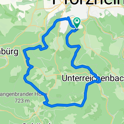
Overview
About this route
- -:--
- Duration
- 129.8 km
- Distance
- 566 m
- Ascent
- 647 m
- Descent
- ---
- Avg. speed
- ---
- Avg. speed
Route quality
Waytypes & surfaces along the route
Waytypes
Road
53.9 km
(42 %)
Busy road
34.2 km
(26 %)
Surfaces
Paved
81.2 km
(63 %)
Unpaved
1.6 km
(1 %)
Asphalt
79.9 km
(62 %)
Ground
1 km
(<1 %)
Continue with Bikemap
Use, edit, or download this cycling route
You would like to ride 2-Frankreichtour or customize it for your own trip? Here is what you can do with this Bikemap route:
Free features
- Save this route as favorite or in collections
- Copy & plan your own version of this route
- Sync your route with Garmin or Wahoo
Premium features
Free trial for 3 days, or one-time payment. More about Bikemap Premium.
- Navigate this route on iOS & Android
- Export a GPX / KML file of this route
- Create your custom printout (try it for free)
- Download this route for offline navigation
Discover more Premium features.
Get Bikemap PremiumFrom our community
Other popular routes starting in Pforzheim
 Pforzheim - Lossburg
- Distance
- 85 km
- Ascent
- 925 m
- Descent
- 521 m
- Location
- Pforzheim, Baden-Württemberg, Germany
 Ringstraße 2, Pforzheim nach Alte Straße 9, Höfen an der Enz
- Distance
- 17 km
- Ascent
- 748 m
- Descent
- 653 m
- Location
- Pforzheim, Baden-Württemberg, Germany
 MTB - Würm-Valley@18:30pm
- Distance
- 20.9 km
- Ascent
- 519 m
- Descent
- 519 m
- Location
- Pforzheim, Baden-Württemberg, Germany
 Gottschalckrunde
- Distance
- 21.4 km
- Ascent
- 486 m
- Descent
- 506 m
- Location
- Pforzheim, Baden-Württemberg, Germany
 Um den Hohberg
- Distance
- 12.4 km
- Ascent
- 160 m
- Descent
- 149 m
- Location
- Pforzheim, Baden-Württemberg, Germany
 Nordwestrunde Pforzheim
- Distance
- 33.9 km
- Ascent
- 446 m
- Descent
- 447 m
- Location
- Pforzheim, Baden-Württemberg, Germany
 dillstein grössel langenbrand U.reichenbach
- Distance
- 31.2 km
- Ascent
- 517 m
- Descent
- 516 m
- Location
- Pforzheim, Baden-Württemberg, Germany
 Nagoldtal-Würmtal-Runde
- Distance
- 49.4 km
- Ascent
- 605 m
- Descent
- 605 m
- Location
- Pforzheim, Baden-Württemberg, Germany
Open it in the app