

2014_05 Bärenschützklamm pěšky
A cycling route starting in Röthelstein, Styria, Austria.
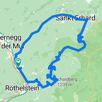
Overview
About this route
-
-
- Vojtěch, Jindra - 31. 5. 2014. Vojtěch, Jindra
-
- -:--
- Duration
- 18.4 km
- Distance
- 1,316 m
- Ascent
- 1,315 m
- Descent
- ---
- Avg. speed
- 1,341 m
- Avg. speed

Continue with Bikemap
Use, edit, or download this cycling route
You would like to ride 2014_05 Bärenschützklamm pěšky or customize it for your own trip? Here is what you can do with this Bikemap route:
Free features
- Save this route as favorite or in collections
- Copy & plan your own version of this route
- Sync your route with Garmin or Wahoo
Premium features
Free trial for 3 days, or one-time payment. More about Bikemap Premium.
- Navigate this route on iOS & Android
- Export a GPX / KML file of this route
- Create your custom printout (try it for free)
- Download this route for offline navigation
Discover more Premium features.
Get Bikemap PremiumFrom our community
Other popular routes starting in Röthelstein
 Drachentour
- Distance
- 41.6 km
- Ascent
- 1,190 m
- Descent
- 1,190 m
- Location
- Röthelstein, Styria, Austria
 teichalm tour
- Distance
- 38.5 km
- Ascent
- 1,124 m
- Descent
- 1,121 m
- Location
- Röthelstein, Styria, Austria
 Teichalm 134 nach Teichalm 134
- Distance
- 6.9 km
- Ascent
- 93 m
- Descent
- 137 m
- Location
- Röthelstein, Styria, Austria
 Drachentour
- Distance
- 42 km
- Ascent
- 1,161 m
- Descent
- 1,164 m
- Location
- Röthelstein, Styria, Austria
 Teichalm -> Stattegg
- Distance
- 34.3 km
- Ascent
- 562 m
- Descent
- 1,333 m
- Location
- Röthelstein, Styria, Austria
- Drachentour
- Distance
- 42 km
- Ascent
- 1,161 m
- Descent
- 1,161 m
- Location
- Röthelstein, Styria, Austria
 Bärenschützklamm + Hochlantsch
- Distance
- 22.4 km
- Ascent
- 1,301 m
- Descent
- 1,301 m
- Location
- Röthelstein, Styria, Austria
 Drachentour (neu)
- Distance
- 41.9 km
- Ascent
- 1,198 m
- Descent
- 1,198 m
- Location
- Röthelstein, Styria, Austria

Open it in the app