

Hohentauern-Edelraute-Hölleralm-Hohentauern
A cycling route starting in Hohentauern, Styria, Austria.
Overview
About this route
Traumhafte Gegend mit Ausblick ins Gesäuse vom gr. Scheiblsee. Edelrautehütte typ. Alpenvereinstatus.Freundliche Bewirtung. Uriger die knapp darunter liegende Scheibelalm. Am besten allerdings gefiel mir die Hölleralm. Preis weit unter der normalen Preisklasse. Schweinbratenbrot und 1/2 Schiwasser € 2.30.
- -:--
- Duration
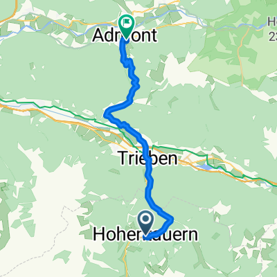
- 17.5 km
- Distance
- 654 m
- Ascent
- 654 m
- Descent
- ---
- Avg. speed
- ---
- Avg. speed

Continue with Bikemap
Use, edit, or download this cycling route
You would like to ride Hohentauern-Edelraute-Hölleralm-Hohentauern or customize it for your own trip? Here is what you can do with this Bikemap route:
Free features
- Save this route as favorite or in collections
- Copy & plan your own version of this route
- Sync your route with Garmin or Wahoo
Premium features
Free trial for 3 days, or one-time payment. More about Bikemap Premium.
- Navigate this route on iOS & Android
- Export a GPX / KML file of this route
- Create your custom printout (try it for free)
- Download this route for offline navigation
Discover more Premium features.
Get Bikemap PremiumFrom our community
Other popular routes starting in Hohentauern
 Alpes-Autumn-CC -- Trieben - Linz 142km REC-Stage
- Distance
- 152.9 km
- Ascent
- 465 m
- Descent
- 1,394 m
- Location
- Hohentauern, Styria, Austria
 Tauernstraße 15, Hohentauern nach Wiener Straße 5, Friesach
- Distance
- 82 km
- Ascent
- 421 m
- Descent
- 1,054 m
- Location
- Hohentauern, Styria, Austria
 Dorfstraße 1A, Hohentauern nach Kärntner Straße 3, Scheifling
- Distance
- 50.9 km
- Ascent
- 1,099 m
- Descent
- 1,617 m
- Location
- Hohentauern, Styria, Austria
 Hohentauern 168 do Hohentauern 168
- Distance
- 13.8 km
- Ascent
- 280 m
- Descent
- 296 m
- Location
- Hohentauern, Styria, Austria
 Hohe Tauern über Oberzeiring,niederwölz,scheifling pöls,Hohetauern
- Distance
- 145.2 km
- Ascent
- 997 m
- Descent
- 1,476 m
- Location
- Hohentauern, Styria, Austria
 Almdorf 36, Hohentauern nach Almdorf 36, Hohentauern
- Distance
- 16.6 km
- Ascent
- 406 m
- Descent
- 404 m
- Location
- Hohentauern, Styria, Austria
 Hohentauern-Admont
- Distance
- 23.8 km
- Ascent
- 434 m
- Descent
- 1,059 m
- Location
- Hohentauern, Styria, Austria
 Brodjäger Weg nach Bergmanngasse 6, Trieben
- Distance
- 4.9 km
- Ascent
- 8 m
- Descent
- 208 m
- Location
- Hohentauern, Styria, Austria
Open it in the app