
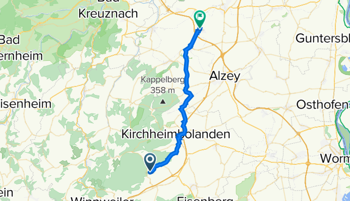
Friedhofstraße 4, Jakobsweiler nach Keltenweg 15, Armsheim
A cycling route starting in Jakobsweiler, Rhineland-Palatinate, Germany.
Overview
About this route
- 2 h 5 min
- Duration
- 29.5 km
- Distance
- 372 m
- Ascent
- 550 m
- Descent
- 14.2 km/h
- Avg. speed
- 336 m
- Avg. speed

Route quality
Waytypes & surfaces along the route
Waytypes
Quiet road
9.6 km
(33 %)
Track
9.1 km
(31 %)
Surfaces
Paved
22.6 km
(77 %)
Unpaved
0.9 km
(3 %)
Asphalt
17.2 km
(58 %)
Concrete
2.5 km
(8 %)
Continue with Bikemap
Use, edit, or download this cycling route
You would like to ride Friedhofstraße 4, Jakobsweiler nach Keltenweg 15, Armsheim or customize it for your own trip? Here is what you can do with this Bikemap route:
Free features
- Save this route as favorite or in collections
- Copy & plan your own version of this route
- Sync your route with Garmin or Wahoo
Premium features
Free trial for 3 days, or one-time payment. More about Bikemap Premium.
- Navigate this route on iOS & Android
- Export a GPX / KML file of this route
- Create your custom printout (try it for free)
- Download this route for offline navigation
Discover more Premium features.
Get Bikemap PremiumFrom our community
Other popular routes starting in Jakobsweiler
 Wildensteinertal-drosselfels
- Distance
- 18.5 km
- Ascent
- 366 m
- Descent
- 620 m
- Location
- Jakobsweiler, Rhineland-Palatinate, Germany
 The Canadian Route
- Distance
- 33.7 km
- Ascent
- 727 m
- Descent
- 727 m
- Location
- Jakobsweiler, Rhineland-Palatinate, Germany
 Donnersbergstraße 7, Dannenfels nach Bahnhofstraße 1, Freinsheim
- Distance
- 31.2 km
- Ascent
- 291 m
- Descent
- 585 m
- Location
- Jakobsweiler, Rhineland-Palatinate, Germany
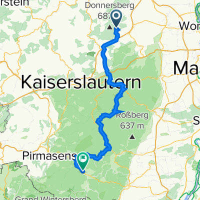 Kastanienweg 11, Dannenfels nach B427, Dahn
- Distance
- 94.2 km
- Ascent
- 2,524 m
- Descent
- 2,707 m
- Location
- Jakobsweiler, Rhineland-Palatinate, Germany
 Friedhofstraße 4, Jakobsweiler nach Keltenweg 15, Armsheim
- Distance
- 29.5 km
- Ascent
- 372 m
- Descent
- 550 m
- Location
- Jakobsweiler, Rhineland-Palatinate, Germany
 Worms-Dannenfels zauberhafte Tour
- Distance
- 37.5 km
- Ascent
- 477 m
- Descent
- 757 m
- Location
- Jakobsweiler, Rhineland-Palatinate, Germany
 Donnersberg - Ruhevorst (Vgl 418 Hm)
- Distance
- 44.2 km
- Ascent
- 344 m
- Descent
- 737 m
- Location
- Jakobsweiler, Rhineland-Palatinate, Germany
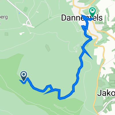 Straße ohne Straßennamen, Dannenfels nach Bennhauser Straße 11, Dannenfels
- Distance
- 4.4 km
- Ascent
- 47 m
- Descent
- 214 m
- Location
- Jakobsweiler, Rhineland-Palatinate, Germany
Open it in the app