
Route 2 Parsley Hay circular via Monsal Trail and High Peak Trail - Route 2 Parsley Hay circular via Monsal Trail and High Peak Trail
A cycling route starting in Bakewell, England, United Kingdom.
Overview
About this route
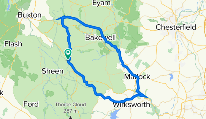
Parsley Hay, Midshires Way to High Peak Junction, Matlock, Darley Dale station, Bakewell, Monsal Trail to MIller's Dale, High Peak Trail and return to Parsley Hay. - Parsley Hay, Midshires Way to High Peak Junction, Matlock, Darley Dale station, Bakewell, Monsal Trail to MIller's Dale, High Peak Trail and return to Parsley Hay.
- -:--
- Duration
- 63.4 km
- Distance
- 926 m
- Ascent
- 926 m
- Descent
- ---
- Avg. speed
- 387 m
- Avg. speed
Route quality
Waytypes & surfaces along the route
Waytypes
Cycleway
39.4 km
(62 %)
Road
13.3 km
(21 %)
Surfaces
Paved
7.1 km
(11 %)
Unpaved
39.5 km
(62 %)
Gravel
39.5 km
(62 %)
Asphalt
6.4 km
(10 %)
Continue with Bikemap
Use, edit, or download this cycling route
You would like to ride Route 2 Parsley Hay circular via Monsal Trail and High Peak Trail - Route 2 Parsley Hay circular via Monsal Trail and High Peak Trail or customize it for your own trip? Here is what you can do with this Bikemap route:
Free features
- Save this route as favorite or in collections
- Copy & plan your own version of this route
- Sync your route with Garmin or Wahoo
Premium features
Free trial for 3 days, or one-time payment. More about Bikemap Premium.
- Navigate this route on iOS & Android
- Export a GPX / KML file of this route
- Create your custom printout (try it for free)
- Download this route for offline navigation
Discover more Premium features.
Get Bikemap PremiumFrom our community
Other popular routes starting in Bakewell
 Stately homes and standing stones 26m
- Distance
- 42.7 km
- Ascent
- 609 m
- Descent
- 609 m
- Location
- Bakewell, England, United Kingdom
 BAKEWELL PEAK D
- Distance
- 49.5 km
- Ascent
- 974 m
- Descent
- 978 m
- Location
- Bakewell, England, United Kingdom
 BAKEWELL
- Distance
- 32.8 km
- Ascent
- 517 m
- Descent
- 516 m
- Location
- Bakewell, England, United Kingdom
 Eroica Britannica
- Distance
- 90.3 km
- Ascent
- 925 m
- Descent
- 931 m
- Location
- Bakewell, England, United Kingdom
 Peak District V2
- Distance
- 39.3 km
- Ascent
- 458 m
- Descent
- 458 m
- Location
- Bakewell, England, United Kingdom
 Over Haddon Loop
- Distance
- 39.1 km
- Ascent
- 813 m
- Descent
- 813 m
- Location
- Bakewell, England, United Kingdom
 tour de peak long
- Distance
- 181.3 km
- Ascent
- 2,021 m
- Descent
- 2,025 m
- Location
- Bakewell, England, United Kingdom
 Tessington Trails
- Distance
- 42.6 km
- Ascent
- 496 m
- Descent
- 496 m
- Location
- Bakewell, England, United Kingdom
Open it in the app