

Thüringer Mühlenradweg - Thüringer Mühlenradweg
A cycling route starting in Hainspitz, Free State of Thuringia, Germany.
Overview
About this route
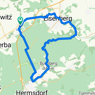
75 Kilometer lange Rad-Rundtour durch das idyllische Eisenberger Mühltal, den urwüchsigen Zeitzgrund und das malerische Gleistal nördlich von Jena.
- -:--
- Duration
- 75.3 km
- Distance
- 688 m
- Ascent
- 687 m
- Descent
- ---
- Avg. speed
- 332 m
- Avg. speed
Route quality
Waytypes & surfaces along the route
Waytypes
Quiet road
26.3 km
(35 %)
Path
15.7 km
(21 %)
Surfaces
Paved
65 km
(86 %)
Unpaved
8.6 km
(11 %)
Asphalt
62.8 km
(83 %)
Gravel
5.6 km
(7 %)
Continue with Bikemap
Use, edit, or download this cycling route
You would like to ride Thüringer Mühlenradweg - Thüringer Mühlenradweg or customize it for your own trip? Here is what you can do with this Bikemap route:
Free features
- Save this route as favorite or in collections
- Copy & plan your own version of this route
- Sync your route with Garmin or Wahoo
Premium features
Free trial for 3 days, or one-time payment. More about Bikemap Premium.
- Navigate this route on iOS & Android
- Export a GPX / KML file of this route
- Create your custom printout (try it for free)
- Download this route for offline navigation
Discover more Premium features.
Get Bikemap PremiumFrom our community
Other popular routes starting in Hainspitz
 Mühlgasse 3, Hainspitz nach Mühlgasse 1, Hainspitz
- Distance
- 24.9 km
- Ascent
- 489 m
- Descent
- 490 m
- Location
- Hainspitz, Free State of Thuringia, Germany
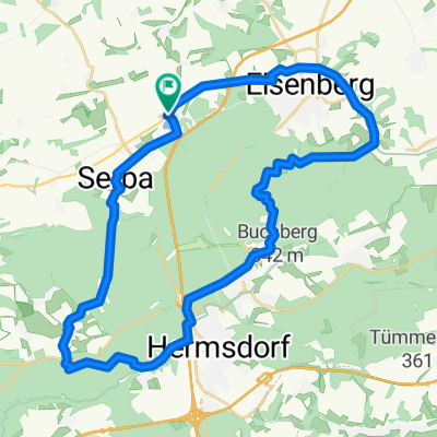
 Mühlenradweg
- Distance
- 75.5 km
- Ascent
- 1,778 m
- Descent
- 1,778 m
- Location
- Hainspitz, Free State of Thuringia, Germany
 Hainspitz-Pfarrmühle
- Distance
- 12.8 km
- Ascent
- 238 m
- Descent
- 241 m
- Location
- Hainspitz, Free State of Thuringia, Germany
 Mühltal eingebaut
- Distance
- 34.6 km
- Ascent
- 243 m
- Descent
- 241 m
- Location
- Hainspitz, Free State of Thuringia, Germany
 Pfarrmühle
- Distance
- 12.1 km
- Ascent
- 224 m
- Descent
- 225 m
- Location
- Hainspitz, Free State of Thuringia, Germany
 Hainspitz 2.0
- Distance
- 32.6 km
- Ascent
- 313 m
- Descent
- 316 m
- Location
- Hainspitz, Free State of Thuringia, Germany
 Zeitz
Zeitz- Distance
- 61.1 km
- Ascent
- 333 m
- Descent
- 331 m
- Location
- Hainspitz, Free State of Thuringia, Germany
 hainspitz-crossen-etzdorf-hainspitz
- Distance
- 28.8 km
- Ascent
- 260 m
- Descent
- 259 m
- Location
- Hainspitz, Free State of Thuringia, Germany
Open it in the app