

To Boardwalk / Beach Access
A cycling route starting in Seabrook Island, South Carolina, United States.
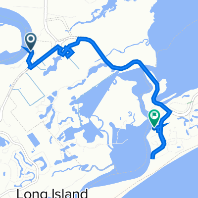
Overview
About this route
- 33 min
- Duration
- 9.3 km
- Distance
- 27 m
- Ascent
- 29 m
- Descent
- 17.2 km/h
- Avg. speed
- 18 m
- Max. altitude
Route quality
Waytypes & surfaces along the route
Waytypes
Cycleway
4.6 km
(49 %)
Quiet road
3.2 km
(34 %)
Surfaces
Paved
5.7 km
(61 %)
Asphalt
4.4 km
(47 %)
Paved (undefined)
1.3 km
(14 %)
Undefined
3.6 km
(39 %)
Continue with Bikemap
Use, edit, or download this cycling route
You would like to ride To Boardwalk / Beach Access or customize it for your own trip? Here is what you can do with this Bikemap route:
Free features
- Save this route as favorite or in collections
- Copy & plan your own version of this route
- Sync your route with Garmin or Wahoo
Premium features
Free trial for 3 days, or one-time payment. More about Bikemap Premium.
- Navigate this route on iOS & Android
- Export a GPX / KML file of this route
- Create your custom printout (try it for free)
- Download this route for offline navigation
Discover more Premium features.
Get Bikemap PremiumFrom our community
Other popular routes starting in Seabrook Island
 585 Freshfields Dr, Johns Island to 54 Surfsong Rd, Kiawah Island
- Distance
- 11.9 km
- Ascent
- 50 m
- Descent
- 44 m
- Location
- Seabrook Island, South Carolina, United States
 131–147 Hedgerow Ln, Johns Island to 225 Freshfields Dr, Johns Island
- Distance
- 46.4 km
- Ascent
- 147 m
- Descent
- 145 m
- Location
- Seabrook Island, South Carolina, United States
 820–896 Kiawah Island Pkwy, Kiawah Island to 31 Burroughs Hall, Kiawah Island
- Distance
- 7.6 km
- Ascent
- 21 m
- Descent
- 19 m
- Location
- Seabrook Island, South Carolina, United States
 1880 Andell Bluff Blvd, Seabrook Island to 9 Sundown Bend, Kiawah Island
- Distance
- 7.2 km
- Ascent
- 23 m
- Descent
- 23 m
- Location
- Seabrook Island, South Carolina, United States
 SCAR LOOP
- Distance
- 1,650.2 km
- Ascent
- 1,653 m
- Descent
- 1,656 m
- Location
- Seabrook Island, South Carolina, United States
 2981 Deer Point Dr, Seabrook Island to 2981 Deer Point Dr, Seabrook Island
- Distance
- 5.2 km
- Ascent
- 6 m
- Descent
- 9 m
- Location
- Seabrook Island, South Carolina, United States
 Moderate route in Seabrook Island
- Distance
- 7 km
- Ascent
- 0 m
- Descent
- 6 m
- Location
- Seabrook Island, South Carolina, United States
 Boy Scout Road 2750, Wadmalaw Island to Boy Scout Road 2750, Wadmalaw Island
- Distance
- 8.2 km
- Ascent
- 23 m
- Descent
- 24 m
- Location
- Seabrook Island, South Carolina, United States
Open it in the app