

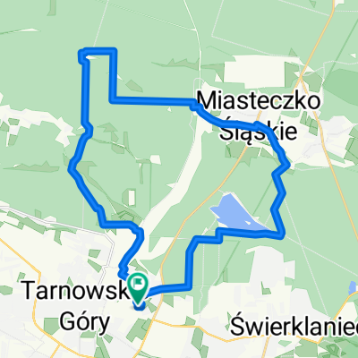
Bałkańska 2c–2g, Tarnowskie Góry do Plac Jana 9, Bytom
A cycling route starting in Tarnowskie Góry, Silesian Voivodeship, Poland.
Overview
About this route
- 1 h 1 min
- Duration
- 16.1 km
- Distance
- 209 m
- Ascent
- 196 m
- Descent
- 15.9 km/h
- Avg. speed
- 344 m
- Avg. speed
Route quality
Waytypes & surfaces along the route
Waytypes
Quiet road
5.8 km
(36 %)
Road
4.1 km
(26 %)
Surfaces
Paved
9.5 km
(59 %)
Unpaved
1.7 km
(11 %)
Asphalt
8.4 km
(52 %)
Ground
1.6 km
(10 %)
Continue with Bikemap
Use, edit, or download this cycling route
You would like to ride Bałkańska 2c–2g, Tarnowskie Góry do Plac Jana 9, Bytom or customize it for your own trip? Here is what you can do with this Bikemap route:
Free features
- Save this route as favorite or in collections
- Copy & plan your own version of this route
- Sync your route with Garmin or Wahoo
Premium features
Free trial for 3 days, or one-time payment. More about Bikemap Premium.
- Navigate this route on iOS & Android
- Export a GPX / KML file of this route
- Create your custom printout (try it for free)
- Download this route for offline navigation
Discover more Premium features.
Get Bikemap PremiumFrom our community
Other popular routes starting in Tarnowskie Góry
 Świerklaniec - Ossy
- Distance
- 27.8 km
- Ascent
- 123 m
- Descent
- 127 m
- Location
- Tarnowskie Góry, Silesian Voivodeship, Poland
 Tour de Pologne 2016 Stage 2: 149 km Tarnowskie Góry - Katowice
- Distance
- 92.9 km
- Ascent
- 337 m
- Descent
- 373 m
- Location
- Tarnowskie Góry, Silesian Voivodeship, Poland
 Long ride through Tarnowskie Góry
- Distance
- 82.8 km
- Ascent
- 281 m
- Descent
- 280 m
- Location
- Tarnowskie Góry, Silesian Voivodeship, Poland
 Single Chechelskie 1
- Distance
- 5 km
- Ascent
- 17 m
- Descent
- 29 m
- Location
- Tarnowskie Góry, Silesian Voivodeship, Poland
 Tarnowskie Góry - Kokotek
- Distance
- 33.7 km
- Ascent
- 96 m
- Descent
- 150 m
- Location
- Tarnowskie Góry, Silesian Voivodeship, Poland
 Do dawnej kopalni rud
- Distance
- 49.9 km
- Ascent
- 3,818 m
- Descent
- 3,771 m
- Location
- Tarnowskie Góry, Silesian Voivodeship, Poland
 Zalew Nakło-Chechło
- Distance
- 37.2 km
- Ascent
- 135 m
- Descent
- 135 m
- Location
- Tarnowskie Góry, Silesian Voivodeship, Poland
 Głęboki dół
- Distance
- 25.7 km
- Ascent
- 75 m
- Descent
- 78 m
- Location
- Tarnowskie Góry, Silesian Voivodeship, Poland
Open it in the app