

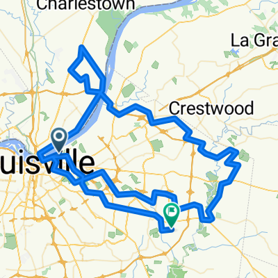
Big 4 Bridge, Louisville to 1153 River Rd, Louisville
A cycling route starting in Jeffersonville, Indiana, United States of America.
Overview
About this route
- 2 h 25 min
- Duration
- 31.8 km
- Distance
- 187 m
- Ascent
- 189 m
- Descent
- 13.2 km/h
- Avg. speed
- 171 m
- Avg. speed
Route quality
Waytypes & surfaces along the route
Waytypes
Busy road
10.7 km
(34 %)
Road
9.1 km
(29 %)
Surfaces
Paved
9.9 km
(31 %)
Concrete
6.8 km
(21 %)
Paved (undefined)
2.9 km
(9 %)
Continue with Bikemap
Use, edit, or download this cycling route
You would like to ride Big 4 Bridge, Louisville to 1153 River Rd, Louisville or customize it for your own trip? Here is what you can do with this Bikemap route:
Free features
- Save this route as favorite or in collections
- Copy & plan your own version of this route
- Sync your route with Garmin or Wahoo
Premium features
Free trial for 3 days, or one-time payment. More about Bikemap Premium.
- Navigate this route on iOS & Android
- Export a GPX / KML file of this route
- Create your custom printout (try it for free)
- Download this route for offline navigation
Discover more Premium features.
Get Bikemap PremiumFrom our community
Other popular routes starting in Jeffersonville
 East Washington Street 1423, Louisville to Dogoon Drive 2005, Louisville
- Distance
- 67.4 km
- Ascent
- 355 m
- Descent
- 294 m
- Location
- Jeffersonville, Indiana, United States of America
 Home to Waterfront Park
- Distance
- 3.1 km
- Ascent
- 37 m
- Descent
- 50 m
- Location
- Jeffersonville, Indiana, United States of America
 River Road 1223, Louisville to River Road 1223, Louisville
- Distance
- 27.9 km
- Ascent
- 80 m
- Descent
- 75 m
- Location
- Jeffersonville, Indiana, United States of America
 84 Miler Starting at Champions Park going back to Champions Park and ending at Bridges of Razor Creek
- Distance
- 138.5 km
- Ascent
- 425 m
- Descent
- 348 m
- Location
- Jeffersonville, Indiana, United States of America
 801 Edith Rd, Louisville to 183–199 Pope St, Louisville
- Distance
- 2 km
- Ascent
- 30 m
- Descent
- 13 m
- Location
- Jeffersonville, Indiana, United States of America
 iroquois
- Distance
- 54.9 km
- Ascent
- 144 m
- Descent
- 142 m
- Location
- Jeffersonville, Indiana, United States of America
 70 miler starting from Champions Park
- Distance
- 115.1 km
- Ascent
- 301 m
- Descent
- 303 m
- Location
- Jeffersonville, Indiana, United States of America
 Ohio River Greenway
- Distance
- 22.8 km
- Ascent
- 59 m
- Descent
- 68 m
- Location
- Jeffersonville, Indiana, United States of America