

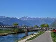
Giro d'Italia Stage 6 Bressanone to Mayrhofen
A cycling route starting in Brixen, Trentino-Alto Adige, Italy.
Overview
About this route
- -:--
- Duration
- 247.4 km
- Distance
- 3,175 m
- Ascent
- 3,094 m
- Descent
- ---
- Avg. speed
- ---
- Avg. speed

Route quality
Waytypes & surfaces along the route
Waytypes
Undefined
247.4 km
(100 %)
Surfaces
Undefined
247.4 km
(100 %)
Continue with Bikemap
Use, edit, or download this cycling route
You would like to ride Giro d'Italia Stage 6 Bressanone to Mayrhofen or customize it for your own trip? Here is what you can do with this Bikemap route:
Free features
- Save this route as favorite or in collections
- Copy & plan your own version of this route
- Sync your route with Garmin or Wahoo
Premium features
Free trial for 3 days, or one-time payment. More about Bikemap Premium.
- Navigate this route on iOS & Android
- Export a GPX / KML file of this route
- Create your custom printout (try it for free)
- Download this route for offline navigation
Discover more Premium features.
Get Bikemap PremiumFrom our community
Other popular routes starting in Brixen
 Route in Brixen
- Distance
- 26.9 km
- Ascent
- 792 m
- Descent
- 779 m
- Location
- Brixen, Trentino-Alto Adige, Italy
 Cleran to Sankt Martin in Thurn +a bit more
- Distance
- 49.6 km
- Ascent
- 2,196 m
- Descent
- 1,145 m
- Location
- Brixen, Trentino-Alto Adige, Italy
 Brixen- siegesmund
- Distance
- 24.1 km
- Ascent
- 333 m
- Descent
- 128 m
- Location
- Brixen, Trentino-Alto Adige, Italy
 🚴♀️E*Bike🇮🇩 Meran - Bozen
- Distance
- 40.6 km
- Ascent
- 85 m
- Descent
- 377 m
- Location
- Brixen, Trentino-Alto Adige, Italy
 Cleran 191, Bressanone to Cleran
- Distance
- 57.9 km
- Ascent
- 1,912 m
- Descent
- 1,917 m
- Location
- Brixen, Trentino-Alto Adige, Italy
 Route im Schneckentempo in Waidbruck
- Distance
- 20.6 km
- Ascent
- 131 m
- Descent
- 225 m
- Location
- Brixen, Trentino-Alto Adige, Italy
 Lüsen - Jakobstoeckl - Rodeneck Alm
- Distance
- 54.9 km
- Ascent
- 1,804 m
- Descent
- 1,806 m
- Location
- Brixen, Trentino-Alto Adige, Italy
 Route to Camping Sass Dlacia
- Distance
- 68.3 km
- Ascent
- 3,979 m
- Descent
- 2,884 m
- Location
- Brixen, Trentino-Alto Adige, Italy