

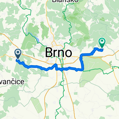
Pod Trojicí, Rosice do U Stadionu 1040, Oslavany
A cycling route starting in Rosice, South Moravian, Czechia.
Overview
About this route
- 35 min
- Duration
- 11.3 km
- Distance
- 84 m
- Ascent
- 212 m
- Descent
- 19.2 km/h
- Avg. speed
- 400 m
- Avg. speed

Route quality
Waytypes & surfaces along the route
Waytypes
Quiet road
4.8 km
(42 %)
Road
4.1 km
(36 %)
Surfaces
Paved
0.7 km
(6 %)
Unpaved
0.3 km
(3 %)
Paved (undefined)
0.6 km
(5 %)
Ground
0.3 km
(3 %)
Continue with Bikemap
Use, edit, or download this cycling route
You would like to ride Pod Trojicí, Rosice do U Stadionu 1040, Oslavany or customize it for your own trip? Here is what you can do with this Bikemap route:
Free features
- Save this route as favorite or in collections
- Copy & plan your own version of this route
- Sync your route with Garmin or Wahoo
Premium features
Free trial for 3 days, or one-time payment. More about Bikemap Premium.
- Navigate this route on iOS & Android
- Export a GPX / KML file of this route
- Create your custom printout (try it for free)
- Download this route for offline navigation
Discover more Premium features.
Get Bikemap PremiumFrom our community
Other popular routes starting in Rosice
 Babí Lom
- Distance
- 42.6 km
- Ascent
- 447 m
- Descent
- 482 m
- Location
- Rosice, South Moravian, Czechia
 Odpoledne u Bílého potoka
- Distance
- 34.6 km
- Ascent
- 459 m
- Descent
- 460 m
- Location
- Rosice, South Moravian, Czechia
 Rosice- Bystrc- Přehrada- Rosice CLONED FROM ROUTE 475755
- Distance
- 35.4 km
- Ascent
- 395 m
- Descent
- 395 m
- Location
- Rosice, South Moravian, Czechia
 Kaštanová, Rosice to Kaštanová, Rosice
- Distance
- 19.3 km
- Ascent
- 224 m
- Descent
- 222 m
- Location
- Rosice, South Moravian, Czechia
 Tetčice-Brněnská přehrada-Šmelcovna-Bahňák-Rosice-Omice-Tetčice
- Distance
- 62.7 km
- Ascent
- 652 m
- Descent
- 655 m
- Location
- Rosice, South Moravian, Czechia
 Pod Trojicí, Rosice do U Stadionu 1040, Oslavany
- Distance
- 11.3 km
- Ascent
- 84 m
- Descent
- 212 m
- Location
- Rosice, South Moravian, Czechia
 Tetcice-Vinicne Sumice
- Distance
- 45.1 km
- Ascent
- 407 m
- Descent
- 421 m
- Location
- Rosice, South Moravian, Czechia
 Rosice-Žebětín-V.Bitýška-V. Bíteš- Rosice
- Distance
- 67.5 km
- Ascent
- 962 m
- Descent
- 831 m
- Location
- Rosice, South Moravian, Czechia
Open it in the app