
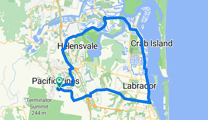
Theme Park - Runaway Bay
A cycling route starting in Mount Nathan, Queensland, Australia.
Overview
About this route
- -:--
- Duration
- 37.4 km
- Distance
- 314 m
- Ascent
- 312 m
- Descent
- ---
- Avg. speed
- 74 m
- Avg. speed
Route quality
Waytypes & surfaces along the route
Waytypes
Busy road
17.1 km
(46 %)
Road
7.4 km
(20 %)
Surfaces
Paved
33.2 km
(89 %)
Paved (undefined)
17.6 km
(47 %)
Asphalt
13.2 km
(35 %)
Continue with Bikemap
Use, edit, or download this cycling route
You would like to ride Theme Park - Runaway Bay or customize it for your own trip? Here is what you can do with this Bikemap route:
Free features
- Save this route as favorite or in collections
- Copy & plan your own version of this route
- Sync your route with Garmin or Wahoo
Premium features
Free trial for 3 days, or one-time payment. More about Bikemap Premium.
- Navigate this route on iOS & Android
- Export a GPX / KML file of this route
- Create your custom printout (try it for free)
- Download this route for offline navigation
Discover more Premium features.
Get Bikemap PremiumFrom our community
Other popular routes starting in Mount Nathan
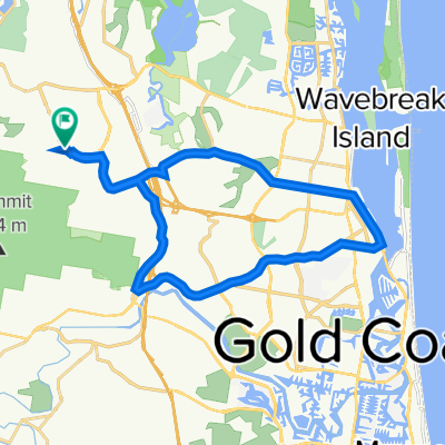
 PacificPines-Oxenford_2
- Distance
- 20.8 km
- Ascent
- 280 m
- Descent
- 278 m
- Location
- Mount Nathan, Queensland, Australia
 PacPines-Oxenford_1
- Distance
- 18.3 km
- Ascent
- 257 m
- Descent
- 257 m
- Location
- Mount Nathan, Queensland, Australia
 Helensvale Rd - Harbour Town
- Distance
- 38.5 km
- Ascent
- 323 m
- Descent
- 322 m
- Location
- Mount Nathan, Queensland, Australia
 Maudsland-Nerang
- Distance
- 31.1 km
- Ascent
- 528 m
- Descent
- 526 m
- Location
- Mount Nathan, Queensland, Australia
 7 Lowe Court, Maudsland to Tamborine Oxenford Road, Oxenford
- Distance
- 8.6 km
- Ascent
- 57 m
- Descent
- 97 m
- Location
- Mount Nathan, Queensland, Australia
 PacPines_1
- Distance
- 8.8 km
- Ascent
- 163 m
- Descent
- 161 m
- Location
- Mount Nathan, Queensland, Australia
 PacPines-Southport_1
- Distance
- 30.4 km
- Ascent
- 378 m
- Descent
- 384 m
- Location
- Mount Nathan, Queensland, Australia
 PacificPines-Arundel_1
- Distance
- 18.9 km
- Ascent
- 270 m
- Descent
- 268 m
- Location
- Mount Nathan, Queensland, Australia
Open it in the app