

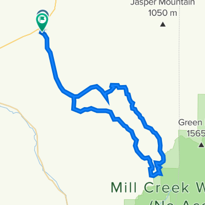
Gravel Route: Blacksnake Ridge Rd to Biscuit Ridge Rd/Upper Dry Creek Rd
A cycling route starting in Waitsburg, Washington, United States of America.
Overview
About this route
- -:--
- Duration
- 42.6 km
- Distance
- 1,089 m
- Ascent
- 1,114 m
- Descent
- ---
- Avg. speed
- 1,416 m
- Avg. speed
Route quality
Waytypes & surfaces along the route
Waytypes
Track
29.1 km
(68 %)
Quiet road
13.4 km
(31 %)
Surfaces
Paved
2.6 km
(6 %)
Unpaved
27.8 km
(65 %)
Gravel
20.5 km
(48 %)
Unpaved (undefined)
7.2 km
(17 %)
Continue with Bikemap
Use, edit, or download this cycling route
You would like to ride Gravel Route: Blacksnake Ridge Rd to Biscuit Ridge Rd/Upper Dry Creek Rd or customize it for your own trip? Here is what you can do with this Bikemap route:
Free features
- Save this route as favorite or in collections
- Copy & plan your own version of this route
- Sync your route with Garmin or Wahoo
Premium features
Free trial for 3 days, or one-time payment. More about Bikemap Premium.
- Navigate this route on iOS & Android
- Export a GPX / KML file of this route
- Create your custom printout (try it for free)
- Download this route for offline navigation
Discover more Premium features.
Get Bikemap PremiumFrom our community
Other popular routes starting in Waitsburg
 Gravel Route: Blacksnake Ridge Rd to Biscuit Ridge Rd/Upper Dry Creek Rd
- Distance
- 42.6 km
- Ascent
- 1,089 m
- Descent
- 1,114 m
- Location
- Waitsburg, Washington, United States of America
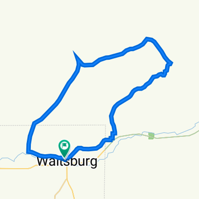 Waitsburg loop !
- Distance
- 33 km
- Ascent
- 357 m
- Descent
- 352 m
- Location
- Waitsburg, Washington, United States of America
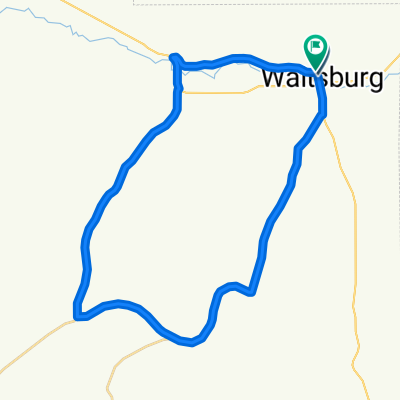 Waitsburg Loop
- Distance
- 32.7 km
- Ascent
- 386 m
- Descent
- 379 m
- Location
- Waitsburg, Washington, United States of America
 Day Six (Plan B)
- Distance
- 115.3 km
- Ascent
- 789 m
- Descent
- 982 m
- Location
- Waitsburg, Washington, United States of America
Open it in the app