

Wattkopf und Strommastentrail
A cycling route starting in Ettlingen, Baden-Württemberg, Germany.
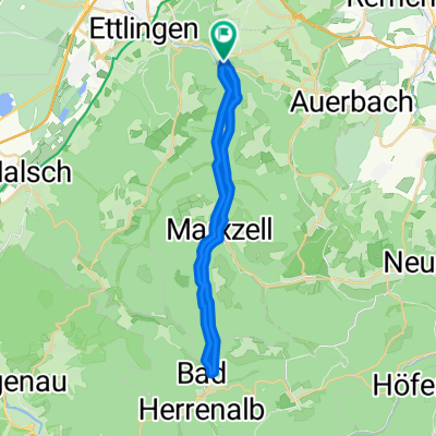
Overview
About this route
Eine kleine Tour am Wattkopf. Als Highlicht geht die Tour mehrmals den Strommastentrail hinab (auch mal nur teilweise).
Zwischendurch kommt man auch an der Hedwigsquelle vorbei, wo man seine Wasservorräte wieder füllen kann.
Für den Trail sollte das MTB (Fully ist sinnvoll) in einwandfreien Zustand sein. Auch fahrtechnisch sollte man wissen, worauf man sich einlässt.
Wer aber sicher im Sattel sitzt hat viel Spaß.
- -:--
- Duration
- 19.4 km
- Distance
- 567 m
- Ascent
- 565 m
- Descent
- ---
- Avg. speed
- ---
- Avg. speed
Route quality
Waytypes & surfaces along the route
Waytypes
Track
13.9 km
(72 %)
Path
3.1 km
(16 %)
Surfaces
Paved
2 km
(10 %)
Unpaved
14.8 km
(76 %)
Gravel
6.8 km
(35 %)
Loose gravel
6 km
(31 %)
Continue with Bikemap
Use, edit, or download this cycling route
You would like to ride Wattkopf und Strommastentrail or customize it for your own trip? Here is what you can do with this Bikemap route:
Free features
- Save this route as favorite or in collections
- Copy & plan your own version of this route
- Sync your route with Garmin or Wahoo
Premium features
Free trial for 3 days, or one-time payment. More about Bikemap Premium.
- Navigate this route on iOS & Android
- Export a GPX / KML file of this route
- Create your custom printout (try it for free)
- Download this route for offline navigation
Discover more Premium features.
Get Bikemap PremiumFrom our community
Other popular routes starting in Ettlingen
 Albtal
- Distance
- 28.8 km
- Ascent
- 552 m
- Descent
- 554 m
- Location
- Ettlingen, Baden-Württemberg, Germany
 Karlsbad-Schwanner Warte-Ellmendingen
- Distance
- 29.8 km
- Ascent
- 406 m
- Descent
- 409 m
- Location
- Ettlingen, Baden-Württemberg, Germany
 Feierabendrunde I
- Distance
- 56.7 km
- Ascent
- 903 m
- Descent
- 903 m
- Location
- Ettlingen, Baden-Württemberg, Germany
 Maibike 2012 ProTour
- Distance
- 66.2 km
- Ascent
- 1,011 m
- Descent
- 1,008 m
- Location
- Ettlingen, Baden-Württemberg, Germany
 Karlsbad Rundtour
- Distance
- 25.2 km
- Ascent
- 210 m
- Descent
- 283 m
- Location
- Ettlingen, Baden-Württemberg, Germany
 Ettlingen -> Hohloh -> Dobel -> Teufelsmühle -> Ettlingen
- Distance
- 129.1 km
- Ascent
- 2,550 m
- Descent
- 2,238 m
- Location
- Ettlingen, Baden-Württemberg, Germany
 Ettlingen-BadHerrenalb
- Distance
- 17.2 km
- Ascent
- 481 m
- Descent
- 254 m
- Location
- Ettlingen, Baden-Württemberg, Germany
 Ettlingen-Teufelsmühle-Ettlingen
- Distance
- 70.6 km
- Ascent
- 973 m
- Descent
- 973 m
- Location
- Ettlingen, Baden-Württemberg, Germany
Open it in the app