

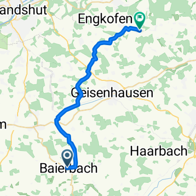
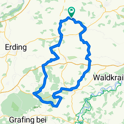
Erding-Walperskirchen
A cycling route starting in Baierbach, Bavaria, Germany.
Overview
About this route
- -:--
- Duration
- 85.5 km
- Distance
- 808 m
- Ascent
- 814 m
- Descent
- ---
- Avg. speed
- 528 m
- Avg. speed
Route quality
Waytypes & surfaces along the route
Waytypes
Road
29.8 km
(35 %)
Quiet road
26.6 km
(31 %)
Surfaces
Paved
77.6 km
(91 %)
Unpaved
1.1 km
(1 %)
Asphalt
77.4 km
(91 %)
Gravel
0.9 km
(1 %)
Continue with Bikemap
Use, edit, or download this cycling route
You would like to ride Erding-Walperskirchen or customize it for your own trip? Here is what you can do with this Bikemap route:
Free features
- Save this route as favorite or in collections
- Copy & plan your own version of this route
- Sync your route with Garmin or Wahoo
Premium features
Free trial for 3 days, or one-time payment. More about Bikemap Premium.
- Navigate this route on iOS & Android
- Export a GPX / KML file of this route
- Create your custom printout (try it for free)
- Download this route for offline navigation
Discover more Premium features.
Get Bikemap PremiumFrom our community
Other popular routes starting in Baierbach
 Isar-Vils Runde
- Distance
- 135.5 km
- Ascent
- 328 m
- Descent
- 335 m
- Location
- Baierbach, Bavaria, Germany
 Zum Bräu in Moos
- Distance
- 107.3 km
- Ascent
- 363 m
- Descent
- 351 m
- Location
- Baierbach, Bavaria, Germany
 1. Etappe Altlandkreisrunde
- Distance
- 31.6 km
- Ascent
- 215 m
- Descent
- 253 m
- Location
- Baierbach, Bavaria, Germany
 Nach Tuntenhausen und zurück
- Distance
- 152.5 km
- Ascent
- 510 m
- Descent
- 543 m
- Location
- Baierbach, Bavaria, Germany
 Von Geisenhausen bis Dorfen
- Distance
- 26.7 km
- Ascent
- 251 m
- Descent
- 266 m
- Location
- Baierbach, Bavaria, Germany
 Durchs Erdingermoos in die Hallertau
- Distance
- 121.7 km
- Ascent
- 372 m
- Descent
- 375 m
- Location
- Baierbach, Bavaria, Germany
 1. Abschnitt- Schitour Altlandkr.
- Distance
- 18.4 km
- Ascent
- 193 m
- Descent
- 148 m
- Location
- Baierbach, Bavaria, Germany
 RC-Tour zum Bergfest 2021
- Distance
- 111.3 km
- Ascent
- 565 m
- Descent
- 566 m
- Location
- Baierbach, Bavaria, Germany
Open it in the app