

Paso Robles - Estrella to Jardine
A cycling route starting in Paso Robles, California, United States of America.
Overview
About this route
Something "funky" happens when I upload this route. Map shows stretches on Buena Vista and Circle B Road near Start/Finish. Those should not be on map.
- -:--
- Duration
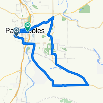
- 45.3 km
- Distance
- 174 m
- Ascent
- 173 m
- Descent
- ---
- Avg. speed
- 272 m
- Avg. speed
Route quality
Waytypes & surfaces along the route
Waytypes
Quiet road
28 km
(62 %)
Busy road
7.9 km
(18 %)
Surfaces
Paved
3.7 km
(8 %)
Asphalt
3.7 km
(8 %)
Concrete
0 km
(<1 %)
Undefined
41.6 km
(92 %)
Continue with Bikemap
Use, edit, or download this cycling route
You would like to ride Paso Robles - Estrella to Jardine or customize it for your own trip? Here is what you can do with this Bikemap route:
Free features
- Save this route as favorite or in collections
- Copy & plan your own version of this route
- Sync your route with Garmin or Wahoo
Premium features
Free trial for 3 days, or one-time payment. More about Bikemap Premium.
- Navigate this route on iOS & Android
- Export a GPX / KML file of this route
- Create your custom printout (try it for free)
- Download this route for offline navigation
Discover more Premium features.
Get Bikemap PremiumFrom our community
Other popular routes starting in Paso Robles
 729 N Trigo Ln, Paso Robles to 729 N Trigo Ln, Paso Robles
- Distance
- 11.3 km
- Ascent
- 62 m
- Descent
- 62 m
- Location
- Paso Robles, California, United States of America
 Paso Robles
- Distance
- 44.4 km
- Ascent
- 634 m
- Descent
- 618 m
- Location
- Paso Robles, California, United States of America
 Rob north to TEMPLETON to home
- Distance
- 34.8 km
- Ascent
- 172 m
- Descent
- 211 m
- Location
- Paso Robles, California, United States of America
 US: Paso Robles west
- Distance
- 43.4 km
- Ascent
- 629 m
- Descent
- 629 m
- Location
- Paso Robles, California, United States of America
 802 Brahma St, Paso Robles to 804 Brahma St, Paso Robles
- Distance
- 43.3 km
- Ascent
- 594 m
- Descent
- 592 m
- Location
- Paso Robles, California, United States of America
 Tour Californie Paso Robles - Fresno
- Distance
- 179.9 km
- Ascent
- 621 m
- Descent
- 766 m
- Location
- Paso Robles, California, United States of America
 Robs Paso Robles Loop 1
- Distance
- 29.4 km
- Ascent
- 216 m
- Descent
- 271 m
- Location
- Paso Robles, California, United States of America
 peachy
- Distance
- 15 km
- Ascent
- 350 m
- Descent
- 303 m
- Location
- Paso Robles, California, United States of America
Open it in the app