

North East PA to Conneaut OH
A cycling route starting in North East, Pennsylvania, United States of America.
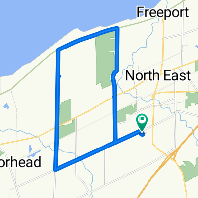
Overview
About this route
Today was a wonderful day with some actual tailwind...rather than the daily gale force headwinds that we've been having regularly in our east to west journey. Unfortunately, my guess is that this tailwind might be the reason that the weather forecast for tomorrow includes thunderstorms.
The first part of the ride was on very low-traficked roads going thorugh vinehards and some residential areas. Nice. Then, getting onto State Rt 5/PA Bicycle Rt 517, we had good shoulder with relatively light traffic, except for when we were approaching Erie PA, when there was increased traffic. Through the worst of the trafficked areas, there was some bicycle/pedestrian path, so it wasn't bad.
Upon getting into OH, the nice road shoulder immediately disappeared. This was on US Rt 20, which had light traffic.
- 4 h 59 min
- Duration
- 77.7 km
- Distance
- 411 m
- Ascent
- 475 m
- Descent
- 15.6 km/h
- Avg. speed
- 318 m
- Avg. speed

Route photos


Route quality
Waytypes & surfaces along the route
Waytypes
Busy road
48.3 km
(62 %)
Road
9.1 km
(12 %)
Surfaces
Paved
64.7 km
(83 %)
Unpaved
1.5 km
(2 %)
Asphalt
61.4 km
(79 %)
Paved (undefined)
1.9 km
(2 %)
Continue with Bikemap
Use, edit, or download this cycling route
You would like to ride North East PA to Conneaut OH or customize it for your own trip? Here is what you can do with this Bikemap route:
Free features
- Save this route as favorite or in collections
- Copy & plan your own version of this route
- Sync your route with Garmin or Wahoo
Premium features
Free trial for 3 days, or one-time payment. More about Bikemap Premium.
- Navigate this route on iOS & Android
- Export a GPX / KML file of this route
- Create your custom printout (try it for free)
- Download this route for offline navigation
Discover more Premium features.
Get Bikemap PremiumFrom our community
Other popular routes starting in North East
 Recorded via Apple Watch at Sep 03 at 18:33
- Distance
- 9 km
- Ascent
- 25 m
- Descent
- 40 m
- Location
- North East, Pennsylvania, United States of America
 Recorded via Apple Watch at Aug 13 at 15:41
- Distance
- 10.6 km
- Ascent
- 42 m
- Descent
- 45 m
- Location
- North East, Pennsylvania, United States of America
 Recorded via Apple Watch at Aug 11 at 17:36
- Distance
- 16.2 km
- Ascent
- 57 m
- Descent
- 64 m
- Location
- North East, Pennsylvania, United States of America
 Recorded via Apple Watch at Jul 27 at 19:18
- Distance
- 19.4 km
- Ascent
- 77 m
- Descent
- 75 m
- Location
- North East, Pennsylvania, United States of America
 To buffalo
- Distance
- 236.6 km
- Ascent
- 1,378 m
- Descent
- 1,414 m
- Location
- North East, Pennsylvania, United States of America
 4585 Vineyard Dr, North East to 4585 Vineyard Dr, North East
- Distance
- 8.6 km
- Ascent
- 25 m
- Descent
- 28 m
- Location
- North East, Pennsylvania, United States of America
 Recorded via Apple Watch at Aug 18 at 19:23
- Distance
- 16.2 km
- Ascent
- 60 m
- Descent
- 60 m
- Location
- North East, Pennsylvania, United States of America
 Sidehill Long Ride
- Distance
- 24.4 km
- Ascent
- 100 m
- Descent
- 99 m
- Location
- North East, Pennsylvania, United States of America
Open it in the app