

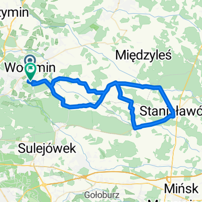
Władysława Broniewskiego 166, Ossów do Czarnoleska 17, Kobyłka
A cycling route starting in Wołomin, Masovian Voivodeship, Poland.
Overview
About this route
- 3 h 1 min
- Duration
- 16.3 km
- Distance
- 189 m
- Ascent
- 183 m
- Descent
- 5.4 km/h
- Avg. speed
- 118 m
- Avg. speed

Route quality
Waytypes & surfaces along the route
Waytypes
Quiet road
4.9 km
(30 %)
Road
3 km
(18 %)
Surfaces
Paved
10.1 km
(62 %)
Unpaved
0.1 km
(<1 %)
Paving stones
4.6 km
(28 %)
Asphalt
4.4 km
(27 %)
Continue with Bikemap
Use, edit, or download this cycling route
You would like to ride Władysława Broniewskiego 166, Ossów do Czarnoleska 17, Kobyłka or customize it for your own trip? Here is what you can do with this Bikemap route:
Free features
- Save this route as favorite or in collections
- Copy & plan your own version of this route
- Sync your route with Garmin or Wahoo
Premium features
Free trial for 3 days, or one-time payment. More about Bikemap Premium.
- Navigate this route on iOS & Android
- Export a GPX / KML file of this route
- Create your custom printout (try it for free)
- Download this route for offline navigation
Discover more Premium features.
Get Bikemap PremiumFrom our community
Other popular routes starting in Wołomin
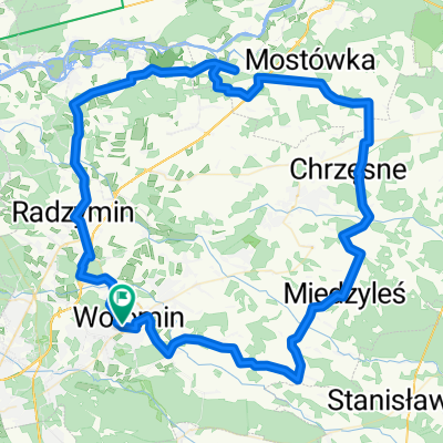
 Partyzantów 46, Wołomin do Partyzantów 48, Wołomin
- Distance
- 43.5 km
- Ascent
- 262 m
- Descent
- 264 m
- Location
- Wołomin, Masovian Voivodeship, Poland
 Legionów 17, Wołomin do Sienkiewicza 47i, Wołomin
- Distance
- 20.7 km
- Ascent
- 129 m
- Descent
- 130 m
- Location
- Wołomin, Masovian Voivodeship, Poland
 C_Ostrowik_AON_20km
- Distance
- 19.7 km
- Ascent
- 22 m
- Descent
- 30 m
- Location
- Wołomin, Masovian Voivodeship, Poland
 planowana trasa
- Distance
- 51.6 km
- Ascent
- 75 m
- Descent
- 73 m
- Location
- Wołomin, Masovian Voivodeship, Poland
 Kościelna 1, Wołomin do Powstańców 27, Ząbki
- Distance
- 17.1 km
- Ascent
- 165 m
- Descent
- 176 m
- Location
- Wołomin, Masovian Voivodeship, Poland
 Mixies
- Distance
- 58.2 km
- Ascent
- 79 m
- Descent
- 76 m
- Location
- Wołomin, Masovian Voivodeship, Poland
 Polska_v3
- Distance
- 94.4 km
- Ascent
- 227 m
- Descent
- 227 m
- Location
- Wołomin, Masovian Voivodeship, Poland
 Wołomin - Ostrołęka
- Distance
- 117 km
- Ascent
- 151 m
- Descent
- 154 m
- Location
- Wołomin, Masovian Voivodeship, Poland
Open it in the app