

DahmeRadweg Etappe 1: Berlin-Köpenick - Königs Wusterhausen
A cycling route starting in Köpenick, Land Berlin, Germany.
Overview
About this route
- -:--
- Duration
- 30.6 km
- Distance
- 101 m
- Ascent
- 85 m
- Descent
- ---
- Avg. speed
- 48 m
- Avg. speed

Route photos

Route quality
Waytypes & surfaces along the route
Waytypes
Pedestrian area
10.1 km
(33 %)
Quiet road
7.3 km
(24 %)
Surfaces
Paved
28.6 km
(94 %)
Unpaved
0.1 km
(<1 %)
Asphalt
18.7 km
(61 %)
Paving stones
9.4 km
(31 %)
Continue with Bikemap
Use, edit, or download this cycling route
You would like to ride DahmeRadweg Etappe 1: Berlin-Köpenick - Königs Wusterhausen or customize it for your own trip? Here is what you can do with this Bikemap route:
Free features
- Save this route as favorite or in collections
- Copy & plan your own version of this route
- Sync your route with Garmin or Wahoo
Premium features
Free trial for 3 days, or one-time payment. More about Bikemap Premium.
- Navigate this route on iOS & Android
- Export a GPX / KML file of this route
- Create your custom printout (try it for free)
- Download this route for offline navigation
Discover more Premium features.
Get Bikemap PremiumFrom our community
Other popular routes starting in Köpenick
 Ausflug in die Märkische Schweiz
- Distance
- 124.4 km
- Ascent
- 285 m
- Descent
- 288 m
- Location
- Köpenick, Land Berlin, Germany
 Köpenick-Erkner-Hohenbinde-Schmöckwitz-Köpenick
- Distance
- 48 km
- Ascent
- 95 m
- Descent
- 97 m
- Location
- Köpenick, Land Berlin, Germany
 Müggelseerunde
- Distance
- 28.6 km
- Ascent
- 51 m
- Descent
- 52 m
- Location
- Köpenick, Land Berlin, Germany
 Müggelseerunde
- Distance
- 27.4 km
- Ascent
- 41 m
- Descent
- 42 m
- Location
- Köpenick, Land Berlin, Germany
 Müggelsee und Erkner
- Distance
- 45.3 km
- Ascent
- 134 m
- Descent
- 131 m
- Location
- Köpenick, Land Berlin, Germany
 Hausrunde Ost
- Distance
- 68.7 km
- Ascent
- 100 m
- Descent
- 101 m
- Location
- Köpenick, Land Berlin, Germany
 2021 Spreewald Tag 3: Version 1 Köpenick - Müggelsee - Neue Mühle, 40 km
- Distance
- 39.9 km
- Ascent
- 140 m
- Descent
- 140 m
- Location
- Köpenick, Land Berlin, Germany
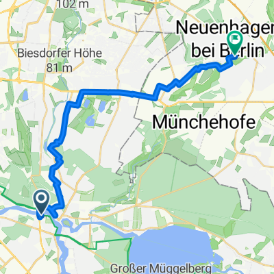 1 I Neuenhagen bei Berlin
- Distance
- 18.8 km
- Ascent
- 48 m
- Descent
- 38 m
- Location
- Köpenick, Land Berlin, Germany
Open it in the app