Premium Badge Download on the App Store Get it on Google Play Turn-by-turn Navigation Offline Maps Bike Type Optimized Routing Premium Maps Custom Bike Computer Export Routes Route Previews Fall Detection Premium Support

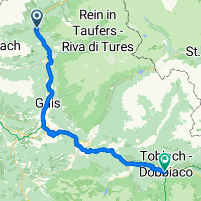
Cycling Route in Sand in Taufers, Trentino-Alto Adige, Italy

Sand-St.Peter-Hasental-Ochsenlenke-Rein-Sand

1
Open this route in the Bikemap app

Open this route in the Bikemap app

Open this route in Bikemap Web

Open this route in Bikemap Web

51 km
Distance
1722 m
Ascent
1722 m
Descent
-:-- h
Duration
-- km/h
Avg. Speed
--- m
Max. Elevation

About This Route

Ab Sand in Taufers leicht ansteigend bis St. Jakob in Ahrntal, von da an nimmt die Steigung leicht zu bis ca. 2 km nach St. Peter, von wo man rechts in das Hasental abbiegt.

Ab dort steil auf Forststraße bis auf die Hasentalalm.

Ab hier geht es nur noch auf sehr steilen Alm-Wanderwegen über die Ochsenlenke hinauf auf das Joch und auf der Rückseite zuerst auf ähnlich steilen Wanderwegen, anschließend auf Forststraße hinunter durch Knuttental, vorbei an der Knuttenalm bis nach Rein in Taufers.

Ab Rein auf der asphaltierten Staatsstraße hinunter zurück nach Sand in Taufers.

This cycling route is ideal for: MTB

You will cycle on the following surfaces: Paved Unpaved Gravel

Customize this cycling route with the Bikemap route planner.

Make it yours!

Did you know? You can use this route as a template in our cycling route planner if you don't wish to start from scratch. Customize it based on your needs to plan your perfect cycling tour.

Open it in the app