

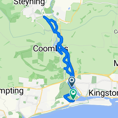
Steyning Line Explore
A cycling route starting in Shoreham-by-Sea, England, United Kingdom.
Overview
About this route
- -:--
- Duration
- 56.7 km
- Distance
- 278 m
- Ascent
- 248 m
- Descent
- ---
- Avg. speed
- 101 m
- Avg. speed

Route quality
Waytypes & surfaces along the route
Waytypes
Cycleway
47.3 km
(83 %)
Quiet road
2.9 km
(5 %)
Surfaces
Paved
5.4 km
(9 %)
Unpaved
31.1 km
(55 %)
Gravel
28 km
(49 %)
Asphalt
5.2 km
(9 %)
Continue with Bikemap
Use, edit, or download this cycling route
You would like to ride Steyning Line Explore or customize it for your own trip? Here is what you can do with this Bikemap route:
Free features
- Save this route as favorite or in collections
- Copy & plan your own version of this route
- Sync your route with Garmin or Wahoo
Premium features
Free trial for 3 days, or one-time payment. More about Bikemap Premium.
- Navigate this route on iOS & Android
- Export a GPX / KML file of this route
- Create your custom printout (try it for free)
- Download this route for offline navigation
Discover more Premium features.
Get Bikemap PremiumFrom our community
Other popular routes starting in Shoreham-by-Sea
 Home from Shoreham
- Distance
- 77 km
- Ascent
- 775 m
- Descent
- 694 m
- Location
- Shoreham-by-Sea, England, United Kingdom
 Wolstonbury Walk 26 to East Street 7
- Distance
- 24 km
- Ascent
- 223 m
- Descent
- 236 m
- Location
- Shoreham-by-Sea, England, United Kingdom
 1st in
- Distance
- 23.9 km
- Ascent
- 116 m
- Descent
- 131 m
- Location
- Shoreham-by-Sea, England, United Kingdom
 shorehambysea-nationalpark
- Distance
- 86.7 km
- Ascent
- 795 m
- Descent
- 792 m
- Location
- Shoreham-by-Sea, England, United Kingdom
 nice bike ride at the river Anvils, St Nicolas Lane, Shoreham-By-Sea to 1 Steyning Road, Shoreham-By-Sea
- Distance
- 13.9 km
- Ascent
- 35 m
- Descent
- 40 m
- Location
- Shoreham-by-Sea, England, United Kingdom
 Bike Ride With Smokey
- Distance
- 16.5 km
- Ascent
- 9 m
- Descent
- 9 m
- Location
- Shoreham-by-Sea, England, United Kingdom
 Shoreham a okolí
- Distance
- 19.2 km
- Ascent
- 236 m
- Descent
- 236 m
- Location
- Shoreham-by-Sea, England, United Kingdom
 Home to Brighton station route 1
- Distance
- 10.7 km
- Ascent
- 72 m
- Descent
- 32 m
- Location
- Shoreham-by-Sea, England, United Kingdom
Open it in the app