

Tosacana_2022-ciriso
A cycling route starting in Riparbella, Tuscany, Italy.
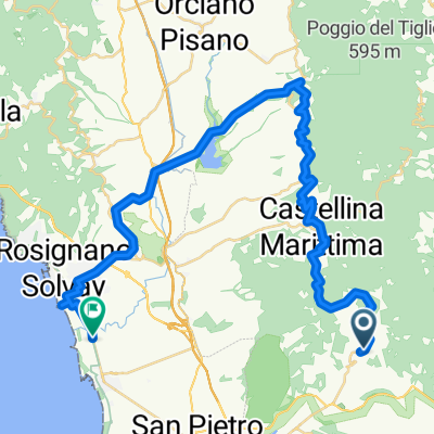
Overview
About this route
Pranzo Osteria Ci.Ri.So
- -:--
- Duration
- 118 km
- Distance
- 2,175 m
- Ascent
- 2,176 m
- Descent
- ---
- Avg. speed
- 611 m
- Avg. speed

Route quality
Waytypes & surfaces along the route
Waytypes
Busy road
86.8 km
(74 %)
Road
25.3 km
(21 %)
Surfaces
Paved
93.9 km
(80 %)
Unpaved
2.7 km
(2 %)
Asphalt
93.9 km
(80 %)
Gravel
2.6 km
(2 %)
Continue with Bikemap
Use, edit, or download this cycling route
You would like to ride Tosacana_2022-ciriso or customize it for your own trip? Here is what you can do with this Bikemap route:
Free features
- Save this route as favorite or in collections
- Copy & plan your own version of this route
- Sync your route with Garmin or Wahoo
Premium features
Free trial for 3 days, or one-time payment. More about Bikemap Premium.
- Navigate this route on iOS & Android
- Export a GPX / KML file of this route
- Create your custom printout (try it for free)
- Download this route for offline navigation
Discover more Premium features.
Get Bikemap PremiumFrom our community
Other popular routes starting in Riparbella
 Tag 4. Rip - Montecatini -Volterra - San Gimignano - Lajatico - Castellina M. - Rip
- Distance
- 141.3 km
- Ascent
- 1,802 m
- Descent
- 1,806 m
- Location
- Riparbella, Tuscany, Italy
 non mi rompere le pale
- Distance
- 25.2 km
- Ascent
- 543 m
- Descent
- 543 m
- Location
- Riparbella, Tuscany, Italy
 Lange Ausfahrt vom 24. Juli, 11:53
- Distance
- 49.7 km
- Ascent
- 460 m
- Descent
- 459 m
- Location
- Riparbella, Tuscany, Italy
 Route_2_43.4km
- Distance
- 43.4 km
- Ascent
- 398 m
- Descent
- 604 m
- Location
- Riparbella, Tuscany, Italy
 Borgo San Pecoraio - Riparbella - Castellina Marittima - Cecina - Riparbella - Borgo San Pecoraio
- Distance
- 39.7 km
- Ascent
- 554 m
- Descent
- 554 m
- Location
- Riparbella, Tuscany, Italy
 2023_Toscana_Gi_Lari
- Distance
- 111.8 km
- Ascent
- 1,661 m
- Descent
- 1,661 m
- Location
- Riparbella, Tuscany, Italy
 Tosacana_2022-ciriso
- Distance
- 118 km
- Ascent
- 2,175 m
- Descent
- 2,176 m
- Location
- Riparbella, Tuscany, Italy
 running around Rifugio della Poiane
- Distance
- 0.6 km
- Ascent
- 46 m
- Descent
- 10 m
- Location
- Riparbella, Tuscany, Italy
Open it in the app