
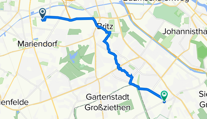
Ullsteinstraße 79–81, Berlin nach Groß-Ziethener Chaussee 55, Berlin
A cycling route starting in Tempelhof, Land Berlin, Germany.
Overview
About this route
- 36 min
- Duration
- 10.3 km
- Distance
- 32 m
- Ascent
- 59 m
- Descent
- 17.1 km/h
- Avg. speed
- 66 m
- Avg. speed

Route quality
Waytypes & surfaces along the route
Waytypes
Path
3.3 km
(32 %)
Road
2.4 km
(23 %)
Surfaces
Paved
9.6 km
(93 %)
Unpaved
0.1 km
(<1 %)
Asphalt
6.2 km
(60 %)
Paving stones
3.2 km
(31 %)
Continue with Bikemap
Use, edit, or download this cycling route
You would like to ride Ullsteinstraße 79–81, Berlin nach Groß-Ziethener Chaussee 55, Berlin or customize it for your own trip? Here is what you can do with this Bikemap route:
Free features
- Save this route as favorite or in collections
- Copy & plan your own version of this route
- Sync your route with Garmin or Wahoo
Premium features
Free trial for 3 days, or one-time payment. More about Bikemap Premium.
- Navigate this route on iOS & Android
- Export a GPX / KML file of this route
- Create your custom printout (try it for free)
- Download this route for offline navigation
Discover more Premium features.
Get Bikemap PremiumFrom our community
Other popular routes starting in Tempelhof
 Berlin Runde (ein bisschen Mauerweg)
- Distance
- 42.2 km
- Ascent
- 115 m
- Descent
- 114 m
- Location
- Tempelhof, Land Berlin, Germany
 Herrfurthstraße 12, Berlin nach Alfred-Döblin-Allee 1, Schönefeld
- Distance
- 14.3 km
- Ascent
- 32 m
- Descent
- 47 m
- Location
- Tempelhof, Land Berlin, Germany
 Ostspaß?
- Distance
- 71.8 km
- Ascent
- 129 m
- Descent
- 129 m
- Location
- Tempelhof, Land Berlin, Germany
 Südost-Rollerrunde von/ab Neukölln mit Schlenker über Draisinenbahnhof Mellensee
- Distance
- 100.9 km
- Ascent
- 130 m
- Descent
- 130 m
- Location
- Tempelhof, Land Berlin, Germany
 Tempelhof
- Distance
- 6.4 km
- Ascent
- 29 m
- Descent
- 28 m
- Location
- Tempelhof, Land Berlin, Germany
 Mariendorfer Weg 21, Berlin nach Mariendorfer Weg 21, Berlin
- Distance
- 26.2 km
- Ascent
- 110 m
- Descent
- 135 m
- Location
- Tempelhof, Land Berlin, Germany
 Berlin(THF)-Grünau-Erkner und zurück
- Distance
- 75.6 km
- Ascent
- 88 m
- Descent
- 88 m
- Location
- Tempelhof, Land Berlin, Germany
 Von Berlin bis Petershagen/Eggersdorf
- Distance
- 31.3 km
- Ascent
- 78 m
- Descent
- 78 m
- Location
- Tempelhof, Land Berlin, Germany