

My-Mai-Tour "Von und über Eching um den Speichersee"
A cycling route starting in Eching, Bavaria, Germany.
Overview
About this route
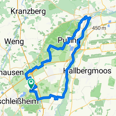
Wir starten diese Frühjahrstour von Eching und fahren den neuen Radweg nach Garching und dann durch den noch lichten Auwald entlang der Isar bis zum Poschinger Weiher. Von dort radeln wir um den Feringasee herum und weiter entlang des südlichen Uferwegs des Speichersees bis zur Staustufe beim Wasserkraftwerk. Der 1929 angelegte Speichersee liegt direkt am Nordufer des Mittlere-Isar-Kanals. Neben der Wasserregulierung der Kraftwerke am Isarkanal und dem Hochwasserschutz dient der See der natürlichen Nachklärung der Münchner Abwässer. Baden ist in dem See verboten, allerdings lassen sich dort gut Wildvögel beobachten und es kann gefischt werden. Weiter geht es entlang des Isarkanals bis Moosinning wo wir unsere Mittagspause beim Gasthof Daimerwirt haben werden. Der Rückweg führt uns dann über das zweite Eching westwärts durchs weite Erdinger-Land bis zum Auwald an der Isar. Entlang der Isar geht es nordwärts bis Dietersheim und abschließend zurück nach Eching. Unterwegs gibt es regelmäßig kleinere Zwischenstopps (Trinkpausen). Die Strecke ist insgesamt ca. 73 km lang und hat fast keine Steigungen. Die Tour ist bereits ausgebucht und damit ist die Anmeldung nicht mehr möglich.
- -:--
- Duration
- 73.3 km
- Distance
- 120 m
- Ascent
- 120 m
- Descent
- ---
- Avg. speed
- 503 m
- Avg. speed

Route quality
Waytypes & surfaces along the route
Waytypes
Quiet road
26.7 km
(36 %)
Track
19 km
(26 %)
Surfaces
Paved
49.5 km
(67 %)
Unpaved
21.4 km
(29 %)
Asphalt
48.8 km
(67 %)
Gravel
13.9 km
(19 %)
Continue with Bikemap
Use, edit, or download this cycling route
You would like to ride My-Mai-Tour "Von und über Eching um den Speichersee" or customize it for your own trip? Here is what you can do with this Bikemap route:
Free features
- Save this route as favorite or in collections
- Copy & plan your own version of this route
- Sync your route with Garmin or Wahoo
Premium features
Free trial for 3 days, or one-time payment. More about Bikemap Premium.
- Navigate this route on iOS & Android
- Export a GPX / KML file of this route
- Create your custom printout (try it for free)
- Download this route for offline navigation
Discover more Premium features.
Get Bikemap PremiumFrom our community
Other popular routes starting in Eching
 Von Eching zum Feringasee
- Distance
- 25.3 km
- Ascent
- 106 m
- Descent
- 82 m
- Location
- Eching, Bavaria, Germany
 Mühlenpark
- Distance
- 9.6 km
- Ascent
- 35 m
- Descent
- 21 m
- Location
- Eching, Bavaria, Germany
 Ins Dachauer HInterland
- Distance
- 117.5 km
- Ascent
- 767 m
- Descent
- 757 m
- Location
- Eching, Bavaria, Germany
 Kleine Kranzberger Wald Runde
- Distance
- 41 km
- Ascent
- 170 m
- Descent
- 166 m
- Location
- Eching, Bavaria, Germany
 Eching - Moosmühle - Freising - Dietersheim - Eching
- Distance
- 47 km
- Ascent
- 179 m
- Descent
- 180 m
- Location
- Eching, Bavaria, Germany
 Eching - Isarauen - TU Garching - Eching
- Distance
- 21.2 km
- Ascent
- 14 m
- Descent
- 13 m
- Location
- Eching, Bavaria, Germany
 Rundtour Eching - Allershausen
- Distance
- 45.6 km
- Ascent
- 289 m
- Descent
- 292 m
- Location
- Eching, Bavaria, Germany
 Kleine Kranzberger Wald Runde CLONED FROM ROUTE 467914
- Distance
- 41 km
- Ascent
- 170 m
- Descent
- 166 m
- Location
- Eching, Bavaria, Germany
Open it in the app