

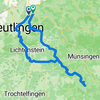
Obere Einsteinstraße 5, Metzingen nach Gestütshof 7, St. Johann
A cycling route starting in Metzingen, Baden-Württemberg, Germany.
Overview
About this route
- 50 min
- Duration
- 14.8 km
- Distance
- 494 m
- Ascent
- 100 m
- Descent
- 17.8 km/h
- Avg. speed
- 763 m
- Avg. speed

Route quality
Waytypes & surfaces along the route
Waytypes
Track
5.6 km
(38 %)
Quiet road
3.5 km
(24 %)
Surfaces
Paved
10.7 km
(72 %)
Unpaved
2.4 km
(16 %)
Asphalt
8.5 km
(58 %)
Paved (undefined)
2 km
(14 %)
Continue with Bikemap
Use, edit, or download this cycling route
You would like to ride Obere Einsteinstraße 5, Metzingen nach Gestütshof 7, St. Johann or customize it for your own trip? Here is what you can do with this Bikemap route:
Free features
- Save this route as favorite or in collections
- Copy & plan your own version of this route
- Sync your route with Garmin or Wahoo
Premium features
Free trial for 3 days, or one-time payment. More about Bikemap Premium.
- Navigate this route on iOS & Android
- Export a GPX / KML file of this route
- Create your custom printout (try it for free)
- Download this route for offline navigation
Discover more Premium features.
Get Bikemap PremiumFrom our community
Other popular routes starting in Metzingen
 Rund um Metzingen 1
- Distance
- 33.5 km
- Ascent
- 793 m
- Descent
- 793 m
- Location
- Metzingen, Baden-Württemberg, Germany
 1 Stunde
- Distance
- 20.3 km
- Ascent
- 495 m
- Descent
- 429 m
- Location
- Metzingen, Baden-Württemberg, Germany
 Moderate Route in Metzingen
- Distance
- 36.3 km
- Ascent
- 0 m
- Descent
- 0 m
- Location
- Metzingen, Baden-Württemberg, Germany
 Metzingen, Lautertal
- Distance
- 90 km
- Ascent
- 1,052 m
- Descent
- 806 m
- Location
- Metzingen, Baden-Württemberg, Germany
 Amselweg-kleiner Stausee
- Distance
- 11 km
- Ascent
- 443 m
- Descent
- 12 m
- Location
- Metzingen, Baden-Württemberg, Germany
 Über Eningen auf d'Alb
- Distance
- 32.5 km
- Ascent
- 604 m
- Descent
- 616 m
- Location
- Metzingen, Baden-Württemberg, Germany
 Durch den Wald nach Bad Urach
- Distance
- 31.1 km
- Ascent
- 492 m
- Descent
- 494 m
- Location
- Metzingen, Baden-Württemberg, Germany
 Metzingen-Roßeld-Wanderweg-Urach-Dettingen-Metzingen
- Distance
- 28.7 km
- Ascent
- 550 m
- Descent
- 550 m
- Location
- Metzingen, Baden-Württemberg, Germany
Open it in the app