

Zugspitz Umrundung MiWA Garmisch Ehrwald Leutasch
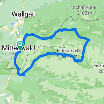
A cycling route starting in Mittenwald, Bavaria, Germany.
Overview
About this route
Start: beliebig: zB. Mittenwald.Auf Radwegen nach Garmisch, Griesen, Ehrwald. Dort mit der "Ehrwalder Almbahn" hochfahren. Anstieg noch ca 400 m - dann Abfahrt über Gaisbachtal> LEutasch. Von dort nach Mittenwald zurück.Dauer ca: 9 Stunden , je nach PAusen.
Achtung Öffnungzeiten der Almbahn beachten.
- -:--
- Duration
- 76.8 km
- Distance
- 986 m
- Ascent
- 787 m
- Descent
- ---
- Avg. speed
- 1,635 m
- Avg. speed
Route quality
Waytypes & surfaces along the route
Waytypes
Track
34 km
(44 %)
Quiet road
21.9 km
(28 %)
Surfaces
Paved
41.6 km
(54 %)
Unpaved
32.5 km
(42 %)
Asphalt
41.6 km
(54 %)
Gravel
30.5 km
(40 %)
Continue with Bikemap
Use, edit, or download this cycling route
You would like to ride Zugspitz Umrundung MiWA Garmisch Ehrwald Leutasch or customize it for your own trip? Here is what you can do with this Bikemap route:
Free features
- Save this route as favorite or in collections
- Copy & plan your own version of this route
- Sync your route with Garmin or Wahoo
Premium features
Free trial for 3 days, or one-time payment. More about Bikemap Premium.
- Navigate this route on iOS & Android
- Export a GPX / KML file of this route
- Create your custom printout (try it for free)
- Download this route for offline navigation
Discover more Premium features.
Get Bikemap PremiumFrom our community
Other popular routes starting in Mittenwald
 Karwendelrunde light - Mittenwald - Scharnitz - Karwendelhaus - Hinterriss - Vorderriss - Wallgau
- Distance
- 75.5 km
- Ascent
- 1,530 m
- Descent
- 1,530 m
- Location
- Mittenwald, Bavaria, Germany
 Mittenwald - Eppzirlalm - Oberbrunnalm
- Distance
- 37.7 km
- Ascent
- 927 m
- Descent
- 926 m
- Location
- Mittenwald, Bavaria, Germany
 Mittenwald-ElmauerAlm-HoherKranzberg-Arnspitzrunde
- Distance
- 70.3 km
- Ascent
- 1,142 m
- Descent
- 1,142 m
- Location
- Mittenwald, Bavaria, Germany
 kurz Miwa Innsbruck
- Distance
- 50.7 km
- Ascent
- 640 m
- Descent
- 877 m
- Location
- Mittenwald, Bavaria, Germany
 Lautersee-wettersteinalm-ellmau-lautersee
- Distance
- 22.9 km
- Ascent
- 558 m
- Descent
- 558 m
- Location
- Mittenwald, Bavaria, Germany
 Karwendelrunde
- Distance
- 65 km
- Ascent
- 1,582 m
- Descent
- 1,572 m
- Location
- Mittenwald, Bavaria, Germany
 Karwendeltour
- Distance
- 78.4 km
- Ascent
- 1,998 m
- Descent
- 1,998 m
- Location
- Mittenwald, Bavaria, Germany
 Unbenannte Route
- Distance
- 120.7 km
- Ascent
- 1,501 m
- Descent
- 1,727 m
- Location
- Mittenwald, Bavaria, Germany
Open it in the app