
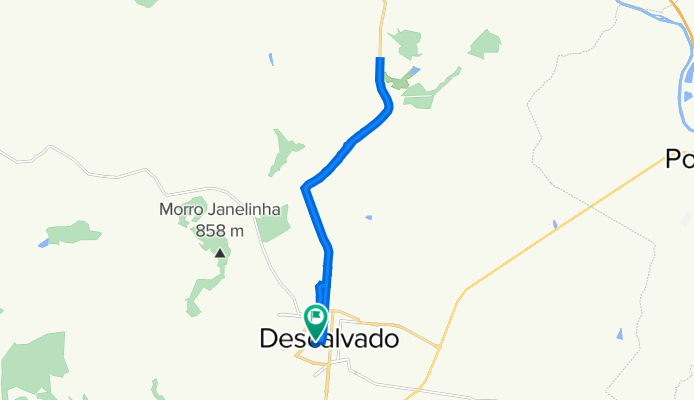
Rua Manoel Ferreira Gaio, 2–72, Descalvado a Rua Manoel Ferreira Gaio, 1–71, Descalvado
A cycling route starting in Descalvado, São Paulo, Brazil.
Overview
About this route
- 1 h 52 min
- Duration
- 24 km
- Distance
- 1,003 m
- Ascent
- 997 m
- Descent
- 12.8 km/h
- Avg. speed
- 766 m
- Avg. speed

Continue with Bikemap
Use, edit, or download this cycling route
You would like to ride Rua Manoel Ferreira Gaio, 2–72, Descalvado a Rua Manoel Ferreira Gaio, 1–71, Descalvado or customize it for your own trip? Here is what you can do with this Bikemap route:
Free features
- Save this route as favorite or in collections
- Copy & plan your own version of this route
- Sync your route with Garmin or Wahoo
Premium features
Free trial for 3 days, or one-time payment. More about Bikemap Premium.
- Navigate this route on iOS & Android
- Export a GPX / KML file of this route
- Create your custom printout (try it for free)
- Download this route for offline navigation
Discover more Premium features.
Get Bikemap PremiumFrom our community
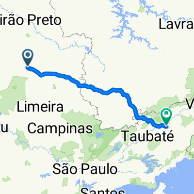
Other popular routes starting in Descalvado
 lixo de segunda-quarta-sexta
- Distance
- 23.9 km
- Ascent
- 460 m
- Descent
- 484 m
- Location
- Descalvado, São Paulo, Brazil
 coleta de terça-quinta-sabado
- Distance
- 28.4 km
- Ascent
- 525 m
- Descent
- 547 m
- Location
- Descalvado, São Paulo, Brazil
 Rua Doutor Jayme Regallo Pereira, 447–549, Descalvado to Rua Doutor Jayme Regallo Pereira, 447–549, Descalvado
- Distance
- 6.9 km
- Ascent
- 66 m
- Descent
- 64 m
- Location
- Descalvado, São Paulo, Brazil
 CAMINHO DO VERDE - ROTA REGIONAL CLONED FROM ROUTE 1905265
- Distance
- 158.7 km
- Ascent
- 1,047 m
- Descent
- 1,047 m
- Location
- Descalvado, São Paulo, Brazil
 De Rua Pedro Alcântara Camargo 320 a BR-488 251
- Distance
- 354.4 km
- Ascent
- 5,997 m
- Descent
- 6,129 m
- Location
- Descalvado, São Paulo, Brazil
 Caminho da Fé - Descalvado a Porto Ferreira por outro trajeto mais curto e por terra.
- Distance
- 17.7 km
- Ascent
- 136 m
- Descent
- 259 m
- Location
- Descalvado, São Paulo, Brazil
 CAMINHO DO VERDE - ROTA REGIONAL
- Distance
- 157.8 km
- Ascent
- 983 m
- Descent
- 979 m
- Location
- Descalvado, São Paulo, Brazil
 Rua Carlos Pulici, Descalvado to Rua Coronel Manuel Leme, 1553–1701, Descalvado
- Distance
- 4.4 km
- Ascent
- 1,569 m
- Descent
- 1,873 m
- Location
- Descalvado, São Paulo, Brazil
Open it in the app