

1468 Route de Strazeele, Caëstre à 5 Domaine des Charmilles, Sainte-Marie-Cappel
A cycling route starting in Caëstre, Nord-Pas-de-Calais-Picardie, France.
Overview
About this route
- 40 min
- Duration
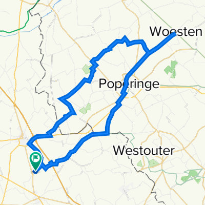
- 11.1 km
- Distance
- 46 m
- Ascent
- 57 m
- Descent
- 16.5 km/h
- Avg. speed
- 59 m
- Avg. speed
Route quality
Waytypes & surfaces along the route
Waytypes
Quiet road
9.6 km
(87 %)
Busy road
1.4 km
(13 %)
Surfaces
Paved
7.1 km
(64 %)
Asphalt
7.1 km
(64 %)
Undefined
4 km
(36 %)
Continue with Bikemap
Use, edit, or download this cycling route
You would like to ride 1468 Route de Strazeele, Caëstre à 5 Domaine des Charmilles, Sainte-Marie-Cappel or customize it for your own trip? Here is what you can do with this Bikemap route:
Free features
- Save this route as favorite or in collections
- Copy & plan your own version of this route
- Sync your route with Garmin or Wahoo
Premium features
Free trial for 3 days, or one-time payment. More about Bikemap Premium.
- Navigate this route on iOS & Android
- Export a GPX / KML file of this route
- Create your custom printout (try it for free)
- Download this route for offline navigation
Discover more Premium features.
Get Bikemap PremiumFrom our community
Other popular routes starting in Caëstre
 1468 Route de Strazeele, Caëstre à 5 Domaine des Charmilles, Sainte-Marie-Cappel
- Distance
- 11.1 km
- Ascent
- 46 m
- Descent
- 57 m
- Location
- Caëstre, Nord-Pas-de-Calais-Picardie, France
 647 Rue Nationale, Pradelles à 10 Rue de l'Église, Hazebrouck
- Distance
- 7.4 km
- Ascent
- 103 m
- Descent
- 106 m
- Location
- Caëstre, Nord-Pas-de-Calais-Picardie, France
 De Voie Communale Hool Straete 126, Caëstre à Grand' Place 27, Cassel
- Distance
- 13.6 km
- Ascent
- 145 m
- Descent
- 38 m
- Location
- Caëstre, Nord-Pas-de-Calais-Picardie, France
 bike tour through Caëstre
- Distance
- 12.1 km
- Ascent
- 62 m
- Descent
- 60 m
- Location
- Caëstre, Nord-Pas-de-Calais-Picardie, France
 Bike Ride & Beer with Soph
- Distance
- 49.4 km
- Ascent
- 262 m
- Descent
- 264 m
- Location
- Caëstre, Nord-Pas-de-Calais-Picardie, France
 401–999 Route du Mont des Cats, Flêtre à 563 Rue Delannoy, Lestrem
- Distance
- 21 km
- Ascent
- 26 m
- Descent
- 60 m
- Location
- Caëstre, Nord-Pas-de-Calais-Picardie, France
 De Rue Cayonque 695, Borre à Chemin des Jeangrands 21, Arbigny
- Distance
- 643.9 km
- Ascent
- 3,341 m
- Descent
- 3,182 m
- Location
- Caëstre, Nord-Pas-de-Calais-Picardie, France
 Route from Rue de Saint-Omer 2119, Méteren
- Distance
- 3.4 km
- Ascent
- 14 m
- Descent
- 17 m
- Location
- Caëstre, Nord-Pas-de-Calais-Picardie, France
Open it in the app