

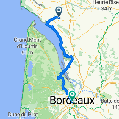
D732, Gémozac à 4 Rue de la Libération, Gémozac
A cycling route starting in Gémozac, Aquitaine-Limousin-Poitou-Charentes, France.
Overview
About this route
- 1 h 45 min
- Duration
- 29.7 km
- Distance
- 63 m
- Ascent
- 59 m
- Descent
- 17 km/h
- Avg. speed
- 43 m
- Avg. speed

Route quality
Waytypes & surfaces along the route
Waytypes
Road
17.9 km
(60 %)
Busy road
7.7 km
(26 %)
Surfaces
Paved
7.8 km
(26 %)
Unpaved
0 km
(<1 %)
Asphalt
7.7 km
(26 %)
Paved (undefined)
0.1 km
(<1 %)
Continue with Bikemap
Use, edit, or download this cycling route
You would like to ride D732, Gémozac à 4 Rue de la Libération, Gémozac or customize it for your own trip? Here is what you can do with this Bikemap route:
Free features
- Save this route as favorite or in collections
- Copy & plan your own version of this route
- Sync your route with Garmin or Wahoo
Premium features
Free trial for 3 days, or one-time payment. More about Bikemap Premium.
- Navigate this route on iOS & Android
- Export a GPX / KML file of this route
- Create your custom printout (try it for free)
- Download this route for offline navigation
Discover more Premium features.
Get Bikemap PremiumFrom our community
Other popular routes starting in Gémozac
 Malt trip 1
- Distance
- 53.7 km
- Ascent
- 116 m
- Descent
- 117 m
- Location
- Gémozac, Aquitaine-Limousin-Poitou-Charentes, France
 2 Rue des Écoles, Virollet à Grande Rue 360 - Tour de Saintonge, Chenac-Saint-Seurin-d'Uzet
- Distance
- 12.8 km
- Ascent
- 77 m
- Descent
- 48 m
- Location
- Gémozac, Aquitaine-Limousin-Poitou-Charentes, France
 descente côte bois blanc + madion
- Distance
- 5.3 km
- Ascent
- 28 m
- Descent
- 28 m
- Location
- Gémozac, Aquitaine-Limousin-Poitou-Charentes, France
 St Andre de lidon nach Blaye
- Distance
- 57.6 km
- Ascent
- 36 m
- Descent
- 55 m
- Location
- Gémozac, Aquitaine-Limousin-Poitou-Charentes, France
 Itinéraire à partir de 7 Rue des Vergers, Villars-en-Pons
- Distance
- 7.4 km
- Ascent
- 16 m
- Descent
- 16 m
- Location
- Gémozac, Aquitaine-Limousin-Poitou-Charentes, France
 Saint andre de Lion-Bordeaux (Fluss entlang)
- Distance
- 141.8 km
- Ascent
- 170 m
- Descent
- 171 m
- Location
- Gémozac, Aquitaine-Limousin-Poitou-Charentes, France
 De Rue des Rosiers, Virollet à 1 Route de Clion, Saint-Germain-de-Lusignan
- Distance
- 28 km
- Ascent
- 127 m
- Descent
- 118 m
- Location
- Gémozac, Aquitaine-Limousin-Poitou-Charentes, France
 Itinéraire confortable à la font Paillaud ( 2 sem après accident)
- Distance
- 2.2 km
- Ascent
- 12 m
- Descent
- 12 m
- Location
- Gémozac, Aquitaine-Limousin-Poitou-Charentes, France
Open it in the app