

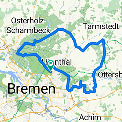
Justus-Liebig-Straße 47, Bremen nach Rotdornallee 55, Bremen
A cycling route starting in Lilienthal, Lower Saxony, Germany.
Overview
About this route
- 1 h 16 min
- Duration
- 21 km
- Distance
- 29 m
- Ascent
- 0 m
- Descent
- 16.5 km/h
- Avg. speed
- 32 m
- Avg. speed
Route quality
Waytypes & surfaces along the route
Waytypes
Quiet road
13.8 km
(66 %)
Path
1.8 km
(9 %)
Surfaces
Paved
20.5 km
(98 %)
Asphalt
18.4 km
(88 %)
Paving stones
1.9 km
(9 %)
Continue with Bikemap
Use, edit, or download this cycling route
You would like to ride Justus-Liebig-Straße 47, Bremen nach Rotdornallee 55, Bremen or customize it for your own trip? Here is what you can do with this Bikemap route:
Free features
- Save this route as favorite or in collections
- Copy & plan your own version of this route
- Sync your route with Garmin or Wahoo
Premium features
Free trial for 3 days, or one-time payment. More about Bikemap Premium.
- Navigate this route on iOS & Android
- Export a GPX / KML file of this route
- Create your custom printout (try it for free)
- Download this route for offline navigation
Discover more Premium features.
Get Bikemap PremiumFrom our community
Other popular routes starting in Lilienthal
 80 km rtf bremen regenfahrt
- Distance
- 77.3 km
- Ascent
- 150 m
- Descent
- 149 m
- Location
- Lilienthal, Lower Saxony, Germany
 1. Borgfeld, Falkenberg, Heidberg, Seebergen
- Distance
- 24 km
- Ascent
- 13 m
- Descent
- 15 m
- Location
- Lilienthal, Lower Saxony, Germany
 80km Runde
- Distance
- 82.6 km
- Ascent
- 102 m
- Descent
- 101 m
- Location
- Lilienthal, Lower Saxony, Germany
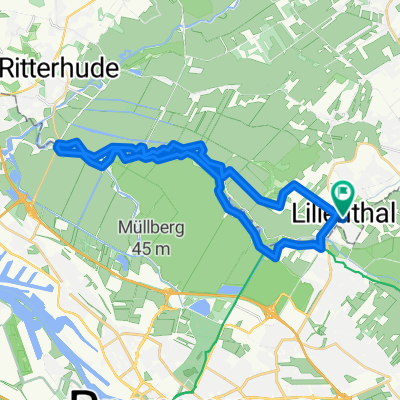 Rundweg Lilenthal - Nordseite - Lilienthal
- Distance
- 29.2 km
- Ascent
- 0 m
- Descent
- 3 m
- Location
- Lilienthal, Lower Saxony, Germany
 Blockland groß
- Distance
- 64 km
- Ascent
- 23 m
- Descent
- 23 m
- Location
- Lilienthal, Lower Saxony, Germany
 Lilienthal -Sagehorn-Fischerhude-Lilienthal
- Distance
- 32 km
- Ascent
- 15 m
- Descent
- 21 m
- Location
- Lilienthal, Lower Saxony, Germany
 Bremen-Achim-Bassen-Bremen
- Distance
- 45.5 km
- Ascent
- 38 m
- Descent
- 38 m
- Location
- Lilienthal, Lower Saxony, Germany
 Geniale Tour bei Hochwasser
- Distance
- 17.5 km
- Ascent
- 16 m
- Descent
- 15 m
- Location
- Lilienthal, Lower Saxony, Germany
Open it in the app